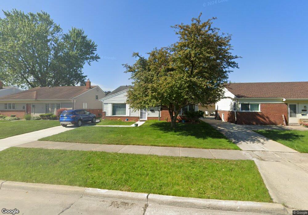
32727 Benson Dr Westland, MI 48185
Estimated Value: $232,000 - $296,000
--
Bed
2
Baths
1,851
Sq Ft
$149/Sq Ft
Est. Value
About This Home
This home is located at 32727 Benson Dr, Westland, MI 48185 and is currently estimated at $275,681, approximately $148 per square foot. 32727 Benson Dr is a home located in Wayne County with nearby schools including Hayes Elementary School, Emerson Middle School, and Cooper Upper Elementary School.
Ownership History
Date
Name
Owned For
Owner Type
Purchase Details
Closed on
Apr 12, 2017
Sold by
Cummins Patricia J and Hollenbeck Patricia J
Bought by
Cummins Patricia J
Current Estimated Value
Purchase Details
Closed on
Jan 15, 2002
Sold by
Cummins June E
Bought by
Hollenbeck Patrciia J
Purchase Details
Closed on
Jun 5, 2001
Sold by
Hollenbeck Dennis M
Bought by
Hollenbeck Patricia J
Purchase Details
Closed on
May 29, 1998
Sold by
Woodruf Diane M and Woodruf John J
Bought by
Hollenbeck Dennis M
Create a Home Valuation Report for This Property
The Home Valuation Report is an in-depth analysis detailing your home's value as well as a comparison with similar homes in the area
Home Values in the Area
Average Home Value in this Area
Purchase History
| Date | Buyer | Sale Price | Title Company |
|---|---|---|---|
| Cummins Patricia J | -- | None Available | |
| Hollenbeck Patrciia J | -- | -- | |
| Hollenbeck Patricia J | -- | -- | |
| Hollenbeck Dennis M | $128,900 | -- |
Source: Public Records
Tax History Compared to Growth
Tax History
| Year | Tax Paid | Tax Assessment Tax Assessment Total Assessment is a certain percentage of the fair market value that is determined by local assessors to be the total taxable value of land and additions on the property. | Land | Improvement |
|---|---|---|---|---|
| 2025 | $2,402 | $140,900 | $0 | $0 |
| 2024 | $2,402 | $130,000 | $0 | $0 |
| 2023 | $2,293 | $117,800 | $0 | $0 |
| 2022 | $2,662 | $102,300 | $0 | $0 |
| 2021 | $2,596 | $97,500 | $0 | $0 |
| 2020 | $2,567 | $93,000 | $0 | $0 |
| 2019 | $2,445 | $89,500 | $0 | $0 |
| 2018 | $1,936 | $71,000 | $0 | $0 |
| 2017 | $871 | $66,300 | $0 | $0 |
| 2016 | $2,336 | $66,700 | $0 | $0 |
| 2015 | $4,385 | $55,440 | $0 | $0 |
| 2013 | $4,248 | $44,420 | $0 | $0 |
| 2012 | $2,188 | $48,660 | $0 | $0 |
Source: Public Records
Map
Nearby Homes
- 32725 Joy Rd
- 33211 Anita Dr
- 32451 Sandra Ln
- 32724 Hees St
- 32047 Anita Dr
- 32327 Washington St
- 9243 Montana St
- 8824 Nevada St
- 8332 Berwick Dr
- 32611 Vermont St
- 33312 Lynx St
- 9212 Idaho St
- 9253 Idaho St
- 7872 Ritz Ave
- 8219 Roselawn St
- 31640 Ann Arbor Trail
- 33030 Cowan Rd
- 7946 Moonwood Place
- 9085 Melrose St
- 7436 Cochise St
- 32737 Benson Dr
- 32717 Benson Dr
- 32747 Benson Dr
- 32707 Benson Dr
- 32734 Sandra Ln
- 32744 Sandra Ln
- 32724 Sandra Ln
- 32754 Sandra Ln
- 32681 Benson Dr
- 32805 Benson Dr
- 32712 Sandra Ln
- 32724 Benson Dr
- 32734 Benson Dr
- 32714 Benson Dr
- 32806 Sandra Ln
- 32700 Sandra Ln
- 32744 Benson Dr
- 32671 Benson Dr
- 32817 Benson Dr
- 32704 Benson Dr