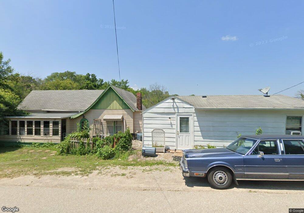
3275 Walnut St Colfax, IA 50054
Estimated Value: $284,000 - $332,000
4
Beds
3
Baths
2,106
Sq Ft
$142/Sq Ft
Est. Value
About This Home
This home is located at 3275 Walnut St, Colfax, IA 50054 and is currently estimated at $299,768, approximately $142 per square foot. 3275 Walnut St is a home located in Jasper County with nearby schools including Colfax-Mingo Elementary School and Colfax-Mingo High School.
Ownership History
Date
Name
Owned For
Owner Type
Purchase Details
Closed on
May 15, 2012
Sold by
Helley Deborah and Deborah Helley Revocable Trust
Bought by
Ward Thomas S and Ward Penni S
Current Estimated Value
Purchase Details
Closed on
Mar 5, 2005
Sold by
Merrill Norman D and Merrill Debra A
Bought by
Helley Deborah A
Home Financials for this Owner
Home Financials are based on the most recent Mortgage that was taken out on this home.
Original Mortgage
$29,900
Interest Rate
5.71%
Mortgage Type
Purchase Money Mortgage
Create a Home Valuation Report for This Property
The Home Valuation Report is an in-depth analysis detailing your home's value as well as a comparison with similar homes in the area
Home Values in the Area
Average Home Value in this Area
Purchase History
| Date | Buyer | Sale Price | Title Company |
|---|---|---|---|
| Ward Thomas S | $140,000 | None Available | |
| Helley Deborah A | -- | None Available |
Source: Public Records
Mortgage History
| Date | Status | Borrower | Loan Amount |
|---|---|---|---|
| Previous Owner | Helley Deborah A | $29,900 |
Source: Public Records
Tax History Compared to Growth
Tax History
| Year | Tax Paid | Tax Assessment Tax Assessment Total Assessment is a certain percentage of the fair market value that is determined by local assessors to be the total taxable value of land and additions on the property. | Land | Improvement |
|---|---|---|---|---|
| 2025 | -- | $284,030 | $60,000 | $224,030 |
| 2024 | -- | $233,910 | $42,170 | $191,740 |
| 2023 | -- | $233,910 | $42,170 | $191,740 |
| 2022 | $0 | $185,600 | $42,170 | $143,430 |
| 2021 | $0 | $170,040 | $42,170 | $127,870 |
| 2020 | $2,364 | $148,080 | $27,600 | $120,480 |
| 2019 | $152 | $130,100 | $0 | $0 |
| 2018 | $0 | $130,100 | $0 | $0 |
| 2017 | $2,186 | $130,100 | $0 | $0 |
| 2016 | $2,186 | $130,100 | $0 | $0 |
| 2015 | $2,186 | $130,100 | $0 | $0 |
| 2014 | $1,990 | $130,100 | $0 | $0 |
Source: Public Records
Map
Nearby Homes
- 215 W Spring St
- 520 S Oak Park Ave
- 223 W Broadway St
- 34 E Broadway St
- 226 S Iowa St
- 108 S Walnut St
- 624 S Goodrich St
- 119 W Washington St
- 222 E Broadway St
- 400 S Goodrich St
- 501 W Broadway St
- 1161 S Goodrich St
- 108 N West St
- 0000 Lincoln St
- 20 S Oak Park Ave
- 200 Jefferson St
- 655 E Division St
- 300 E Front St
- 11213 Orchard Ave
- HWY 117 at Intersection of Fleet Ave
- 3275 S Walnut St
- 3262 Walnut St
- 625 S Walnut St
- 3353 Walnut St
- 617 S Walnut St
- 3352 Walnut St
- 613 S Walnut St
- 609 S Walnut St
- 3490 Walnut St
- 3358 West St
- 3358 West St
- 666 S West St Unit A
- 666 S West St
- 603 S Walnut St
- 3540 S Walnut St
- 81 W High St
- 3249 West St
- 664 S West St
- 51 W High St
- 123 W High St