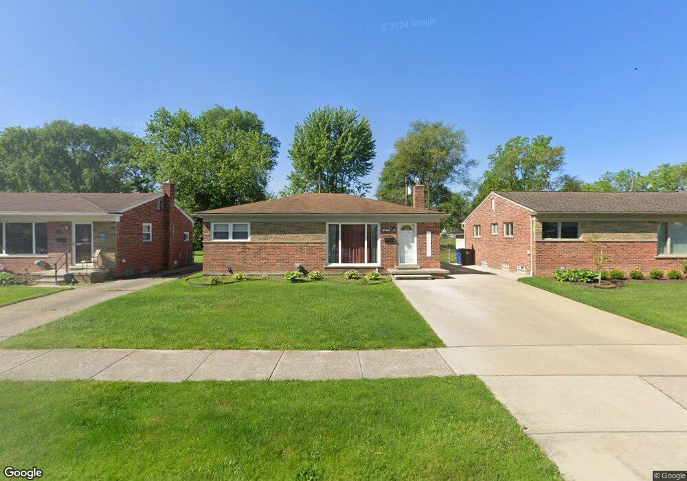
32751 Merritt Dr Westland, MI 48185
Estimated Value: $237,000 - $277,000
--
Bed
1
Bath
1,114
Sq Ft
$229/Sq Ft
Est. Value
About This Home
This home is located at 32751 Merritt Dr, Westland, MI 48185 and is currently estimated at $254,920, approximately $228 per square foot. 32751 Merritt Dr is a home located in Wayne County with nearby schools including Hayes Elementary School, Cooper Upper Elementary School, and Emerson Middle School.
Ownership History
Date
Name
Owned For
Owner Type
Purchase Details
Closed on
Jan 25, 2012
Sold by
Katinsky Jessica M and Brussow Jessica M
Bought by
Brussow Jessica M and Katinsky Mark A
Current Estimated Value
Home Financials for this Owner
Home Financials are based on the most recent Mortgage that was taken out on this home.
Original Mortgage
$150,172
Outstanding Balance
$104,011
Interest Rate
4.12%
Mortgage Type
FHA
Estimated Equity
$150,909
Purchase Details
Closed on
Jul 12, 2006
Sold by
Nelson Cynthia and Grisamer William
Bought by
Katinsky Jessica M
Create a Home Valuation Report for This Property
The Home Valuation Report is an in-depth analysis detailing your home's value as well as a comparison with similar homes in the area
Home Values in the Area
Average Home Value in this Area
Purchase History
| Date | Buyer | Sale Price | Title Company |
|---|---|---|---|
| Brussow Jessica M | -- | First Centennial Title Inc | |
| Katinsky Jessica M | $155,000 | Multiple |
Source: Public Records
Mortgage History
| Date | Status | Borrower | Loan Amount |
|---|---|---|---|
| Open | Brussow Jessica M | $150,172 |
Source: Public Records
Tax History Compared to Growth
Tax History
| Year | Tax Paid | Tax Assessment Tax Assessment Total Assessment is a certain percentage of the fair market value that is determined by local assessors to be the total taxable value of land and additions on the property. | Land | Improvement |
|---|---|---|---|---|
| 2025 | $2,048 | $107,100 | $0 | $0 |
| 2024 | $2,048 | $99,400 | $0 | $0 |
| 2023 | $2,457 | $90,100 | $0 | $0 |
| 2022 | $2,669 | $78,100 | $0 | $0 |
| 2021 | $2,288 | $74,500 | $0 | $0 |
| 2020 | $2,198 | $70,500 | $0 | $0 |
| 2019 | $2,699 | $68,200 | $0 | $0 |
| 2018 | $1,919 | $57,400 | $0 | $0 |
| 2017 | $1,691 | $53,500 | $0 | $0 |
| 2016 | $1,991 | $53,900 | $0 | $0 |
| 2015 | $4,020 | $50,770 | $0 | $0 |
| 2013 | $3,894 | $39,800 | $0 | $0 |
| 2012 | $1,794 | $39,980 | $0 | $0 |
Source: Public Records
Map
Nearby Homes
- 33211 Anita Dr
- 32451 Sandra Ln
- 32725 Joy Rd
- 32724 Hees St
- 33312 Lynx St
- 32047 Anita Dr
- 7946 Moonwood Place
- 32327 Washington St
- 33030 Cowan Rd
- 9243 Montana St
- 7436 Cochise St
- 8332 Berwick Dr
- 8824 Nevada St
- 7872 Ritz Ave
- 32611 Vermont St
- 31640 Ann Arbor Trail
- 8219 Roselawn St
- 33632 Cindy St
- 9212 Idaho St
- 9253 Idaho St
- 32761 Merritt Dr
- 32741 Merritt Dr
- 32801 Merritt Dr
- 32731 Merritt Dr
- 32809 Merritt Dr
- 32721 Merritt Dr
- 32750 Merritt Dr
- 32740 Merritt Dr
- 32800 Merritt Dr
- 32817 Merritt Dr
- 32730 Merritt Dr
- 32711 Merritt Dr
- 32808 Merritt Dr
- 8315 Rae Dr
- 32825 Merritt Dr
- 32701 Merritt Dr
- 32816 Merritt Dr
- 8329 Rae Dr Unit Bldg-Unit
- 8329 Rae Dr
- Ann Arbor Trail