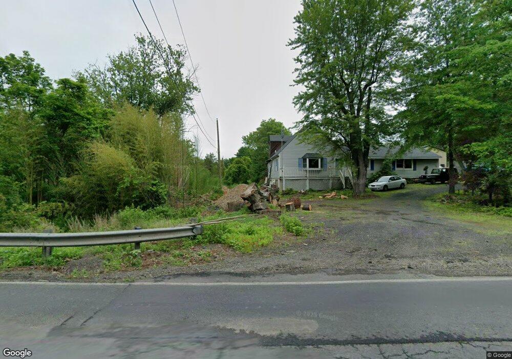
3279 Bristol Rd Doylestown, PA 18901
Estimated Value: $711,000 - $925,000
4
Beds
2
Baths
1,687
Sq Ft
$480/Sq Ft
Est. Value
About This Home
This home is located at 3279 Bristol Rd, Doylestown, PA 18901 and is currently estimated at $810,067, approximately $480 per square foot. 3279 Bristol Rd is a home located in Bucks County with nearby schools including Mill Creek Elementary School, Unami Middle School, and Central Bucks High School - South.
Ownership History
Date
Name
Owned For
Owner Type
Purchase Details
Closed on
Mar 30, 2006
Sold by
Denner Bryan
Bought by
Denner Michael A and Denner Danielle M
Current Estimated Value
Home Financials for this Owner
Home Financials are based on the most recent Mortgage that was taken out on this home.
Original Mortgage
$313,000
Interest Rate
6.4%
Mortgage Type
Unknown
Purchase Details
Closed on
Mar 28, 2003
Sold by
Denner Russell
Bought by
Denner Bryan
Home Financials for this Owner
Home Financials are based on the most recent Mortgage that was taken out on this home.
Original Mortgage
$300,000
Interest Rate
4.13%
Mortgage Type
Unknown
Create a Home Valuation Report for This Property
The Home Valuation Report is an in-depth analysis detailing your home's value as well as a comparison with similar homes in the area
Home Values in the Area
Average Home Value in this Area
Purchase History
| Date | Buyer | Sale Price | Title Company |
|---|---|---|---|
| Denner Michael A | $418,000 | None Available | |
| Denner Bryan | $375,000 | Lawyers Title Insurance Corp |
Source: Public Records
Mortgage History
| Date | Status | Borrower | Loan Amount |
|---|---|---|---|
| Closed | Denner Michael A | $313,000 | |
| Closed | Denner Bryan | $300,000 |
Source: Public Records
Tax History Compared to Growth
Tax History
| Year | Tax Paid | Tax Assessment Tax Assessment Total Assessment is a certain percentage of the fair market value that is determined by local assessors to be the total taxable value of land and additions on the property. | Land | Improvement |
|---|---|---|---|---|
| 2025 | $8,608 | $48,640 | $17,800 | $30,840 |
| 2024 | $8,608 | $48,640 | $17,800 | $30,840 |
| 2023 | $8,208 | $48,640 | $17,800 | $30,840 |
| 2022 | $8,116 | $48,640 | $17,800 | $30,840 |
| 2021 | $7,949 | $48,640 | $17,800 | $30,840 |
| 2020 | $7,913 | $48,640 | $17,800 | $30,840 |
| 2019 | $7,827 | $48,640 | $17,800 | $30,840 |
| 2018 | $7,803 | $48,640 | $17,800 | $30,840 |
| 2017 | $7,742 | $48,640 | $17,800 | $30,840 |
| 2016 | $7,694 | $48,640 | $17,800 | $30,840 |
| 2015 | -- | $48,640 | $17,800 | $30,840 |
| 2014 | -- | $48,640 | $17,800 | $30,840 |
Source: Public Records
Map
Nearby Homes
- 73 Tradesville Dr
- 73 Tradesville Dr Unit 80
- 52 Tradesville Dr Unit 83
- Vetri Plan at Doylestown Walk
- 52 Tradesville Dr
- 2 Mill Creek Dr
- 2 Mill Creek Dr Unit 137
- 1 Mill Creek Dr
- 6 Mill Creek Dr
- 21 Mill Creek Dr Unit 11
- 21 Mill Creek Dr
- 23 Mill Creek Dr
- 47 Mill Creek Dr Unit 32
- 47 Mill Creek Dr
- 25 Mill Creek Dr
- 25 Mill Creek Dr Unit 13
- 20 Woodstone Dr
- 242 Snapdragon St
- 803 Sweet Cherry St
- 1101 Deerfield Ln
- 1425 Lower State Rd
- 1439 Lower State Rd
- 1405 Lower State Rd
- 1451 Lower State Rd
- 3247 Bristol Rd
- 1463 Lower State Rd
- 1410 Lower State Rd
- 3235 Bristol Rd
- 1467 Lower State Rd
- 1396 Lower State Rd
- 3298 Bristol Rd
- 3270 Bristol Rd
- 1377 Lower State Rd
- 3233 Bristol Rd
- 1469 Lower State Rd
- 1485 Lower State Rd
- 3223 Bristol Rd
- 1347 Lower State Rd
- 1347 Lower State Rd Unit L
- 1497 Lower State Rd