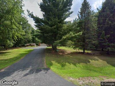
3281 Anston Rd Suamico, WI 54313
Estimated Value: $263,514 - $426,000
--
Bed
--
Bath
--
Sq Ft
1.35
Acres
About This Home
This home is located at 3281 Anston Rd, Suamico, WI 54313 and is currently estimated at $324,629. 3281 Anston Rd is a home located in Brown County with nearby schools including Suamico Elementary School, Lineville Intermediate School, and Bay View Middle School.
Ownership History
Date
Name
Owned For
Owner Type
Purchase Details
Closed on
Feb 3, 2004
Sold by
Caelwaerts Debra K
Bought by
Caelwaerts Debra K
Current Estimated Value
Purchase Details
Closed on
Jan 30, 2001
Sold by
Caelwaerts Lawrence
Bought by
Caelwaerts Debra K
Create a Home Valuation Report for This Property
The Home Valuation Report is an in-depth analysis detailing your home's value as well as a comparison with similar homes in the area
Home Values in the Area
Average Home Value in this Area
Purchase History
| Date | Buyer | Sale Price | Title Company |
|---|---|---|---|
| Caelwaerts Debra K | $40,000 | -- | |
| Caelwaerts Debra K | -- | -- |
Source: Public Records
Mortgage History
| Date | Status | Borrower | Loan Amount |
|---|---|---|---|
| Open | Caelwaerts Debra K | $92,000 | |
| Closed | Caelwaerts Debra K | $104,800 | |
| Closed | Caelwaerts Debra K | $110,351 | |
| Closed | Caelwaerts Debra K | $100,000 | |
| Closed | Caelwaerts Debra | $88,000 |
Source: Public Records
Tax History Compared to Growth
Tax History
| Year | Tax Paid | Tax Assessment Tax Assessment Total Assessment is a certain percentage of the fair market value that is determined by local assessors to be the total taxable value of land and additions on the property. | Land | Improvement |
|---|---|---|---|---|
| 2024 | $2,705 | $155,100 | $50,600 | $104,500 |
| 2023 | $2,642 | $155,100 | $50,600 | $104,500 |
| 2022 | $2,614 | $155,100 | $50,600 | $104,500 |
| 2021 | $2,470 | $155,100 | $50,600 | $104,500 |
| 2020 | $2,536 | $155,100 | $50,600 | $104,500 |
| 2019 | $2,465 | $124,500 | $38,800 | $85,700 |
| 2018 | $2,383 | $124,500 | $38,800 | $85,700 |
| 2017 | $2,355 | $124,500 | $38,800 | $85,700 |
| 2016 | $2,271 | $124,500 | $38,800 | $85,700 |
| 2015 | $2,334 | $124,500 | $38,800 | $85,700 |
| 2014 | $2,320 | $124,500 | $38,800 | $85,700 |
| 2013 | $2,320 | $124,500 | $38,800 | $85,700 |
Source: Public Records
Map
Nearby Homes
- 3068 Hidden Forest Ct
- 2635 Northwood Rd
- 3699 Evelyn Rose Ln
- 3727 Evelyn Rose Ln
- 3738 Evelyn Rose Ln
- 3733 Evelyn Rose Ln
- 3745 Evelyn Rose Ln
- 3773 Evelyn Ln
- 3752 Evelyn Rose Ln
- 2956 Westline Rd
- 3757 Evelyn Rose Ln
- 3783 Westpoint Rd
- 3752 Westpoint Rd
- 3778 Evelyn Rose Ln
- 2338 Tumbleweed Trail
- 3775 Evelyn Rose Ln
- 3781 Evelyn Rose Ln
- 2876 Whippoorwill Rd
- 2426 Pristine Ln
- 2430 Pristine Ln
- 3281 Anston Rd
- 2847 Brook Hills Dr
- 3309 Anston Rd
- 2840 Brook Hills Dr
- 3271 Anston Rd
- 2833 Brook Hills Dr
- 2780 E Kenlar Cir
- 3260 Anston Rd
- 3260 Anston Rd
- 3341 Anston Rd
- 3274 Anston Rd
- 2821 E Kenlar Cir
- 3242 Brook Hills Ct
- 3243 Anston Rd
- 3252 Anston Rd
- 3252 Anston Rd
- 2817 Brook Hills Dr
- 2799 E Kenlar Cir
- 3253 Brook Hills Ct
- 2730 E Kenlar Cir
