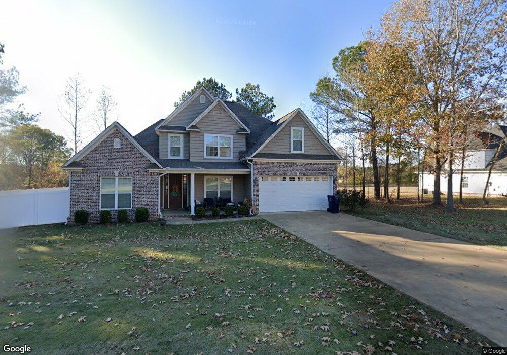
3281 Shadowood Ln Corinth, MS 38834
Estimated Value: $412,000 - $442,000
Studio
--
Bath
3,108
Sq Ft
$137/Sq Ft
Est. Value
About This Home
This home is located at 3281 Shadowood Ln, Corinth, MS 38834 and is currently estimated at $424,669, approximately $136 per square foot. 3281 Shadowood Ln is a home with nearby schools including Corinth Elementary School, Corinth Middle School, and Corinth High School.
Ownership History
Date
Name
Owned For
Owner Type
Purchase Details
Closed on
Jun 22, 2019
Sold by
Smith Matthew E and Smith Stephanie R
Bought by
Choate Kyle C and Choate Amber A
Current Estimated Value
Purchase Details
Closed on
Jun 27, 2018
Sold by
Barker James Richard
Bought by
Smith Matthew E and Smith Stephanie R
Home Financials for this Owner
Home Financials are based on the most recent Mortgage that was taken out on this home.
Original Mortgage
$288,063
Interest Rate
4.5%
Mortgage Type
New Conventional
Purchase Details
Closed on
Oct 5, 2016
Sold by
Tays Construction Inc
Bought by
Barker James Richard and Barker Muriel
Create a Home Valuation Report for This Property
The Home Valuation Report is an in-depth analysis detailing your home's value as well as a comparison with similar homes in the area
Purchase History
| Date | Buyer | Sale Price | Title Company |
|---|---|---|---|
| Choate Kyle C | -- | None Available | |
| Smith Matthew E | -- | None Available | |
| Barker James Richard | -- | -- |
Source: Public Records
Mortgage History
| Date | Status | Borrower | Loan Amount |
|---|---|---|---|
| Previous Owner | Smith Matthew E | $288,063 |
Source: Public Records
Tax History
| Year | Tax Paid | Tax Assessment Tax Assessment Total Assessment is a certain percentage of the fair market value that is determined by local assessors to be the total taxable value of land and additions on the property. | Land | Improvement |
|---|---|---|---|---|
| 2025 | $1,218 | $29,136 | $0 | $0 |
| 2024 | $12 | $25,120 | $0 | $0 |
| 2023 | $1,216 | $25,095 | $0 | $0 |
| 2022 | $1,216 | $25,095 | $0 | $0 |
| 2021 | $1,169 | $24,227 | $0 | $0 |
| 2020 | $1,158 | $24,027 | $0 | $0 |
| 2019 | $1,158 | $24,027 | $0 | $0 |
| 2018 | $921 | $24,027 | $0 | $0 |
| 2017 | $917 | $0 | $0 | $0 |
| 2016 | $57 | $0 | $0 | $0 |
| 2015 | -- | $0 | $0 | $0 |
| 2014 | -- | $0 | $0 | $0 |
Source: Public Records
Map
Nearby Homes
- 3285 Shadowood Ln
- 4402 Dove Cove
- Lot# 1 N Shiloh Rd
- Lot# 2 N Shiloh Rd
- 4506 N Shiloh Rd
- 2102 Beauregard Park
- 4108 Forrest Rd
- 3001 N Haven Dr
- Lot# 3 Bynum Dr
- 0 Tract 6 Richman Dr
- 0 Tract 3 Richman Cir
- 0 Tract 2 Richman Cir
- 0 Tract 5 Richman Cir
- 0 Tract 1 Richman Cir
- 0 Tract 4 Richman Cir
- Lot 6 Northtown Dr
- Lot 12 Northtown Dr
- Lot 4 Northtown Dr
- Lot 5 Northtown Dr
- Lot 2 Northtown Dr
- 3286 Shadowood Ln
- 3284 Shadowood Ln
- 3285 Shadowood Ln
- 3406 Thornwood Trail
- 3405 Old Ashbrook Dr
- 3407 Old Ashbrook Dr
- 3410 Thornwood
- 3500 Old Ashbrook Dr
- 3409 Thornwood Trail
- 3500 Thornwood Trail
- 3409 Old Ashbrook Dr
- 3501 Thornwood Trail
- 3502 Old Ashbrook Dr
- 3402 Blue Bird Ln
- 3502 Thornwood
- 3503 Thornwood Trail
- 3504 Old Ashbrook Dr
- 3270 Shadowood Ln
- 3504 Thornwood Trail
- 3404 Blue Bird Ln
Your Personal Tour Guide
Ask me questions while you tour the home.