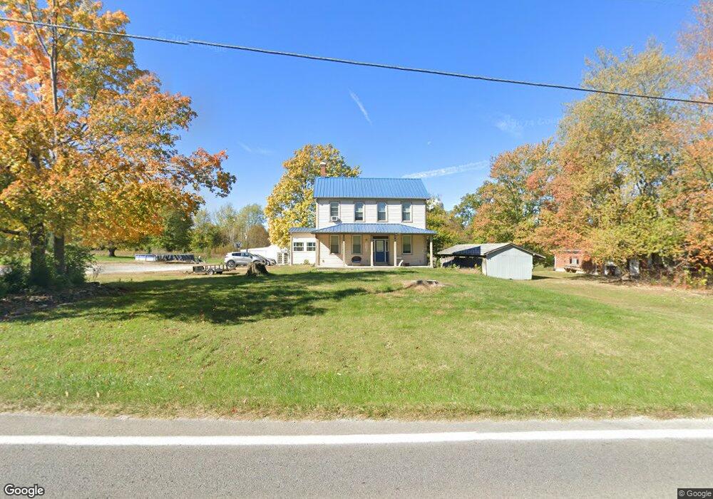
3281 State Route 132 Amelia, OH 45102
Estimated Value: $329,000 - $423,000
3
Beds
3
Baths
2,232
Sq Ft
$164/Sq Ft
Est. Value
About This Home
This home is located at 3281 State Route 132, Amelia, OH 45102 and is currently estimated at $366,446, approximately $164 per square foot. 3281 State Route 132 is a home located in Clermont County with nearby schools including Amelia Elementary School, West Clermont Middle School, and West Clermont High School.
Ownership History
Date
Name
Owned For
Owner Type
Purchase Details
Closed on
Aug 21, 2006
Sold by
Swinson Denny M
Bought by
Lohrer Properties Llc
Current Estimated Value
Purchase Details
Closed on
Jun 25, 1998
Sold by
Murray John M
Bought by
Swinson Denny M
Home Financials for this Owner
Home Financials are based on the most recent Mortgage that was taken out on this home.
Original Mortgage
$95,025
Interest Rate
11.63%
Mortgage Type
New Conventional
Purchase Details
Closed on
Apr 16, 1990
Purchase Details
Closed on
Jun 1, 1987
Create a Home Valuation Report for This Property
The Home Valuation Report is an in-depth analysis detailing your home's value as well as a comparison with similar homes in the area
Home Values in the Area
Average Home Value in this Area
Purchase History
| Date | Buyer | Sale Price | Title Company |
|---|---|---|---|
| Lohrer Properties Llc | $68,000 | None Available | |
| Swinson Denny M | $126,700 | -- | |
| -- | $65,000 | -- | |
| -- | $35,000 | -- |
Source: Public Records
Mortgage History
| Date | Status | Borrower | Loan Amount |
|---|---|---|---|
| Previous Owner | Swinson Denny M | $95,025 |
Source: Public Records
Tax History Compared to Growth
Tax History
| Year | Tax Paid | Tax Assessment Tax Assessment Total Assessment is a certain percentage of the fair market value that is determined by local assessors to be the total taxable value of land and additions on the property. | Land | Improvement |
|---|---|---|---|---|
| 2024 | $3,931 | $75,180 | $25,410 | $49,770 |
| 2023 | $3,937 | $75,180 | $25,410 | $49,770 |
| 2022 | $3,388 | $56,290 | $18,940 | $37,350 |
| 2021 | $3,351 | $56,290 | $18,940 | $37,350 |
| 2020 | $3,352 | $56,290 | $18,940 | $37,350 |
| 2019 | $2,270 | $41,270 | $18,690 | $22,580 |
| 2018 | $2,292 | $41,270 | $18,690 | $22,580 |
| 2017 | $2,181 | $41,270 | $18,690 | $22,580 |
| 2016 | $2,181 | $35,570 | $16,560 | $19,010 |
| 2015 | $2,049 | $35,570 | $16,560 | $19,010 |
| 2014 | $2,049 | $35,570 | $16,560 | $19,010 |
| 2013 | $2,237 | $38,610 | $19,220 | $19,390 |
Source: Public Records
Map
Nearby Homes
- 1700 White Birch
- 1336 Dee Ln
- 1742 Petri Dr
- 105 Cedarwood Dr
- 27 Locustwood Ct
- 23 Belwood Ct
- 1770 Sunny Acres Ln
- 59 Red Bud Cir
- 41 Mallard Dr
- 21 Mallard Dr
- 3330 Huntsman Trace Unit 803C
- 9 Eagle Ct
- 166 Wooded Ridge Dr
- 164 Wooded Ridge Dr
- 232 Deer Creek Dr
- 2167 Ohio 125
- 2139 Ohio 125
- 247 Deer Creek Dr
- 0 St Rt 125 Unit 1849632
- 149 Wooded Ridge Dr
- 3287 State Route 132
- 3288 State Route 132
- 3270 State Route 132
- 1716 White Birch
- 3288 St Rt 132
- 3296 State Route 132
- 3291 St Rt 132
- 3291 State Route 132
- 3317 State Route 132
- 3308 State Route 132
- 1715 White Birch
- 1708 White Birch
- 1ac Tib Day Ln
- 3258 State Route 132
- 3320 State Route 132
- 3255 State Route 132
- 6 Tib Day Ln
- 8 Tib Day Ln
- 1734 Tib Day Ln
- 1738 Tib Day Ln