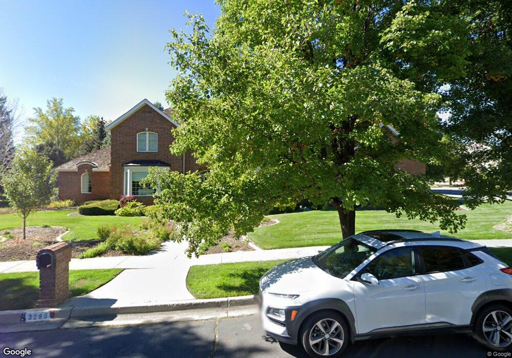
3285 Brookside Dr Provo, UT 84604
Riverside NeighborhoodEstimated Value: $1,399,304 - $1,685,000
6
Beds
6
Baths
4,900
Sq Ft
$324/Sq Ft
Est. Value
About This Home
This home is located at 3285 Brookside Dr, Provo, UT 84604 and is currently estimated at $1,588,076, approximately $324 per square foot. 3285 Brookside Dr is a home located in Utah County with nearby schools including Canyon Crest Elementary School, Centennial Middle School, and Timpview High School.
Ownership History
Date
Name
Owned For
Owner Type
Purchase Details
Closed on
Apr 23, 2024
Sold by
Marilyn Rae Richards Family Living Trust and Richards Marilyn Rae
Bought by
Clark Trust and Clark
Current Estimated Value
Purchase Details
Closed on
Apr 4, 2018
Sold by
Ricahrds Marilyn Rae
Bought by
Richards Marilyn Rae and The Marilyn Rae Richards Famil
Home Financials for this Owner
Home Financials are based on the most recent Mortgage that was taken out on this home.
Original Mortgage
$75,000
Interest Rate
4.4%
Mortgage Type
Credit Line Revolving
Purchase Details
Closed on
May 31, 2000
Sold by
Richards Marilyn Rae
Bought by
Richards Marilyn Rae
Home Financials for this Owner
Home Financials are based on the most recent Mortgage that was taken out on this home.
Original Mortgage
$125,000
Interest Rate
8.27%
Purchase Details
Closed on
Feb 7, 1997
Sold by
Richards Marilyn Rae
Bought by
Richards Marilyn Rae
Home Financials for this Owner
Home Financials are based on the most recent Mortgage that was taken out on this home.
Original Mortgage
$42,600
Interest Rate
7.66%
Create a Home Valuation Report for This Property
The Home Valuation Report is an in-depth analysis detailing your home's value as well as a comparison with similar homes in the area
Home Values in the Area
Average Home Value in this Area
Purchase History
| Date | Buyer | Sale Price | Title Company |
|---|---|---|---|
| Clark Trust | -- | Skyline Title | |
| Richards Marilyn Rae | -- | Meridian Title Co | |
| Richards Marilyn Rae | -- | Meridian Title Co | |
| Richards Marilyn Rae | -- | Century Title | |
| Richards Marilyn Rae | -- | -- |
Source: Public Records
Mortgage History
| Date | Status | Borrower | Loan Amount |
|---|---|---|---|
| Previous Owner | Richards Marilyn Rae | $75,000 | |
| Previous Owner | Richards Marilyn Rae | $125,000 | |
| Previous Owner | Richards Marilyn Rae | $42,600 |
Source: Public Records
Tax History
| Year | Tax Paid | Tax Assessment Tax Assessment Total Assessment is a certain percentage of the fair market value that is determined by local assessors to be the total taxable value of land and additions on the property. | Land | Improvement |
|---|---|---|---|---|
| 2025 | $6,296 | $702,350 | -- | -- |
| 2024 | $6,296 | $619,740 | $0 | $0 |
| 2023 | $6,217 | $603,295 | $0 | $0 |
| 2022 | $6,000 | $587,125 | $0 | $0 |
| 2021 | $4,845 | $826,800 | $459,200 | $367,600 |
| 2020 | $4,667 | $746,700 | $382,700 | $364,000 |
| 2019 | $4,488 | $746,700 | $382,700 | $364,000 |
| 2018 | $4,198 | $708,400 | $344,400 | $364,000 |
| 2017 | $4,202 | $389,620 | $0 | $0 |
| 2016 | $4,508 | $389,620 | $0 | $0 |
| 2015 | $4,171 | $364,375 | $0 | $0 |
| 2014 | -- | $341,385 | $0 | $0 |
Source: Public Records
Map
Nearby Homes
- 158 Woodside Dr
- 3240 Shadowbrook Dr
- 111 Candlewood Place
- 3305 N Shadowbrook Cir
- 3057 N 100 W
- 2999 N Marrcrest West Dr
- 3013 N 100 W
- 2939 N Marrcrest Dr W
- 404 W 3700 N
- 3025 N 250 E
- 1360 S Carterville Rd
- 5600 N Canyon Rd
- 2735 N Country Club Dr
- 745 S 900 E
- 3711 N Canyon Rd
- 2774 N 370 E
- 544 S Carterville Rd
- 528 E 3750 N
- 407 E 3900 Rd N Unit 1
- 407 E 3900 Rd N
- 3288 Brookside Dr
- 3263 Brookside Dr
- 3258 Brookside Dr
- 202 W 3300 N
- 226 W 3300 N
- 188 W 3300 N
- 201 Woodside Dr
- 201 Woodside Dr Unit 47
- 223 Woodside Dr
- 223 Woodside Dr Unit 50
- 262 W 3300 N
- 205 Woodside Dr
- 205 Woodside Dr Unit 48
- 191 Woodside Dr
- 217 Woodside Dr
- 235 Woodside Dr
- 186 W 3250 N
- 185 Woodside Dr
- 185 Woodside Dr Unit 46
- 241 Woodside Dr
Your Personal Tour Guide
Ask me questions while you tour the home.