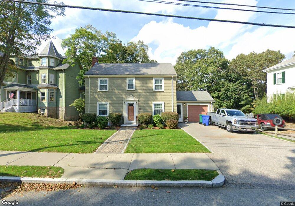
329 Central St Auburndale, MA 02466
Auburndale NeighborhoodEstimated Value: $1,633,000 - $1,723,000
5
Beds
3
Baths
2,604
Sq Ft
$642/Sq Ft
Est. Value
About This Home
This home is located at 329 Central St, Auburndale, MA 02466 and is currently estimated at $1,671,465, approximately $641 per square foot. 329 Central St is a home located in Middlesex County with nearby schools including Williams Elementary School, Charles E Brown Middle School, and Newton South High School.
Ownership History
Date
Name
Owned For
Owner Type
Purchase Details
Closed on
Sep 27, 2010
Sold by
Tennermann William A E and Tennermann T
Bought by
Abend Lawrence J
Current Estimated Value
Home Financials for this Owner
Home Financials are based on the most recent Mortgage that was taken out on this home.
Original Mortgage
$523,750
Interest Rate
4.48%
Mortgage Type
Purchase Money Mortgage
Purchase Details
Closed on
Sep 1, 1999
Sold by
Bachrach Hillel and Bachrach Lilliana
Bought by
Tennermann William A and Tennermann Kathleen G
Create a Home Valuation Report for This Property
The Home Valuation Report is an in-depth analysis detailing your home's value as well as a comparison with similar homes in the area
Home Values in the Area
Average Home Value in this Area
Purchase History
| Date | Buyer | Sale Price | Title Company |
|---|---|---|---|
| Abend Lawrence J | $709,000 | -- | |
| Abend Lawrence J | $709,000 | -- | |
| Tennermann William A | $475,000 | -- |
Source: Public Records
Mortgage History
| Date | Status | Borrower | Loan Amount |
|---|---|---|---|
| Open | Tennermann William A | $517,000 | |
| Closed | Abend Lawrence J | $523,750 |
Source: Public Records
Tax History Compared to Growth
Tax History
| Year | Tax Paid | Tax Assessment Tax Assessment Total Assessment is a certain percentage of the fair market value that is determined by local assessors to be the total taxable value of land and additions on the property. | Land | Improvement |
|---|---|---|---|---|
| 2025 | $12,722 | $1,298,200 | $804,000 | $494,200 |
| 2024 | $12,107 | $1,240,500 | $780,600 | $459,900 |
| 2023 | $11,546 | $1,134,200 | $602,600 | $531,600 |
| 2022 | $11,048 | $1,050,200 | $558,000 | $492,200 |
| 2021 | $10,661 | $990,800 | $526,400 | $464,400 |
| 2020 | $10,344 | $990,800 | $526,400 | $464,400 |
| 2019 | $10,052 | $961,900 | $511,100 | $450,800 |
| 2018 | $9,676 | $894,300 | $468,300 | $426,000 |
| 2017 | $9,382 | $843,700 | $441,800 | $401,900 |
| 2016 | $8,973 | $788,500 | $412,900 | $375,600 |
| 2015 | $8,555 | $736,900 | $385,900 | $351,000 |
Source: Public Records
Map
Nearby Homes
- 27 Oakwood Rd
- 17 Lasell St
- 2202 Commonwealth Ave Unit 2
- 2202 Commonwealth Ave Unit 1
- 283 Melrose St
- 224 Auburn St Unit 224
- 224 Auburn St Unit A
- 226 Auburn St Unit 226
- 17 Deforest Rd
- 283 Woodland Rd
- 62-64 Rowe St Unit B
- 1754 Washington St
- 13 Weir St
- 1639 Washington St
- 49 Staniford St
- 51 Bourne St
- 17 Gilbert St
- 160 Pine St Unit 12
- 17 Crescent St
- 2084 Washington St
- 321 Central St
- 337 Central St
- 337 Central St Unit C
- 337 Central St Unit D
- 337 Central St Unit Right
- 337 Central St Unit Left
- 337 Central St Unit 1
- 337 Central St Unit 2
- 338 Central St
- 330 Central St
- 324 Central St
- 347 Central St
- 315 Central St
- 316 Central St
- 17 Leighton Rd
- 348 Central St
- 11 Fern St
- 305 Central St
- 305 Central St
- 305 Central St Unit 1