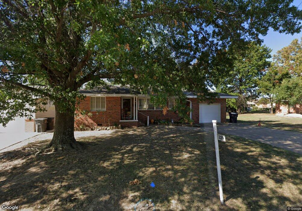
329 SE Queenstown Ave Bartlesville, OK 74006
Estimated Value: $123,695 - $136,000
3
Beds
1
Bath
1,193
Sq Ft
$109/Sq Ft
Est. Value
About This Home
This home is located at 329 SE Queenstown Ave, Bartlesville, OK 74006 and is currently estimated at $130,174, approximately $109 per square foot. 329 SE Queenstown Ave is a home located in Washington County with nearby schools including Hoover Elementary School, Madison Middle School, and Bartlesville High School.
Ownership History
Date
Name
Owned For
Owner Type
Purchase Details
Closed on
Aug 29, 2008
Sold by
Federal National Mortgage Association
Bought by
Miller Douglas A and Miller Brandi
Current Estimated Value
Purchase Details
Closed on
Aug 14, 2008
Sold by
State Farm Bank Fsb
Bought by
Federal National Mortgage Asociation
Purchase Details
Closed on
Mar 24, 2004
Sold by
Vannoster Jennifer
Purchase Details
Closed on
Aug 3, 2000
Sold by
Hinten Ruth Living Trust
Purchase Details
Closed on
Jul 22, 1999
Sold by
Hinten Mary Ruth
Purchase Details
Closed on
Mar 8, 1993
Sold by
Hinten Gerald L and Mary Ruth
Create a Home Valuation Report for This Property
The Home Valuation Report is an in-depth analysis detailing your home's value as well as a comparison with similar homes in the area
Home Values in the Area
Average Home Value in this Area
Purchase History
| Date | Buyer | Sale Price | Title Company |
|---|---|---|---|
| Miller Douglas A | $35,000 | None Available | |
| Federal National Mortgage Asociation | -- | None Available | |
| -- | $45,000 | -- | |
| -- | $37,000 | -- | |
| -- | -- | -- | |
| -- | -- | -- |
Source: Public Records
Tax History Compared to Growth
Tax History
| Year | Tax Paid | Tax Assessment Tax Assessment Total Assessment is a certain percentage of the fair market value that is determined by local assessors to be the total taxable value of land and additions on the property. | Land | Improvement |
|---|---|---|---|---|
| 2025 | $1,190 | $10,402 | $1,103 | $9,299 |
| 2024 | $1,190 | $9,906 | $1,050 | $8,856 |
| 2023 | $1,190 | $9,434 | $1,020 | $8,414 |
| 2022 | $1,130 | $9,434 | $1,020 | $8,414 |
| 2021 | $1,086 | $9,248 | $1,020 | $8,228 |
| 2020 | $1,057 | $8,807 | $1,020 | $7,787 |
| 2019 | $1,008 | $8,388 | $1,020 | $7,368 |
| 2018 | $1,003 | $8,388 | $1,020 | $7,368 |
| 2017 | $1,026 | $8,388 | $1,020 | $7,368 |
| 2016 | $931 | $8,110 | $794 | $7,316 |
| 2015 | $897 | $7,723 | $480 | $7,243 |
| 2014 | $546 | $4,644 | $504 | $4,140 |
Source: Public Records
Map
Nearby Homes
- 328 SE Waverly Ave
- 300 SE Waverly Ave
- 366 SE Wilshire Ave
- 3615 Utah Ave
- 348 SE Elmhurst Ave
- 397 Fleetwood Dr
- 4600 Cara Lee Ln
- 4507 E Frank Phillips Blvd
- 4512 E Frank Phillips Blvd
- 4513 Tuxedo Blvd
- 136 SE Debell Ave
- 4212 Michigan St
- 202 Bradley Place
- 0 SE Adams Rd Unit 2541155
- 220 SE Roselawn Ave
- 3317 Tuxedo Blvd Unit B
- 4816 Carole Ct
- 4709 Amherst Dr
- 616 SE Greystone Ave
- 633 Kenwood Dr
- 333 SE Queenstown Ave
- 325 SE Queenstown Ave
- 337 SE Queenstown Ave
- 321 SE Queenstown Ave
- 328 SE Queenstown Ave
- 324 SE Queenstown Ave
- 332 SE Queenstown Ave
- 350 SE Avondale Ave
- 320 SE Queenstown Ave
- 317 SE Queenstown Ave
- 341 SE Queenstown Ave
- 336 SE Queenstown Ave
- 314 SE Queenstown Ave
- 313 SE Queenstown Ave
- 318 SE Avondale Ave
- 340 SE Queenstown Ave
- 341 SE Avondale Ave
- 316 SE Avondale Ave Unit 318
- 348 SE Avondale Ave
- 341 SE Avondale Ave