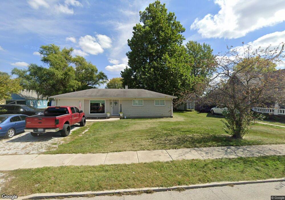
329 State Route 19 Cicero, IN 46034
Estimated Value: $157,000 - $269,000
4
Beds
1
Bath
1,300
Sq Ft
$172/Sq Ft
Est. Value
About This Home
This home is located at 329 State Route 19, Cicero, IN 46034 and is currently estimated at $223,084, approximately $171 per square foot. 329 State Route 19 is a home located in Hamilton County with nearby schools including Hamilton Heights Primary School, Hamilton Heights Elementary School, and Hamilton Heights Middle School.
Ownership History
Date
Name
Owned For
Owner Type
Purchase Details
Closed on
Feb 23, 2011
Sold by
Citi Property Holdings Inc
Bought by
Widows Stanley R and Widows Brenda G
Current Estimated Value
Purchase Details
Closed on
Sep 30, 2010
Sold by
Ward Brandy L and Ward Jonathan H
Bought by
Citi Property Holdings Inc
Purchase Details
Closed on
Aug 7, 2003
Sold by
Trout Marilyn Kay and Trout Marilyn K
Bought by
Ward Jonathan H
Home Financials for this Owner
Home Financials are based on the most recent Mortgage that was taken out on this home.
Original Mortgage
$85,000
Interest Rate
6.18%
Mortgage Type
Purchase Money Mortgage
Purchase Details
Closed on
Aug 4, 2003
Sold by
Trout Daniel Ellis and Markovich Carl A
Bought by
Trout Marilyn Kay
Home Financials for this Owner
Home Financials are based on the most recent Mortgage that was taken out on this home.
Original Mortgage
$85,000
Interest Rate
6.18%
Mortgage Type
Purchase Money Mortgage
Create a Home Valuation Report for This Property
The Home Valuation Report is an in-depth analysis detailing your home's value as well as a comparison with similar homes in the area
Home Values in the Area
Average Home Value in this Area
Purchase History
| Date | Buyer | Sale Price | Title Company |
|---|---|---|---|
| Widows Stanley R | -- | Security Title Services Llc | |
| Citi Property Holdings Inc | $76,000 | None Available | |
| Ward Jonathan H | -- | -- | |
| Trout Marilyn Kay | -- | -- |
Source: Public Records
Mortgage History
| Date | Status | Borrower | Loan Amount |
|---|---|---|---|
| Previous Owner | Ward Jonathan H | $85,000 |
Source: Public Records
Tax History Compared to Growth
Tax History
| Year | Tax Paid | Tax Assessment Tax Assessment Total Assessment is a certain percentage of the fair market value that is determined by local assessors to be the total taxable value of land and additions on the property. | Land | Improvement |
|---|---|---|---|---|
| 2024 | $2,010 | $122,600 | $36,900 | $85,700 |
| 2023 | $2,010 | $105,600 | $36,900 | $68,700 |
| 2022 | $2,424 | $125,400 | $58,700 | $66,700 |
| 2021 | $2,319 | $116,300 | $58,700 | $57,600 |
| 2020 | $2,326 | $116,300 | $58,700 | $57,600 |
| 2019 | $1,916 | $95,800 | $35,600 | $60,200 |
| 2018 | $1,812 | $90,600 | $35,600 | $55,000 |
| 2017 | $1,742 | $87,100 | $35,600 | $51,500 |
| 2016 | $1,734 | $86,700 | $35,600 | $51,100 |
| 2014 | $1,647 | $82,300 | $39,600 | $42,700 |
| 2013 | $1,647 | $86,400 | $39,600 | $46,800 |
Source: Public Records
Map
Nearby Homes
- 140 Wiley St
- 70 Armitage St
- 600 Lakeview Ln
- 999 Shoreline Cir
- 100 Confidential Dr
- 18 Point Ln
- 31 Bluewater Dr
- 14 Morse Ct
- 15 Morse Ct
- 1209 Half Moon Ln
- 826 N Lanyard Dr
- 29 Point Ln
- 243 Alvor Ct
- 1689 Nantucket Dr
- 815 Morse Landing Dr
- 1940 Nantucket Dr
- 131 Batteese Dr
- 221 Common Loon Blvd
- 24 Karner Blue Ct
- 27 Karner Blue Ct
- 329 S Peru St
- 349 S Peru St
- 371 S Peru St
- 289 S Peru St
- 350 S Harrison St
- 389 S Peru St
- 300 S Peru St
- 310 S Harrison St
- 290 S Harrison St
- 290 N Harrison St
- 290 S Peru St
- 70 E Neal St
- 390 S Peru St
- 270 S Harrison St
- 370 S Peru St
- 250 S Peru St
- 409 S Peru St
- 218 S Harrison St
- 410 S Peru St
- 218 S Harrison St