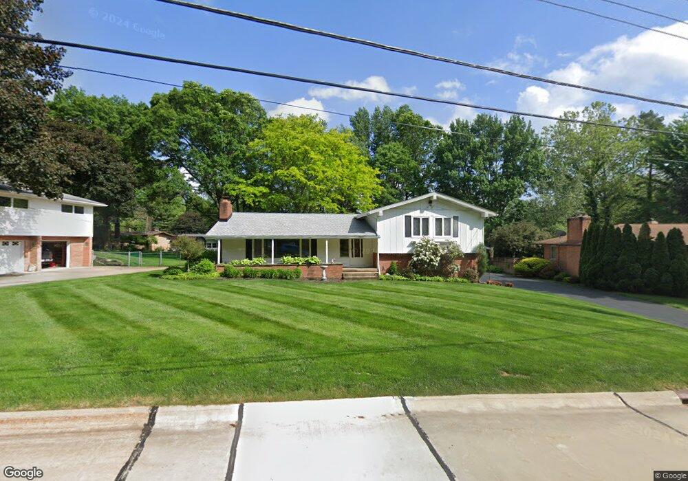
329 Stouffer Rd Fairlawn, OH 44333
Estimated Value: $311,974 - $357,000
3
Beds
3
Baths
1,928
Sq Ft
$173/Sq Ft
Est. Value
About This Home
This home is located at 329 Stouffer Rd, Fairlawn, OH 44333 and is currently estimated at $334,494, approximately $173 per square foot. 329 Stouffer Rd is a home located in Summit County with nearby schools including Copley-Fairlawn Middle School, Copley High School, and Fairlawn Lutheran School.
Ownership History
Date
Name
Owned For
Owner Type
Purchase Details
Closed on
Aug 15, 1996
Sold by
Strandberg Brent B
Bought by
Flanagan Rosemary M
Current Estimated Value
Home Financials for this Owner
Home Financials are based on the most recent Mortgage that was taken out on this home.
Original Mortgage
$65,000
Interest Rate
8.18%
Mortgage Type
New Conventional
Purchase Details
Closed on
Oct 21, 1994
Sold by
Woodyard David K
Bought by
Brent B and Brent Strandberg
Home Financials for this Owner
Home Financials are based on the most recent Mortgage that was taken out on this home.
Original Mortgage
$118,800
Interest Rate
8.53%
Mortgage Type
New Conventional
Create a Home Valuation Report for This Property
The Home Valuation Report is an in-depth analysis detailing your home's value as well as a comparison with similar homes in the area
Home Values in the Area
Average Home Value in this Area
Purchase History
| Date | Buyer | Sale Price | Title Company |
|---|---|---|---|
| Flanagan Rosemary M | $156,500 | -- | |
| Brent B | $148,500 | -- |
Source: Public Records
Mortgage History
| Date | Status | Borrower | Loan Amount |
|---|---|---|---|
| Closed | Flanagan Rosemary M | $65,000 | |
| Previous Owner | Brent B | $118,800 |
Source: Public Records
Tax History Compared to Growth
Tax History
| Year | Tax Paid | Tax Assessment Tax Assessment Total Assessment is a certain percentage of the fair market value that is determined by local assessors to be the total taxable value of land and additions on the property. | Land | Improvement |
|---|---|---|---|---|
| 2025 | $3,274 | $91,658 | $18,109 | $73,549 |
| 2024 | $3,274 | $91,658 | $18,109 | $73,549 |
| 2023 | $3,274 | $91,658 | $18,109 | $73,549 |
| 2022 | $2,917 | $69,476 | $13,619 | $55,857 |
| 2021 | $2,740 | $69,476 | $13,619 | $55,857 |
| 2020 | $2,679 | $69,480 | $13,620 | $55,860 |
| 2019 | $2,578 | $61,060 | $12,940 | $48,120 |
| 2018 | $2,526 | $61,060 | $12,940 | $48,120 |
| 2017 | $2,241 | $61,060 | $12,940 | $48,120 |
| 2016 | $2,239 | $52,130 | $12,940 | $39,190 |
| 2015 | $2,241 | $52,130 | $12,940 | $39,190 |
| 2014 | $2,233 | $52,130 | $12,940 | $39,190 |
| 2013 | $2,388 | $55,330 | $12,940 | $42,390 |
Source: Public Records
Map
Nearby Homes
- 3143 Morewood Rd
- 3354 Bancroft Rd
- 360 Marviel Dr
- 3317 Morewood Rd
- 288 Kenridge Rd
- 3404 S Smith Rd
- 1012 Bunker Dr Unit 304
- 462 Gresham Dr
- 3475 Bancroft Rd
- 3340 Willow Ln
- 482 Gresham Dr
- 278 Chestnut Ln
- 3451 Stanley Rd
- V/L White Tail Ridge Dr
- 342 S Miller Rd
- 242 Elm Ln
- 0 Brunsdorph Rd
- 3430 Links Dr
- 786 Brunsdorph Rd
- 595 Moorfield Rd
- 339 Stouffer Rd
- 319 Stouffer Rd
- 340 Ormsby Rd
- 350 Ormsby Rd
- 349 Stouffer Rd
- 3096 Stanley Rd
- 334 Stouffer Rd
- 3116 Stanley Rd
- 360 Ormsby Rd
- 3080 Stanley Rd
- 344 Stouffer Rd
- 322 Ormsby Rd
- 3097 Bancroft Rd
- 3081 Bancroft Rd
- 3115 Bancroft Rd
- 3060 Stanley Rd
- 3109 Stanley Rd
- 3097 Stanley Rd
- 339 Ormsby Rd
- 349 Ormsby Rd