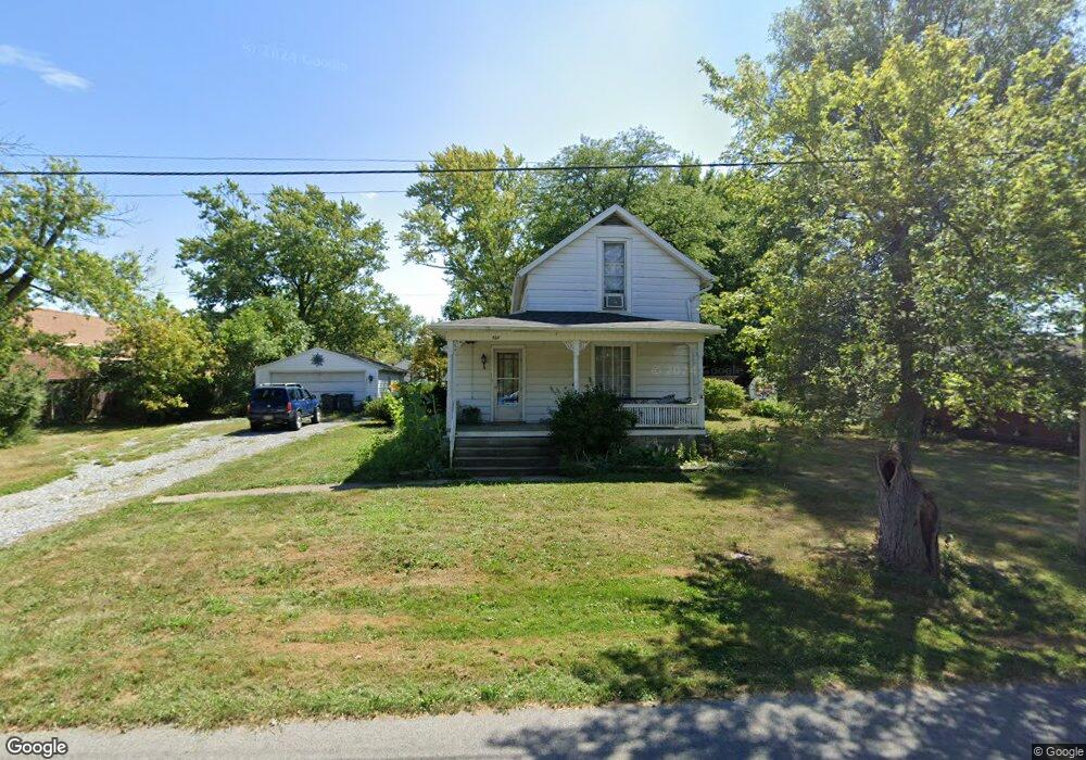
329 W Kildare Ave Lima, OH 45801
Northside Lima NeighborhoodEstimated Value: $100,981 - $114,000
3
Beds
1
Bath
1,168
Sq Ft
$93/Sq Ft
Est. Value
About This Home
This home is located at 329 W Kildare Ave, Lima, OH 45801 and is currently estimated at $108,245, approximately $92 per square foot. 329 W Kildare Ave is a home located in Allen County with nearby schools including Independence Elementary School, Lima North Middle School, and Lima West Middle School.
Ownership History
Date
Name
Owned For
Owner Type
Purchase Details
Closed on
Jun 1, 2022
Sold by
Lehman Enterprises Llc
Bought by
Mckissick William
Current Estimated Value
Purchase Details
Closed on
Apr 5, 2019
Sold by
Boyd Cheryl L and Huntington National Bank Sbm S
Bought by
Lehman Enterprises Llc
Purchase Details
Closed on
Jun 4, 1999
Sold by
Gremling Robert W
Bought by
Boyd Cheryl L
Home Financials for this Owner
Home Financials are based on the most recent Mortgage that was taken out on this home.
Original Mortgage
$37,800
Interest Rate
6.94%
Mortgage Type
New Conventional
Purchase Details
Closed on
Jul 1, 1983
Bought by
Gremling Robert W
Create a Home Valuation Report for This Property
The Home Valuation Report is an in-depth analysis detailing your home's value as well as a comparison with similar homes in the area
Home Values in the Area
Average Home Value in this Area
Purchase History
| Date | Buyer | Sale Price | Title Company |
|---|---|---|---|
| Mckissick William | $45,000 | Pedlow Edward B | |
| Lehman Enterprises Llc | $32,200 | None Available | |
| Boyd Cheryl L | $42,000 | -- | |
| Gremling Robert W | -- | -- |
Source: Public Records
Mortgage History
| Date | Status | Borrower | Loan Amount |
|---|---|---|---|
| Previous Owner | Boyd Cheryl L | $37,800 |
Source: Public Records
Tax History
| Year | Tax Paid | Tax Assessment Tax Assessment Total Assessment is a certain percentage of the fair market value that is determined by local assessors to be the total taxable value of land and additions on the property. | Land | Improvement |
|---|---|---|---|---|
| 2024 | $1,093 | $29,120 | $9,170 | $19,950 |
| 2023 | $940 | $21,430 | $6,760 | $14,670 |
| 2022 | $938 | $21,430 | $6,760 | $14,670 |
| 2021 | $994 | $21,430 | $6,760 | $14,670 |
| 2020 | $999 | $18,560 | $6,550 | $12,010 |
| 2019 | $999 | $18,560 | $6,550 | $12,010 |
| 2018 | $949 | $18,560 | $6,550 | $12,010 |
| 2017 | $951 | $18,560 | $6,550 | $12,010 |
| 2016 | $962 | $18,560 | $6,550 | $12,010 |
| 2015 | $860 | $18,560 | $6,550 | $12,010 |
| 2014 | $860 | $16,310 | $6,300 | $10,010 |
| 2013 | $837 | $16,310 | $6,300 | $10,010 |
Source: Public Records
Map
Nearby Homes
- 1212 Virginia Ave
- 1889 N Metcalf St
- 207 W Lane Ave
- 608 W O'Connor Ave
- 1317 Virginia Ave
- 576 W Ashton Ave
- 1021 N McDonel St
- 645 W O'Connor Ave
- 557 W Ashton Ave
- 1435 N Central Ave
- 635 W Ashton Ave
- 760 W O'Connor Ave
- 919 N Main St
- 1705 Karen St
- 406 Ewing Ave
- 316 Ewing Ave
- 735 N Elizabeth St
- 934 N Metcalf St
- 745 Ewing Ave
- 435 Marian Ave
- 397 W Kildare Ave
- 399 W Kildare Ave
- 320 W Kildare Ave
- 310 W Robb Ave
- 312 W Robb Ave
- 340 W Robb Ave
- 398 W Kildare Ave
- 401 W Kildare Ave
- 316 W Kildare Ave
- 1201 N McDonel St
- 403 W Kildare Ave
- 1301 N McDonel St
- 1231 N West St
- 404 W Robb Ave
- 1233 N West St
- 325 Ashwood Ave
- 412 W Kildare Ave
- 327 Ashwood Ave
- 399 Ashwood Ave
Your Personal Tour Guide
Ask me questions while you tour the home.