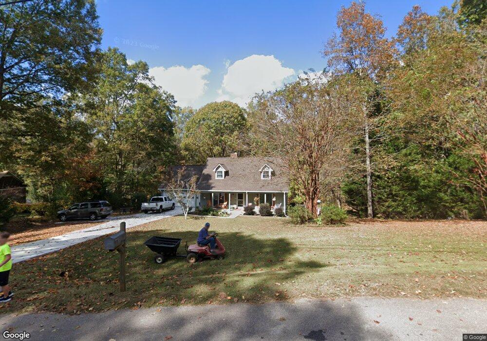
329 Woodfield Cir Lagrange, GA 30240
Estimated Value: $278,156 - $309,000
3
Beds
3
Baths
2,075
Sq Ft
$140/Sq Ft
Est. Value
About This Home
This home is located at 329 Woodfield Cir, Lagrange, GA 30240 and is currently estimated at $290,289, approximately $139 per square foot. 329 Woodfield Cir is a home located in Troup County with nearby schools including Long Cane Elementary School, Berta Weathersbee Elementary School, and Whitesville Road Elementary School.
Ownership History
Date
Name
Owned For
Owner Type
Purchase Details
Closed on
Dec 1, 1992
Sold by
First Federal Savings Bank Of
Bought by
Vickery Steven L and Vickery Wanda J
Current Estimated Value
Purchase Details
Closed on
Sep 18, 1992
Sold by
Brasher Kenneth T and Brasher Joanne M
Bought by
First Federal Savings Bank Of
Purchase Details
Closed on
Jun 28, 1985
Sold by
Knight & Knight Of Laginc
Bought by
Brasher Kenneth T and Brasher Joanne M
Purchase Details
Closed on
Nov 24, 1975
Sold by
Knight W Hooper Etal
Bought by
Knight & Knight Of Laginc
Create a Home Valuation Report for This Property
The Home Valuation Report is an in-depth analysis detailing your home's value as well as a comparison with similar homes in the area
Home Values in the Area
Average Home Value in this Area
Purchase History
| Date | Buyer | Sale Price | Title Company |
|---|---|---|---|
| Vickery Steven L | $76,500 | -- | |
| First Federal Savings Bank Of | $83,900 | -- | |
| Brasher Kenneth T | $89,900 | -- | |
| Knight & Knight Of Laginc | -- | -- |
Source: Public Records
Tax History Compared to Growth
Tax History
| Year | Tax Paid | Tax Assessment Tax Assessment Total Assessment is a certain percentage of the fair market value that is determined by local assessors to be the total taxable value of land and additions on the property. | Land | Improvement |
|---|---|---|---|---|
| 2024 | $2,100 | $79,000 | $14,000 | $65,000 |
| 2023 | $1,918 | $72,320 | $8,000 | $64,320 |
| 2022 | $1,797 | $66,360 | $8,000 | $58,360 |
| 2021 | $1,753 | $60,120 | $8,000 | $52,120 |
| 2020 | $1,753 | $60,120 | $8,000 | $52,120 |
| 2019 | $1,577 | $54,280 | $8,000 | $46,280 |
| 2018 | $1,503 | $51,840 | $8,000 | $43,840 |
| 2017 | $1,504 | $51,840 | $8,000 | $43,840 |
| 2016 | $1,431 | $49,436 | $7,200 | $42,236 |
| 2015 | $1,434 | $49,436 | $7,200 | $42,236 |
| 2014 | $1,369 | $47,213 | $7,200 | $40,013 |
| 2013 | -- | $49,100 | $7,200 | $41,900 |
Source: Public Records
Map
Nearby Homes
- 141 Plymouth Dr
- 105 Hawthorne Cir
- 102 Franklin Place
- 103 Hawthorne Cir
- 119 Plymouth Dr
- 110 Hawthorne Cir
- 100 Huntcliff Ct
- 101 Ivy Springs Dr
- 124 Foxdale Dr
- 135 Planters Ridge Dr
- 190 Hill Rd
- 474 Newton Rd
- 40 River Point Dr
- 509 Connie Dr
- 808 S Fling Rd
- 0 Deming St Unit 10550189
- 37 Overbrook Dr
- 108 Hidden Springs Dr
- 0 Bradfield Dr Unit 10568803
- 205 Linda Ln
- 327 Woodfield Cir
- 331 Woodfield Cir
- 325 Woodfield Cir
- 328 Woodfield Cir
- 324 Woodfield Cir
- 324 Woodfield Cir Unit 27
- 323 Woodfield Cir
- 334 Woodfield Cir
- 335 Woodfield Cir
- 321 Woodfield Cir
- 109 Oakdale Dr
- 108 Oakdale Dr
- 320 Woodfield Cir
- 359 Maley Rd
- 337 Woodfield Cir
- 107 Oakdale Dr
- 319 Woodfield Cir
- 213 Woodfield Cir
- 348 Maley Rd
- 106 Oakdale Dr