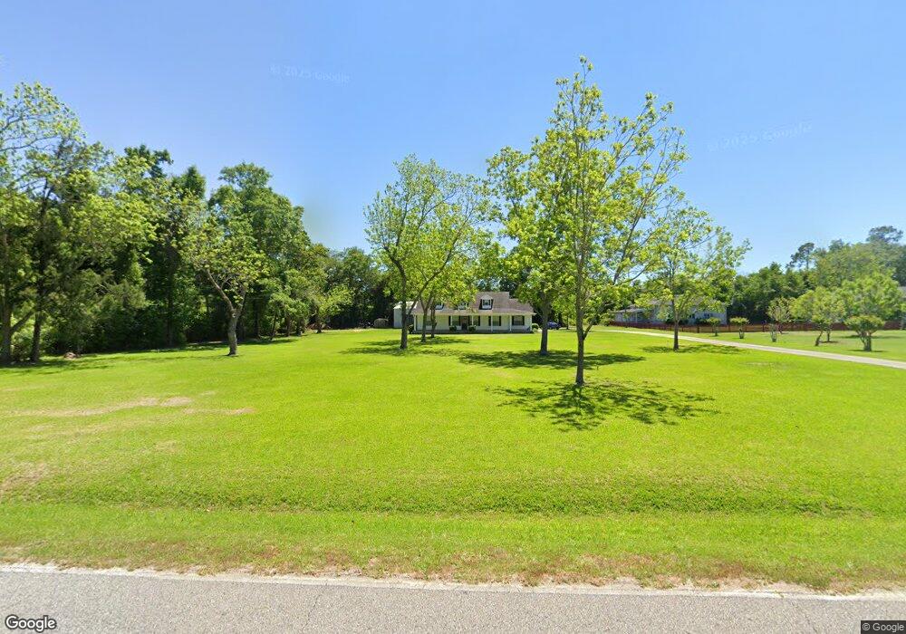
32926 Carrier Dr Lillian, AL 36549
Estimated Value: $375,635 - $426,000
--
Bed
1
Bath
1,952
Sq Ft
$204/Sq Ft
Est. Value
About This Home
This home is located at 32926 Carrier Dr, Lillian, AL 36549 and is currently estimated at $397,409, approximately $203 per square foot. 32926 Carrier Dr is a home located in Baldwin County with nearby schools including Elberta Elementary School, Elberta Middle School, and Elberta High School.
Ownership History
Date
Name
Owned For
Owner Type
Purchase Details
Closed on
Nov 21, 2011
Sold by
Anderson Steven W and Anderson Tamara A
Bought by
Anderson Steven W and Anderson Tamara A
Current Estimated Value
Purchase Details
Closed on
Jul 13, 2007
Sold by
Potter Duane E and Potter Viola M
Bought by
Anderson Steven W and Anderson Tamara A
Home Financials for this Owner
Home Financials are based on the most recent Mortgage that was taken out on this home.
Original Mortgage
$105,000
Interest Rate
6.37%
Mortgage Type
Purchase Money Mortgage
Create a Home Valuation Report for This Property
The Home Valuation Report is an in-depth analysis detailing your home's value as well as a comparison with similar homes in the area
Home Values in the Area
Average Home Value in this Area
Purchase History
| Date | Buyer | Sale Price | Title Company |
|---|---|---|---|
| Anderson Steven W | -- | None Available | |
| Anderson Steven W | -- | Gst |
Source: Public Records
Mortgage History
| Date | Status | Borrower | Loan Amount |
|---|---|---|---|
| Closed | Anderson Steven W | $105,000 |
Source: Public Records
Tax History Compared to Growth
Tax History
| Year | Tax Paid | Tax Assessment Tax Assessment Total Assessment is a certain percentage of the fair market value that is determined by local assessors to be the total taxable value of land and additions on the property. | Land | Improvement |
|---|---|---|---|---|
| 2024 | $727 | $34,700 | $9,600 | $25,100 |
| 2023 | $644 | $30,860 | $6,340 | $24,520 |
| 2022 | $579 | $27,800 | $0 | $0 |
| 2021 | $645 | $24,440 | $0 | $0 |
| 2020 | $584 | $22,480 | $0 | $0 |
| 2019 | $540 | $20,880 | $0 | $0 |
| 2018 | $475 | $18,560 | $0 | $0 |
| 2017 | $458 | $17,960 | $0 | $0 |
| 2016 | $451 | $17,720 | $0 | $0 |
| 2015 | -- | $16,840 | $0 | $0 |
| 2014 | -- | $17,000 | $0 | $0 |
| 2013 | -- | $17,160 | $0 | $0 |
Source: Public Records
Map
Nearby Homes
- 10257 Lyttleton Loop
- 33119 Arbor Ridge Cir Unit 15
- 32563 Arbor Ridge Cir
- 10675 Aloe Ln
- 10677 Aloe Ln
- 0 Lantana Dr
- 0 Route Rd Unit 1
- 10679 Mahogany Ln
- 33260 Woodlands Dr
- 10702 Mahogany Ln
- 33003 Albert Hollon Ln Unit 16
- 0 Tarklin View Dr Unit 1 377230
- 0 Lyttleton Loop Unit 11
- 33580 Woodlands Dr
- 32807 N Pickens Ave
- 33495 Woodlands Dr
- 106 Portage Cir
- 222 Defuniak Loop
- 271 Defuniak Cir
- 63 Buena Vista Dr
- 32860 Carrier Dr
- 32935 Carrier Dr
- 32780 Carrier Dr
- 32877 W Carrier Dr
- 32877 Carrier Dr
- 32999 Carrier Dr
- 32821 Carrier Dr
- 33045 Carrier Dr
- 32821 W Carrier Dr
- 32778 Carrier Dr
- 10305 County Road 99
- 10475 County Road 99
- 32709 Arbor Ridge Cir
- 32721 Arbor Ridge Cir
- 32691 Arbor Ridge Cir
- 32741 Arbor Ridge Cir
- 32675 Arbor Ridge Cir
- 32803 Carrier Dr
- 32759 Arbor Ridge Cir
- 32657 Arbor Ridge Cir