Estimated Value: $773,000 - $929,000
4
Beds
3
Baths
1,930
Sq Ft
$440/Sq Ft
Est. Value
About This Home
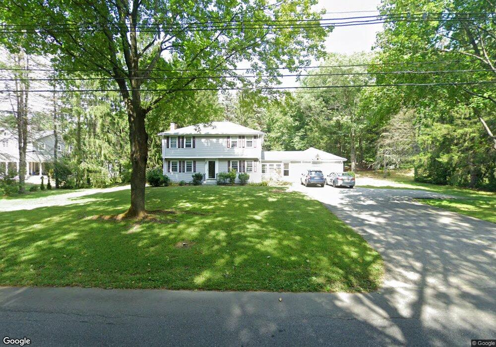
This home is located at 33 Adams St, Acton, MA 01720 and is currently estimated at $849,830, approximately $440 per square foot. 33 Adams St is a home located in Middlesex County with nearby schools including Acton-Boxborough Regional High School, Maynard Knowledge Beginnings, and The Imago School.
Create a Home Valuation Report for This Property
The Home Valuation Report is an in-depth analysis detailing your home's value as well as a comparison with similar homes in the area
Home Values in the Area
Average Home Value in this Area
Tax History Compared to Growth
Tax History
| Year | Tax Paid | Tax Assessment Tax Assessment Total Assessment is a certain percentage of the fair market value that is determined by local assessors to be the total taxable value of land and additions on the property. | Land | Improvement |
|---|---|---|---|---|
| 2025 | $12,005 | $700,000 | $315,900 | $384,100 |
| 2024 | $11,261 | $675,500 | $315,900 | $359,600 |
| 2023 | $11,137 | $634,200 | $287,300 | $346,900 |
| 2022 | $10,550 | $542,400 | $249,800 | $292,600 |
| 2021 | $10,281 | $508,200 | $231,100 | $277,100 |
| 2020 | $9,705 | $504,400 | $231,100 | $273,300 |
| 2019 | $9,234 | $476,700 | $231,100 | $245,600 |
| 2018 | $8,895 | $459,000 | $231,100 | $227,900 |
| 2017 | $8,678 | $455,300 | $231,100 | $224,200 |
| 2016 | $8,471 | $440,500 | $231,100 | $209,400 |
| 2015 | $8,313 | $436,400 | $231,100 | $205,300 |
| 2014 | $8,097 | $416,300 | $231,100 | $185,200 |
Source: Public Records
Map
Nearby Homes
- 1 Maillet Dr
- 2 & 6 Powder Mill Rd
- 69 Powder Mill Rd
- 66 Powder Mill Rd
- 7 King St
- 20 Tremont St
- 12 Walcott St
- 22 Garfield Ave
- 17 Prospect St
- 37 Glendale St
- 132 Parker St Unit G5
- 96 Forest Ridge Rd Unit 96
- 128 Parker St Unit 3B
- 91 Nason St
- 2 Wall Ct
- 9 Black Birch Ln Unit 9
- 30 Acton St
- 25 Main St
- 22-26 Waltham St
- 28 Waltham St Unit B