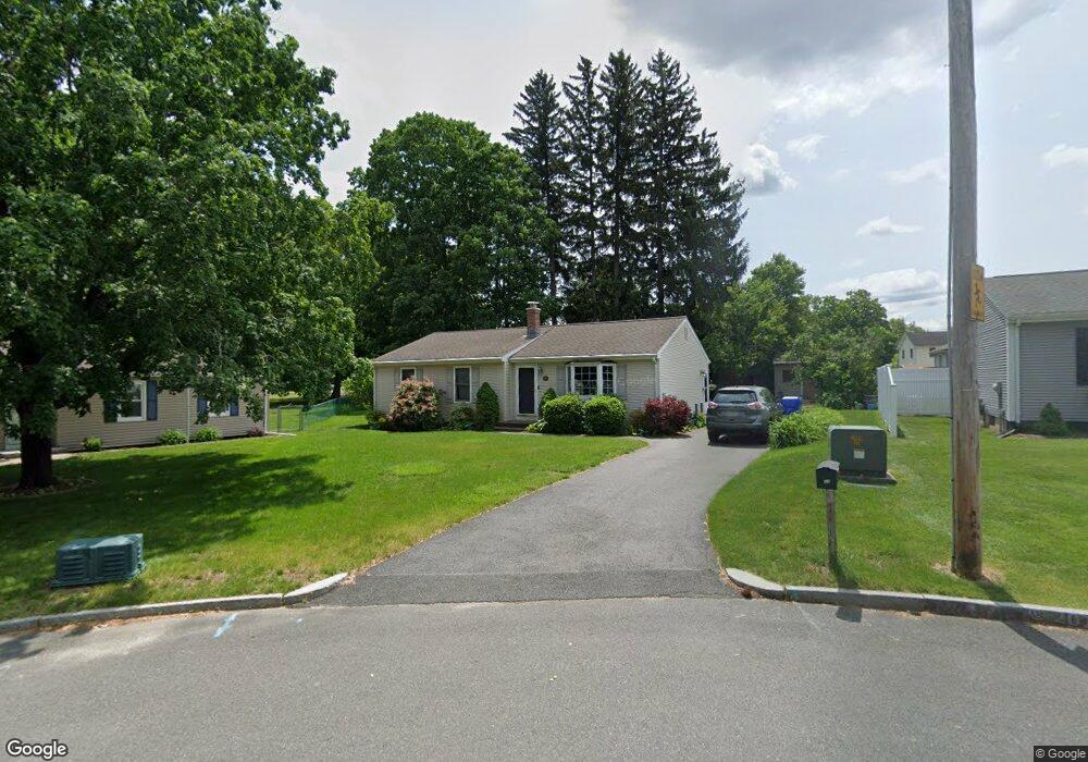
33 Baird Trace Springfield, MA 01118
East Forest Park NeighborhoodEstimated Value: $294,000 - $336,000
3
Beds
1
Bath
1,104
Sq Ft
$289/Sq Ft
Est. Value
About This Home
This home is located at 33 Baird Trace, Springfield, MA 01118 and is currently estimated at $319,536, approximately $289 per square foot. 33 Baird Trace is a home located in Hampden County with nearby schools including Frederick Harris Elementary School, M Marcus Kiley Middle, and Springfield High School of Science and Technology.
Create a Home Valuation Report for This Property
The Home Valuation Report is an in-depth analysis detailing your home's value as well as a comparison with similar homes in the area
Home Values in the Area
Average Home Value in this Area
Tax History
| Year | Tax Paid | Tax Assessment Tax Assessment Total Assessment is a certain percentage of the fair market value that is determined by local assessors to be the total taxable value of land and additions on the property. | Land | Improvement |
|---|---|---|---|---|
| 2025 | $4,590 | $292,700 | $51,800 | $240,900 |
| 2024 | $4,270 | $265,900 | $51,800 | $214,100 |
| 2023 | $4,044 | $237,200 | $49,300 | $187,900 |
| 2022 | $3,948 | $209,800 | $49,300 | $160,500 |
| 2021 | $3,943 | $208,600 | $44,800 | $163,800 |
| 2020 | $3,726 | $190,800 | $44,800 | $146,000 |
| 2019 | $3,588 | $182,300 | $44,800 | $137,500 |
| 2018 | $3,454 | $175,500 | $44,800 | $130,700 |
| 2017 | $3,417 | $173,800 | $44,800 | $129,000 |
| 2016 | $3,065 | $155,900 | $44,800 | $111,100 |
| 2015 | $2,972 | $151,100 | $44,800 | $106,300 |
Source: Public Records
Map
Nearby Homes
- 55 Allen St
- 101 Regal St
- 120 Bridle Path Rd
- 647 Plumtree Rd
- 19 Manor Ct Unit 19
- 17 Pebble Mill Rd
- 86 Talmadge Dr
- 85 Talmadge Dr
- 24 Wands St
- 125 Manor Ct Unit 125
- 509 Plumtree Rd
- 81 W Crystal Brook Dr
- 37 Chesterfield Ave
- 86 Wildwood Ave
- 206 Treetop Ave
- 41 Hillside Dr
- 55 Old Farm Rd
- 47 Hartford Terrace
- 75 Gillette Cir
- 384 Abbott St
Your Personal Tour Guide
Ask me questions while you tour the home.