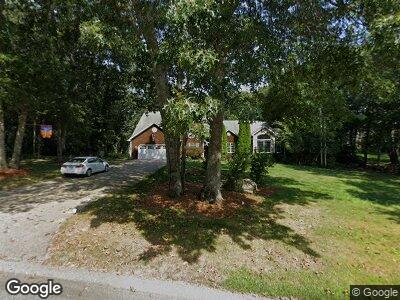
33 Beauchamp Dr Saunderstown, RI 02874
Estimated Value: $1,147,176 - $1,497,000
4
Beds
3
Baths
3,769
Sq Ft
$338/Sq Ft
Est. Value
About This Home
This home is located at 33 Beauchamp Dr, Saunderstown, RI 02874 and is currently estimated at $1,273,044, approximately $337 per square foot. 33 Beauchamp Dr is a home located in Washington County with nearby schools including Hamilton Elementary School, Wickford Middle School, and North Kingstown Sr. High School.
Ownership History
Date
Name
Owned For
Owner Type
Purchase Details
Closed on
Jun 8, 1998
Sold by
In David A Cote Blders
Bought by
Lafferty Martin A and Sherer Carol A
Current Estimated Value
Create a Home Valuation Report for This Property
The Home Valuation Report is an in-depth analysis detailing your home's value as well as a comparison with similar homes in the area
Home Values in the Area
Average Home Value in this Area
Purchase History
| Date | Buyer | Sale Price | Title Company |
|---|---|---|---|
| Lafferty Martin A | $276,500 | -- |
Source: Public Records
Mortgage History
| Date | Status | Borrower | Loan Amount |
|---|---|---|---|
| Open | Lafferty Carol A | $497,500 | |
| Closed | Lafferty Martin A | $100,000 | |
| Closed | David A Cote Bldrs Inc | $417,000 | |
| Closed | David A Cote Bldrs Inc | $363,000 | |
| Closed | David A Cote Bldrs Inc | $350,000 |
Source: Public Records
Tax History Compared to Growth
Tax History
| Year | Tax Paid | Tax Assessment Tax Assessment Total Assessment is a certain percentage of the fair market value that is determined by local assessors to be the total taxable value of land and additions on the property. | Land | Improvement |
|---|---|---|---|---|
| 2024 | $12,606 | $879,100 | $269,200 | $609,900 |
| 2023 | $12,606 | $879,100 | $269,200 | $609,900 |
| 2022 | $12,360 | $879,100 | $269,200 | $609,900 |
| 2021 | $11,709 | $669,100 | $199,300 | $469,800 |
| 2020 | $11,435 | $669,100 | $199,300 | $469,800 |
| 2019 | $11,435 | $669,100 | $199,300 | $469,800 |
| 2018 | $11,173 | $589,000 | $199,300 | $389,700 |
| 2017 | $10,950 | $589,000 | $199,300 | $389,700 |
| 2016 | $10,637 | $589,000 | $199,300 | $389,700 |
| 2015 | $9,638 | $499,400 | $148,100 | $351,300 |
| 2014 | $7,083 | $499,400 | $148,100 | $351,300 |
Source: Public Records
Map
Nearby Homes
- 331 Congdon Hill Rd
- 34 Finch Ln
- 156 Douglas Dr
- 210 Explorer Dr
- 202 Explorer Dr
- 168 Explorer Dr
- 158 Explorer Dr
- 195 Deer Ridge Dr
- 285 Pendar Rd
- 68 Delta Dr
- 0 Congdon Hill Rd
- 402 Sylvan Ct
- 397 Sylvan Ct
- 108 Shady Lea Rd
- 294 Railroad Ave
- 36 Jasmine Cir
- 2180 Tower Hill Rd
- 119 Mill Pond Rd
- 604 Stony Fort Rd
- 2424 Tower Hill Rd
- 33 Beauchamp Dr
- 53 Beauchamp Dr
- 559 Congdon Hill Rd
- 32 Ilex Ct
- 539 Congdon Hill Rd
- 18 Ilex Ct
- 519 Congdon Hill Rd
- 591 Congdon Hill Rd
- 60 Beauchamp Dr
- 81 Beauchamp Dr
- 542 Congdon Hill Rd
- 16 Pheasant Run
- 497 Congdon Hill Rd
- 19 Ilex Ct
- 615 Congdon Hill Rd
- 80 Beauchamp Dr
- 168 Holly Hills Ln
- 19 Pheasant Run
- 23 Haggarty Hill Rd
- 510 Congdon Hill Rd