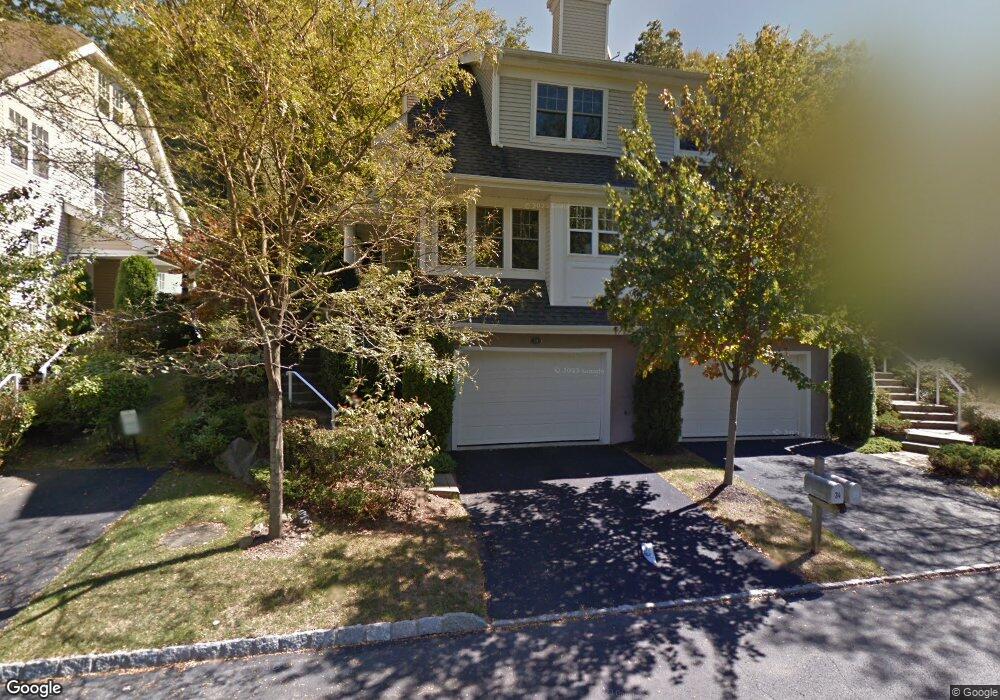
33 Briarbrook Dr Briarcliff Manor, NY 10510
Estimated Value: $737,000 - $791,000
--
Bed
4
Baths
--
Sq Ft
436
Sq Ft Lot
About This Home
This home is located at 33 Briarbrook Dr, Briarcliff Manor, NY 10510 and is currently estimated at $755,379. 33 Briarbrook Dr is a home located in Westchester County with nearby schools including Park School, Claremont School, and Roosevelt Elementary School.
Ownership History
Date
Name
Owned For
Owner Type
Purchase Details
Closed on
Aug 3, 2019
Sold by
Ciampi Sabrina
Bought by
Ciampi Sabrina and Sabrina Ciampi Revocable Living Trust
Current Estimated Value
Purchase Details
Closed on
Aug 19, 2005
Sold by
Burns Carrie A
Bought by
Rodrick Anthony and Rodrick Janet
Purchase Details
Closed on
May 2, 2005
Sold by
Burns Paul T and Burns Carrie A
Bought by
Burns Carrie A
Create a Home Valuation Report for This Property
The Home Valuation Report is an in-depth analysis detailing your home's value as well as a comparison with similar homes in the area
Home Values in the Area
Average Home Value in this Area
Purchase History
| Date | Buyer | Sale Price | Title Company |
|---|---|---|---|
| Ciampi Sabrina | -- | None Available | |
| Rodrick Anthony | $632,000 | First American Title Ins Co | |
| Burns Carrie A | -- | -- |
Source: Public Records
Tax History Compared to Growth
Tax History
| Year | Tax Paid | Tax Assessment Tax Assessment Total Assessment is a certain percentage of the fair market value that is determined by local assessors to be the total taxable value of land and additions on the property. | Land | Improvement |
|---|---|---|---|---|
| 2024 | $11,462 | $383,200 | $111,100 | $272,100 |
| 2023 | $11,135 | $371,500 | $110,500 | $261,000 |
| 2022 | $11,726 | $342,100 | $108,100 | $234,000 |
| 2021 | $11,417 | $330,000 | $107,100 | $222,900 |
| 2020 | $11,525 | $320,300 | $107,100 | $213,200 |
| 2019 | $11,357 | $310,000 | $107,100 | $202,900 |
| 2018 | $9,181 | $310,000 | $107,100 | $202,900 |
| 2017 | $1,488 | $296,700 | $106,400 | $190,300 |
| 2016 | $49,470 | $296,700 | $106,400 | $190,300 |
| 2015 | $6,125 | $16,788 | $6,900 | $9,888 |
| 2014 | $6,125 | $16,788 | $6,900 | $9,888 |
| 2013 | $6,125 | $16,788 | $6,900 | $9,888 |
Source: Public Records
Map
Nearby Homes
- 10 Briarbrook Dr
- 70 Briarbrook Dr
- 155 Revolutionary Rd
- 36 Revolutionary Rd
- 608 Kemeys Cove Unit 6-08
- 147 Charter Cir Unit 147
- 23 Liberty St
- 16 Rockledge Ave Unit 7J
- 16 Rockledge Ave Unit 5B1
- 16 Rockledge Ave Unit 3E1
- 16 Rockledge Ave Unit 5L2
- 97 Charter Cir Unit 97
- 84 Charter Cir Unit 84
- 39 Admiral Wordens Ln
- 7 Liberty St
- 129 S Highland Ave Unit C-2
- 3 Holbrook Rd
- 123 S Highland Ave Unit B3
- 125 S Highland Ave Unit 4B
- 127 S Highland Ave Unit A4
- 34 Briarbrook Dr
- 32 Briarbrook Dr
- 32 Briarbrook Dr Unit 32
- 36 Briarbrook Dr Unit 36
- 36 Briarbrook Dr
- 36 Briarbrook Dr Unit 93
- 30 Briarbrook Dr
- 39 Briarbrook Dr
- 40 Briarbrook Dr
- 40 Briarbrook Dr Unit 40
- 28 Briarbrook Dr
- 27 Briarbrook Dr
- 42 Briarbrook Dr
- 26 Briarbrook Dr
- 26 Briarbrook Dr
- 26 Briarbrook Dr Unit 26
- 25 Briarbrook Dr Unit 25
- 43 Briarbrook Dr
- 44 Briarbrook Dr Unit 44
- 81 Brookwood Dr