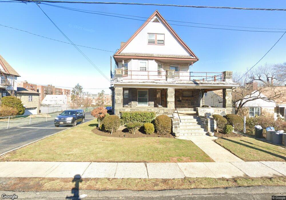
33 Broad St E Mount Vernon, NY 10552
North Side NeighborhoodEstimated Value: $901,000 - $1,018,000
Studio
2
Baths
2,886
Sq Ft
$331/Sq Ft
Est. Value
About This Home
This home is located at 33 Broad St E, Mount Vernon, NY 10552 and is currently estimated at $954,562, approximately $330 per square foot. 33 Broad St E is a home located in Westchester County with nearby schools including Pennington Elementary School, Mount Vernon High School, and The Montfort Academy.
Ownership History
Date
Name
Owned For
Owner Type
Purchase Details
Closed on
Oct 31, 2022
Sold by
Foti Robert
Bought by
Persaud Naresh
Current Estimated Value
Home Financials for this Owner
Home Financials are based on the most recent Mortgage that was taken out on this home.
Original Mortgage
$533,000
Outstanding Balance
$516,381
Interest Rate
6.92%
Mortgage Type
New Conventional
Estimated Equity
$438,181
Purchase Details
Closed on
Jan 30, 2019
Sold by
Siconolfi Michael and Siconolfi Patsy
Bought by
Foti Robert
Home Financials for this Owner
Home Financials are based on the most recent Mortgage that was taken out on this home.
Original Mortgage
$585,062
Interest Rate
4.75%
Mortgage Type
FHA
Purchase Details
Closed on
Nov 21, 2012
Sold by
Siconolfi Michele and Siconolfi Anna
Bought by
Siconolfi Michael
Create a Home Valuation Report for This Property
The Home Valuation Report is an in-depth analysis detailing your home's value as well as a comparison with similar homes in the area
Home Values in the Area
Average Home Value in this Area
Purchase History
| Date | Buyer | Sale Price | Title Company |
|---|---|---|---|
| Persaud Naresh | $725,000 | First American Title | |
| Foti Robert | $600,000 | Judicial Title Insurance | |
| Siconolfi Michael | -- | None Available |
Source: Public Records
Mortgage History
| Date | Status | Borrower | Loan Amount |
|---|---|---|---|
| Open | Persaud Naresh | $533,000 | |
| Previous Owner | Foti Robert | $585,062 |
Source: Public Records
Tax History
| Year | Tax Paid | Tax Assessment Tax Assessment Total Assessment is a certain percentage of the fair market value that is determined by local assessors to be the total taxable value of land and additions on the property. | Land | Improvement |
|---|---|---|---|---|
| 2024 | $22,935 | $13,900 | $4,300 | $9,600 |
| 2023 | $17,846 | $13,900 | $4,300 | $9,600 |
| 2022 | $21,915 | $13,900 | $4,300 | $9,600 |
| 2021 | $21,521 | $13,900 | $4,300 | $9,600 |
| 2020 | $20,497 | $13,900 | $4,300 | $9,600 |
| 2019 | $20,244 | $13,900 | $4,300 | $9,600 |
| 2018 | $5,851 | $13,900 | $4,300 | $9,600 |
| 2017 | $0 | $13,900 | $4,300 | $9,600 |
| 2016 | $19,798 | $13,900 | $4,300 | $9,600 |
| 2015 | -- | $13,900 | $4,300 | $9,600 |
| 2014 | -- | $13,900 | $4,300 | $9,600 |
| 2013 | -- | $13,900 | $4,300 | $9,600 |
Source: Public Records
Map
Nearby Homes
- 32 Broad St E Unit 1B
- 625 Gramatan Ave Unit 4R
- 117 E Cedar St
- 472 Gramatan Ave Unit Bldg 6, Unit BB4
- 472 Gramatan Ave Unit CC3, Building 6
- 472 Gramatan Ave Unit Bldg.3, Unit L2
- 472 Gramatan Ave Unit H1
- 472 Gramatan Ave Unit Bldg., 6, FF2
- 290 Collins Ave Unit 5D
- 280 Collins Ave Unit 4E
- 60 Broad St W Unit 1K
- 60 Broad St W Unit 1L
- 445 Gramatan Ave Unit E-B3
- 445 Gramatan Ave Unit G-C2
- 445 Gramatan Ave Unit GA2
- 445 Gramatan Ave Unit GD1
- 40 Harding Pkwy
- 673 Locust St Unit 1F
- 663 Locust St Unit 5-G
- 777 N MacQuesten Pkwy Unit 308
- 33 Broad St E Unit C 3-C
- 35 Broad St E
- 25 Broad St E Unit 1st fl
- 25 Broad St E Unit B
- 25 Broad St E Unit 2
- 25 Broad St E
- 41 Broad St E
- 21 Broad St E
- 45 Broad St E
- 460 Westchester Ave
- 24 Broad St E
- 42 Broad St E
- 428 Westchester Ave
- 20 Broad St E
- 420 Westchester Ave Unit 2
- 420 Westchester Ave
- 32 Broad St E Unit C 2A
- 32 Broad St E Unit B2A
- 32 Broad St E Unit C1C
- 32 Broad St E Unit D2B
Your Personal Tour Guide
Ask me questions while you tour the home.