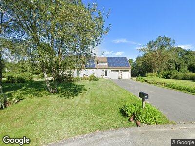
33 Butterfly Trail North Dartmouth, MA 02747
Freetown NeighborhoodEstimated Value: $758,000 - $897,000
3
Beds
3
Baths
2,900
Sq Ft
$288/Sq Ft
Est. Value
About This Home
This home is located at 33 Butterfly Trail, North Dartmouth, MA 02747 and is currently estimated at $834,692, approximately $287 per square foot. 33 Butterfly Trail is a home located in Bristol County with nearby schools including Dartmouth High School.
Ownership History
Date
Name
Owned For
Owner Type
Purchase Details
Closed on
Oct 7, 1994
Sold by
Asm Rlty Inc
Bought by
Mello Peter J and Mello Patricia F
Current Estimated Value
Home Financials for this Owner
Home Financials are based on the most recent Mortgage that was taken out on this home.
Original Mortgage
$111,300
Interest Rate
8.55%
Mortgage Type
Purchase Money Mortgage
Create a Home Valuation Report for This Property
The Home Valuation Report is an in-depth analysis detailing your home's value as well as a comparison with similar homes in the area
Home Values in the Area
Average Home Value in this Area
Purchase History
| Date | Buyer | Sale Price | Title Company |
|---|---|---|---|
| Mello Peter J | $40,000 | -- |
Source: Public Records
Mortgage History
| Date | Status | Borrower | Loan Amount |
|---|---|---|---|
| Closed | Mello Peter J | $336,000 | |
| Closed | Mello Peter J | $304,000 | |
| Closed | Mello Peter J | $60,000 | |
| Closed | Mello Peter J | $285,000 | |
| Closed | Mello Peter J | $163,000 | |
| Closed | Mello Peter J | $111,300 |
Source: Public Records
Tax History Compared to Growth
Tax History
| Year | Tax Paid | Tax Assessment Tax Assessment Total Assessment is a certain percentage of the fair market value that is determined by local assessors to be the total taxable value of land and additions on the property. | Land | Improvement |
|---|---|---|---|---|
| 2025 | $5,225 | $577,400 | $168,000 | $409,400 |
| 2024 | $5,043 | $551,800 | $168,000 | $383,800 |
| 2023 | $5,054 | $521,600 | $168,000 | $353,600 |
| 2022 | $4,896 | $472,600 | $168,000 | $304,600 |
| 2021 | $5,032 | $464,600 | $163,200 | $301,400 |
| 2020 | $4,765 | $438,000 | $161,600 | $276,400 |
| 2019 | $4,639 | $427,600 | $155,100 | $272,500 |
| 2018 | $4,136 | $392,400 | $158,300 | $234,100 |
| 2017 | $3,944 | $370,700 | $146,100 | $224,600 |
| 2016 | $3,653 | $345,300 | $123,200 | $222,100 |
| 2015 | $3,569 | $339,600 | $115,000 | $224,600 |
| 2014 | $3,462 | $331,600 | $112,000 | $219,600 |
Source: Public Records
Map
Nearby Homes
- 20 Dartmouth Farm Trail
- 1261 N Hixville Rd
- 700 Old Fall River Rd
- 2 Donna Marie Dr
- 1 Knollwood Dr
- 427 Yellow Hill Rd
- 818 Reed Rd
- 9 E Lakeside Ave
- 21 Evergreen St
- 7 Westview Dr
- 259 Highland Ave
- 335 Old Fall River Rd
- 93 Highland Ave
- 269 Flag Swamp Rd
- 854 State Rd
- 3 Diane Way
- 0 Copicut Rd Unit 1373633
- 28 Elmwood Ave
- 7 Idola St
- 636 Fauce Corner Rd
- 33 Butterfly Trail
- 1 Skipper Ln
- 29 Butterfly Trail
- 3 Skipper Ln
- 908 Old Fall River Rd
- 2 Purple Wing Ln
- 25 Butterfly Trail
- 30 Butterfly Trail
- 34 Butterfly Trail
- 910 Old Fall River Rd
- 26 Butterfly Trail
- 906 Old Fall River Rd
- 21 Butterfly Trail
- 7 Purple Wing Ln
- 6 Purple Wing Ln
- 22 Butterfly Trail
- 913 Old Fall River Rd
- 909 Old Fall River Rd
- 18 Butterfly Trail
- 879 Old Fall River Rd