33 Damon Rd Brewster, MA 02631
Brewster AreaEstimated Value: $916,000 - $1,093,852
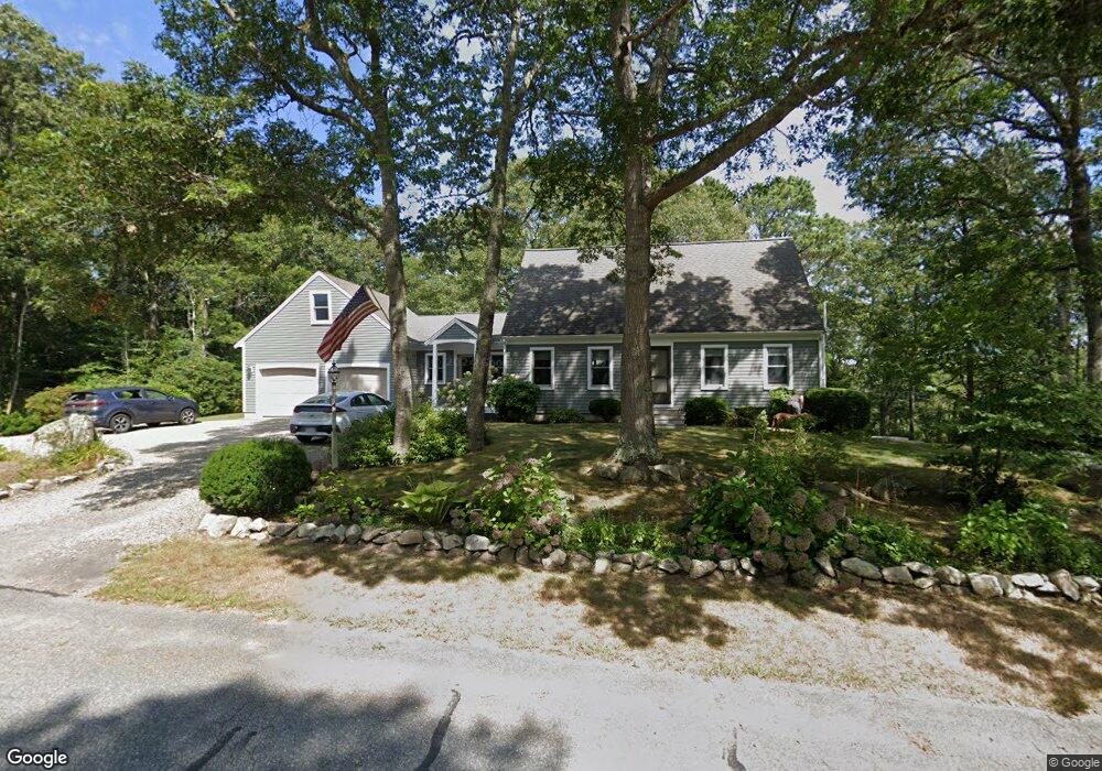
About This Home
This home is located at 33 Damon Rd, Brewster, MA 02631 and is currently estimated at $1,002,963, approximately $557 per square foot. 33 Damon Rd is a home located in Barnstable County with nearby schools including Stony Brook Elementary School, Eddy Elementary School, and Nauset Regional Middle School.
Ownership History
We collect this data history from publicly available records. To have your information removed, we recommend requesting removal directly through your county’s website.
Purchase Details
Purchase Details
Home Values in the Area
Average Home Value in this Area
Purchase History
We collect this data history from publicly available records. To have your information removed, we recommend requesting removal directly through your county’s website.
| Date | Buyer | Sale Price | Title Company |
|---|---|---|---|
| -- | -- | ||
| $427,000 | -- |
Mortgage History
We collect this data history from publicly available records. To have your information removed, we recommend requesting removal directly through your county’s website.
| Date | Status | Borrower | Loan Amount |
|---|---|---|---|
| Previous Owner | $165,000 | ||
| Previous Owner | $25,000 | ||
| Previous Owner | $123,500 | ||
| Previous Owner | $119,014 |
Tax History
We collect this data history from publicly available records. To have your information removed, we recommend requesting removal directly through your county’s website.
| Year | Tax Paid | Tax Assessment Tax Assessment Total Assessment is a certain percentage of the fair market value that is determined by local assessors to be the total taxable value of land and additions on the property. | Land | Improvement |
|---|---|---|---|---|
| 2025 | $6,410 | $931,700 | $304,500 | $627,200 |
| 2024 | $6,160 | $904,600 | $312,200 | $592,400 |
| 2023 | $5,697 | $815,000 | $278,700 | $536,300 |
| 2022 | $5,349 | $681,400 | $232,200 | $449,200 |
| 2021 | $5,114 | $596,000 | $201,900 | $394,100 |
| 2020 | $4,830 | $560,300 | $185,700 | $374,600 |
| 2019 | $1,833 | $536,400 | $170,900 | $365,500 |
| 2018 | $4,317 | $522,600 | $170,900 | $351,700 |
| 2017 | $1,614 | $507,200 | $170,900 | $336,300 |
| 2016 | $3,833 | $454,700 | $152,300 | $302,400 |
| 2015 | $2,854 | $345,500 | $149,300 | $196,200 |
Map
- 57 Damon Rd
- 62 Camelot Ln
- 44 Damon Rd
- 17 Damon Rd
- 24 Damon Rd
- 50 Camelot Ln
- 170 Donahue Rd
- 64 Camelot Ln
- 607 Great Fields Rd
- 553 Great Fields Rd
- 159 Donahue Rd
- 0 Damon Rd
- 619 Great Fields Rd
- 533 Great Fields Rd
- 570 Great Fields Rd
- 140 Donahue Rd
- 631 Great Fields Rd
- 90 Damon Rd
- 606 Great Fields Rd
- 639 Great Fields Rd
Ask me questions while you tour the home.