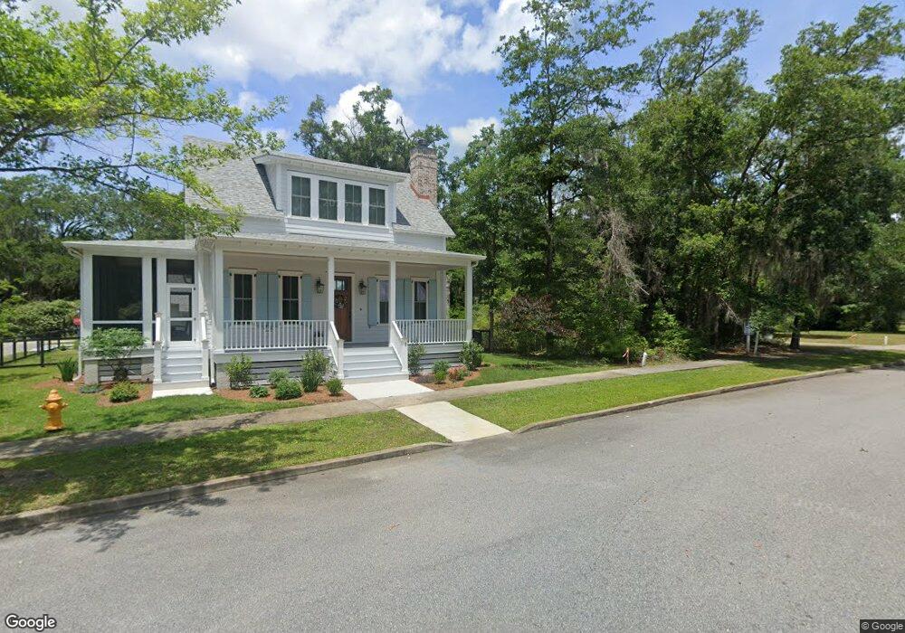
33 Fernswood Ln Beaufort, SC 29907
Estimated Value: $524,000 - $841,000
--
Bed
--
Bath
--
Sq Ft
3.84
Acres
About This Home
This home is located at 33 Fernswood Ln, Beaufort, SC 29907 and is currently estimated at $655,933. 33 Fernswood Ln is a home with nearby schools including Coosa Elementary School, Lady's Island Middle School, and Beaufort High School.
Ownership History
Date
Name
Owned For
Owner Type
Purchase Details
Closed on
Feb 6, 2025
Sold by
Jones Graham and Jones Amanda Sutcliffe
Bought by
Canton Living Trust and Jones
Current Estimated Value
Purchase Details
Closed on
Oct 7, 2020
Sold by
Sutcliffe Gerald L and Sutcliffe Barbara Davis
Bought by
Jones Amanda Sutcliffe and Jones Graham
Home Financials for this Owner
Home Financials are based on the most recent Mortgage that was taken out on this home.
Original Mortgage
$394,250
Interest Rate
2.8%
Mortgage Type
New Conventional
Create a Home Valuation Report for This Property
The Home Valuation Report is an in-depth analysis detailing your home's value as well as a comparison with similar homes in the area
Home Values in the Area
Average Home Value in this Area
Purchase History
| Date | Buyer | Sale Price | Title Company |
|---|---|---|---|
| Canton Living Trust | -- | None Listed On Document | |
| Canton Living Trust | -- | None Listed On Document | |
| Canton Living Trust | -- | None Listed On Document | |
| Canton Living Trust | -- | None Listed On Document | |
| Jones Amanda Sutcliffe | $415,000 | None Available |
Source: Public Records
Mortgage History
| Date | Status | Borrower | Loan Amount |
|---|---|---|---|
| Previous Owner | Jones Amanda Sutcliffe | $394,250 |
Source: Public Records
Tax History Compared to Growth
Tax History
| Year | Tax Paid | Tax Assessment Tax Assessment Total Assessment is a certain percentage of the fair market value that is determined by local assessors to be the total taxable value of land and additions on the property. | Land | Improvement |
|---|---|---|---|---|
| 2024 | $1,560 | $5,880 | $0 | $0 |
| 2023 | $1,560 | $5,000 | $0 | $0 |
| 2022 | $1,230 | $4,340 | $0 | $0 |
| 2021 | $1,299 | $4,340 | $0 | $0 |
| 2020 | $1,259 | $4,340 | $0 | $0 |
| 2019 | $1,244 | $4,340 | $0 | $0 |
| 2018 | $1,173 | $4,340 | $0 | $0 |
| 2017 | $1,264 | $4,540 | $0 | $0 |
| 2016 | $1,142 | $4,540 | $0 | $0 |
| 2014 | $1,063 | $4,540 | $0 | $0 |
Source: Public Records
Map
Nearby Homes
- 37 Park Square S
- 1 Park Row
- 53 Park Way
- 28 Western Way
- 29 Carter Oaks Dr
- 27 Western Way
- 23 Western Way
- 4 Flyway Dr
- 1 Carter Oaks Dr
- 6 Tuxedo Dr
- 97 Western Trace
- 106 Coosaw Club Dr
- 110 Coosaw Club Dr
- 9 Hendersons Way
- 63 Woodland Ridge Cir
- 20 Millers Pond Dr
- TBD Arbor Victory Rd
- 6 Tiller Island Dr
- 140 Coosaw Club Dr
- 40 Briarpatch Ln