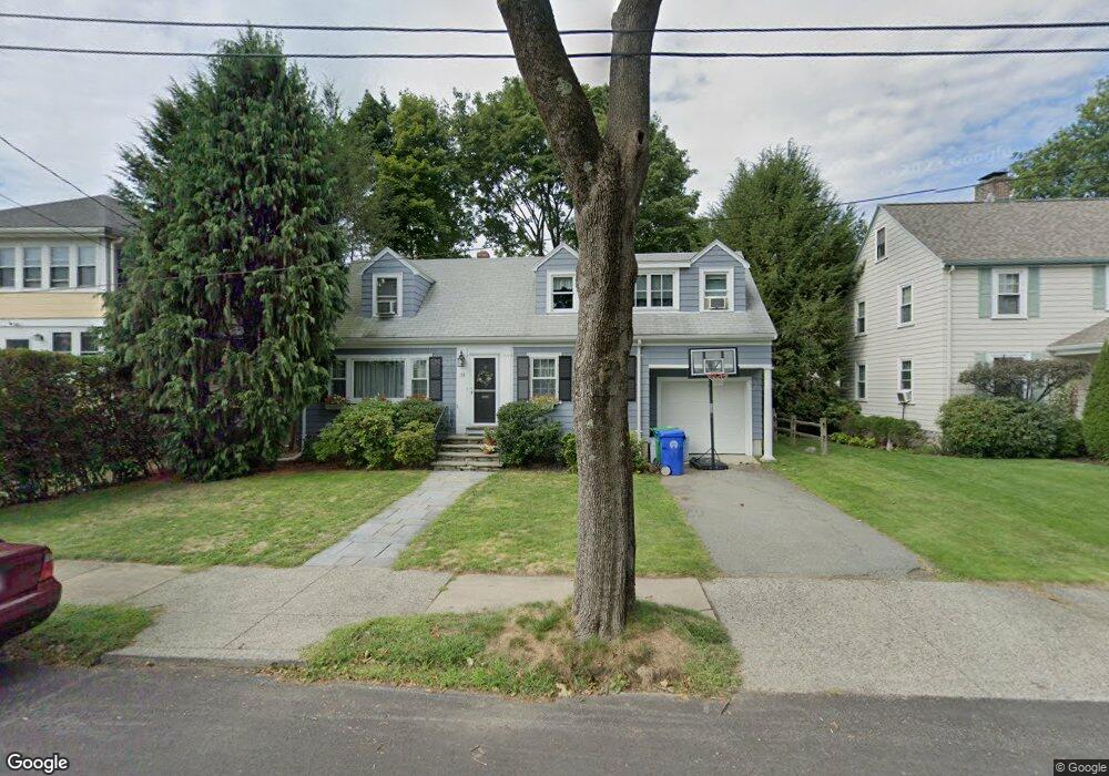
33 Fordham Rd West Newton, MA 02465
West Newton NeighborhoodEstimated Value: $1,142,000 - $1,363,000
3
Beds
2
Baths
1,849
Sq Ft
$655/Sq Ft
Est. Value
About This Home
This home is located at 33 Fordham Rd, West Newton, MA 02465 and is currently estimated at $1,211,319, approximately $655 per square foot. 33 Fordham Rd is a home located in Middlesex County with nearby schools including Franklin Elementary School, F.A. Day Middle School, and Newton North High School.
Ownership History
Date
Name
Owned For
Owner Type
Purchase Details
Closed on
May 28, 1993
Sold by
Hill Kristine B
Bought by
Nugent Paul H and Gamberoni Clare M
Current Estimated Value
Home Financials for this Owner
Home Financials are based on the most recent Mortgage that was taken out on this home.
Original Mortgage
$174,150
Interest Rate
7.41%
Mortgage Type
Purchase Money Mortgage
Purchase Details
Closed on
May 13, 1991
Sold by
Olson Clarence G and Olson Susan E
Bought by
Hill Steven G and Hill Kristine B
Purchase Details
Closed on
May 15, 1987
Sold by
Page Frederick
Bought by
Olsen Clarence G
Create a Home Valuation Report for This Property
The Home Valuation Report is an in-depth analysis detailing your home's value as well as a comparison with similar homes in the area
Home Values in the Area
Average Home Value in this Area
Purchase History
| Date | Buyer | Sale Price | Title Company |
|---|---|---|---|
| Nugent Paul H | $193,500 | -- | |
| Hill Steven G | $80,000 | -- | |
| Olsen Clarence G | $165,000 | -- |
Source: Public Records
Mortgage History
| Date | Status | Borrower | Loan Amount |
|---|---|---|---|
| Open | Olsen Clarence G | $156,000 | |
| Closed | Olsen Clarence G | $40,000 | |
| Closed | Olsen Clarence G | $158,000 | |
| Closed | Olsen Clarence G | $174,150 |
Source: Public Records
Tax History Compared to Growth
Tax History
| Year | Tax Paid | Tax Assessment Tax Assessment Total Assessment is a certain percentage of the fair market value that is determined by local assessors to be the total taxable value of land and additions on the property. | Land | Improvement |
|---|---|---|---|---|
| 2025 | $8,479 | $865,200 | $761,400 | $103,800 |
| 2024 | $8,198 | $840,000 | $739,200 | $100,800 |
| 2023 | $7,618 | $748,300 | $557,100 | $191,200 |
| 2022 | $7,289 | $692,900 | $515,800 | $177,100 |
| 2021 | $7,034 | $653,700 | $486,600 | $167,100 |
| 2020 | $6,825 | $653,700 | $486,600 | $167,100 |
| 2019 | $6,633 | $634,700 | $472,400 | $162,300 |
| 2018 | $6,345 | $586,400 | $429,500 | $156,900 |
| 2017 | $6,152 | $553,200 | $405,200 | $148,000 |
| 2016 | $5,883 | $517,000 | $378,700 | $138,300 |
| 2015 | $5,610 | $483,200 | $353,900 | $129,300 |
Source: Public Records
Map
Nearby Homes
- 75 Cherry St
- 76 Taft Ave Unit 1
- 76 Taft Ave
- 76 Taft Ave Unit 2
- 76 Harding St
- 162 Myrtle St Unit 1
- 138 Myrtle St Unit 2
- 9 John St
- 53-55 N Gate Park
- 24 Tolman St Unit A
- 25 Tolman St Unit 2
- 39 Clinton St Unit 2
- 39 Clinton St Unit 1
- 308 Newton St Unit 1
- 97 North St
- 287 Cherry St Unit 2
- 41 Kilburn Rd
- 81 Alder St
- 56 Dearborn St
- 33 Joseph Rd
- 37 Fordham Rd Unit 39
- 29 Fordham Rd
- 76 Cherry St Unit 78
- 80 Cherry St Unit 82
- 70 Cherry St Unit 72
- 72 Cherry St Unit 2
- 72 Cherry St Unit 72
- 34 Fordham Rd Unit 36
- 34 Fordham Rd Unit 2
- 25 Fordham Rd
- 50 Annapolis Rd
- 64 Cherry St Unit 66
- 64 Cherry St Unit 64
- 17 Fordham Rd Unit 19
- 19 Fordham Rd
- 90 Cherry St Unit 2
- 90 Cherry St Unit 92
- 90 Cherry St Unit 92
- 90 Cherry St Unit 1
- 90 Cherry St Unit 90