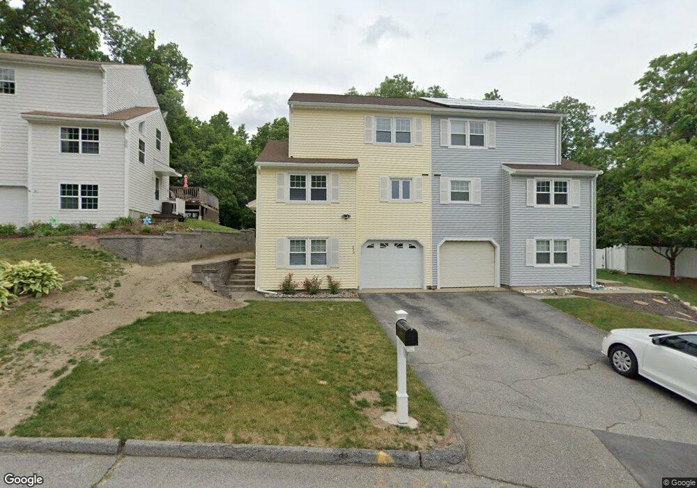
33 Gates Rd Worcester, MA 01603
Webster Square NeighborhoodEstimated Value: $396,230 - $453,000
2
Beds
2
Baths
1,488
Sq Ft
$289/Sq Ft
Est. Value
About This Home
This home is located at 33 Gates Rd, Worcester, MA 01603 and is currently estimated at $430,558, approximately $289 per square foot. 33 Gates Rd is a home located in Worcester County with nearby schools including Gates Lane, Jacob Hiatt Magnet School, and Chandler Magnet.
Ownership History
Date
Name
Owned For
Owner Type
Purchase Details
Closed on
Oct 10, 2003
Sold by
Riley John W and Riley Kathleen C
Bought by
Furzland Christopher and Garrison Nicole
Current Estimated Value
Home Financials for this Owner
Home Financials are based on the most recent Mortgage that was taken out on this home.
Original Mortgage
$185,250
Outstanding Balance
$87,278
Interest Rate
6.35%
Mortgage Type
Purchase Money Mortgage
Estimated Equity
$343,280
Purchase Details
Closed on
Dec 30, 1992
Sold by
Gates Lane Rt and Kargman William
Bought by
Riley John W
Home Financials for this Owner
Home Financials are based on the most recent Mortgage that was taken out on this home.
Original Mortgage
$92,900
Interest Rate
8.32%
Mortgage Type
Purchase Money Mortgage
Create a Home Valuation Report for This Property
The Home Valuation Report is an in-depth analysis detailing your home's value as well as a comparison with similar homes in the area
Home Values in the Area
Average Home Value in this Area
Purchase History
| Date | Buyer | Sale Price | Title Company |
|---|---|---|---|
| Furzland Christopher | $195,000 | -- | |
| Riley John W | $99,900 | -- |
Source: Public Records
Mortgage History
| Date | Status | Borrower | Loan Amount |
|---|---|---|---|
| Open | Furzland Christopher | $185,250 | |
| Previous Owner | Riley John W | $82,000 | |
| Previous Owner | Riley John W | $92,900 |
Source: Public Records
Tax History Compared to Growth
Tax History
| Year | Tax Paid | Tax Assessment Tax Assessment Total Assessment is a certain percentage of the fair market value that is determined by local assessors to be the total taxable value of land and additions on the property. | Land | Improvement |
|---|---|---|---|---|
| 2025 | $4,561 | $345,800 | $94,400 | $251,400 |
| 2024 | $4,340 | $315,600 | $94,400 | $221,200 |
| 2023 | $4,114 | $286,900 | $82,100 | $204,800 |
| 2022 | $3,763 | $247,400 | $65,600 | $181,800 |
| 2021 | $3,627 | $222,800 | $52,500 | $170,300 |
| 2020 | $3,538 | $208,100 | $52,100 | $156,000 |
| 2019 | $3,379 | $187,700 | $45,500 | $142,200 |
| 2018 | $3,377 | $178,600 | $45,500 | $133,100 |
| 2017 | $3,202 | $166,600 | $45,500 | $121,100 |
| 2016 | $3,114 | $151,100 | $32,700 | $118,400 |
| 2015 | $3,033 | $151,100 | $32,700 | $118,400 |
| 2014 | $2,952 | $151,100 | $32,700 | $118,400 |
Source: Public Records
Map
Nearby Homes
- 25 Wyola Dr
- 2 Montague St
- 19 Monticello Dr
- 23 Lakewood St
- 26 Sylvan St
- 15 Teddy Rd
- 128 Wildwood Ave
- 57 1st St
- 114 Lovell St
- 47 4th St
- 45 Fourth St
- 45 Fourth St Unit Right
- 34 Rosslare Dr Unit 108
- 34 Scandinavia Ave
- 76 Parsons Hill Dr Unit A
- 5 Stoneland Rd
- 19 Oliver St
- 11 Timrod Dr
- 12 Stoneland Rd
- 47 Birch St
- 33 Gates Rd
- 33A Gates Rd
- 35A Gates Rd
- 35 B Gates Rd Unit B
- 31 Gates Rd Unit B
- 31 Gates Rd Unit A
- 31 Gates Rd Unit 8
- 31 Gates Rd Unit A
- 31 Gates Rd
- 27 Gates Rd Unit B
- 27 Gates Rd Unit A
- 27A Gates Rd Unit L
- 27 Gates Rd
- 29 Gates Rd Unit B
- 29 Gates Rd Unit A
- 36 Gates Rd
- 37 Gates Rd
- 85 Gates Ln
- 26 Gates Rd
- 25 Gates Rd Unit B