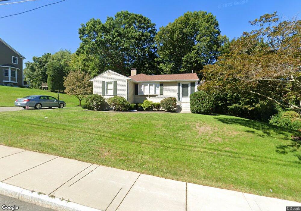
33 Gilman Rd Waltham, MA 02452
North Waltham NeighborhoodEstimated Value: $718,000 - $786,259
1
Bed
1
Bath
1,344
Sq Ft
$563/Sq Ft
Est. Value
About This Home
This home is located at 33 Gilman Rd, Waltham, MA 02452 and is currently estimated at $757,065, approximately $563 per square foot. 33 Gilman Rd is a home located in Middlesex County with nearby schools including Northeast Elementary School, John F Kennedy Middle School, and Waltham Sr High School.
Ownership History
Date
Name
Owned For
Owner Type
Purchase Details
Closed on
Jun 13, 2025
Sold by
Fogg Kevin M
Bought by
Cincotta Ronald
Current Estimated Value
Home Financials for this Owner
Home Financials are based on the most recent Mortgage that was taken out on this home.
Original Mortgage
$705,425
Outstanding Balance
$702,360
Interest Rate
6.76%
Mortgage Type
VA
Estimated Equity
$54,705
Purchase Details
Closed on
Jun 5, 2003
Sold by
Fogg Dorothy M and Fogg Gerald C
Bought by
Fogg Dorothy M and Fogg Gerald C
Purchase Details
Closed on
Jun 27, 1963
Bought by
Fogg Gerald and Fogg Dorothy
Create a Home Valuation Report for This Property
The Home Valuation Report is an in-depth analysis detailing your home's value as well as a comparison with similar homes in the area
Home Values in the Area
Average Home Value in this Area
Purchase History
| Date | Buyer | Sale Price | Title Company |
|---|---|---|---|
| Cincotta Ronald | $755,000 | None Available | |
| Cincotta Ronald | $755,000 | None Available | |
| Fogg Dorothy M | -- | -- | |
| Fogg Dorothy M | -- | -- | |
| Fogg Gerald | -- | -- |
Source: Public Records
Mortgage History
| Date | Status | Borrower | Loan Amount |
|---|---|---|---|
| Open | Cincotta Ronald | $705,425 | |
| Closed | Cincotta Ronald | $705,425 | |
| Previous Owner | Fogg Gerald | $100,000 | |
| Previous Owner | Fogg Gerald | $65,000 |
Source: Public Records
Tax History Compared to Growth
Tax History
| Year | Tax Paid | Tax Assessment Tax Assessment Total Assessment is a certain percentage of the fair market value that is determined by local assessors to be the total taxable value of land and additions on the property. | Land | Improvement |
|---|---|---|---|---|
| 2025 | $7,088 | $721,800 | $491,500 | $230,300 |
| 2024 | $6,719 | $697,000 | $469,700 | $227,300 |
| 2023 | $6,640 | $643,400 | $426,300 | $217,100 |
| 2022 | $6,586 | $591,200 | $382,800 | $208,400 |
| 2021 | $12,458 | $580,300 | $382,800 | $197,500 |
| 2020 | $6,528 | $546,300 | $356,700 | $189,600 |
| 2019 | $6,533 | $516,000 | $352,300 | $163,700 |
| 2018 | $11,337 | $470,500 | $326,200 | $144,300 |
| 2017 | $5,528 | $440,100 | $295,800 | $144,300 |
| 2016 | $5,174 | $422,700 | $278,400 | $144,300 |
| 2015 | $5,018 | $382,200 | $243,600 | $138,600 |
Source: Public Records
Map
Nearby Homes
- 107 Clocktower Dr Unit 3302
- 170 Clocktower Dr Unit 5103
- 87 Clocktower Dr Unit 2207
- 750 Trapelo Rd
- 30 Jacqueline Rd Unit C
- 1105 Lexington St Unit 102
- 65 Woburn St
- 55 Circle Dr
- 23 Wight St
- 30 Wampum Ave
- 129 Lake St
- 116 Raffaele Dr
- 14 Piedmont Ave
- 28 College Farm Rd Unit 2
- 311 Concord Ave
- 70 Rosewood Dr
- 5 April Ln Unit 12
- 65 Montclair Ave
- 44 Sachem St
- 234 Lake St