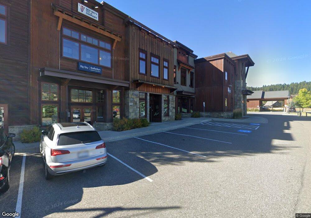
33 Lone Peak Dr Unit 104 Big Sky, MT 59716
Big Sky NeighborhoodEstimated Value: $1,299,331
--
Bed
--
Bath
1,204
Sq Ft
$1,079/Sq Ft
Est. Value
About This Home
This home is located at 33 Lone Peak Dr Unit 104, Big Sky, MT 59716 and is currently priced at $1,299,331, approximately $1,079 per square foot. 33 Lone Peak Dr Unit 104 is a home located in Gallatin County with nearby schools including Ophir Elementary School, Ophir Junior High School, and Lone Peak High School.
Ownership History
Date
Name
Owned For
Owner Type
Purchase Details
Closed on
Apr 24, 2023
Sold by
Ab Commercial Llc
Bought by
Salt House Properties Llc
Current Estimated Value
Purchase Details
Closed on
Apr 21, 2021
Sold by
33 Lone Peak Llc
Bought by
Ab Commercial Llc
Home Financials for this Owner
Home Financials are based on the most recent Mortgage that was taken out on this home.
Original Mortgage
$442,500
Interest Rate
3.05%
Mortgage Type
Commercial
Create a Home Valuation Report for This Property
The Home Valuation Report is an in-depth analysis detailing your home's value as well as a comparison with similar homes in the area
Home Values in the Area
Average Home Value in this Area
Purchase History
| Date | Buyer | Sale Price | Title Company |
|---|---|---|---|
| Salt House Properties Llc | -- | Flying S Title And Escrow | |
| Ab Commercial Llc | -- | First Americantitle Co |
Source: Public Records
Mortgage History
| Date | Status | Borrower | Loan Amount |
|---|---|---|---|
| Previous Owner | Ab Commercial Llc | $442,500 |
Source: Public Records
Tax History Compared to Growth
Tax History
| Year | Tax Paid | Tax Assessment Tax Assessment Total Assessment is a certain percentage of the fair market value that is determined by local assessors to be the total taxable value of land and additions on the property. | Land | Improvement |
|---|---|---|---|---|
| 2025 | $3,524 | $672,148 | $0 | $0 |
| 2024 | $3,107 | $504,100 | $0 | $0 |
| 2023 | $3,345 | $504,100 | $0 | $0 |
| 2022 | $3,746 | $409,400 | $0 | $0 |
| 2021 | $3,469 | $388,700 | $0 | $0 |
| 2020 | $3,154 | $316,533 | $0 | $0 |
| 2019 | $2,911 | $316,533 | $0 | $0 |
| 2018 | $2,514 | $247,803 | $0 | $0 |
| 2017 | $2,399 | $247,803 | $0 | $0 |
| 2016 | $2,603 | $224,200 | $0 | $0 |
| 2015 | $2,580 | $224,200 | $0 | $0 |
| 2014 | $2,945 | $227,083 | $0 | $0 |
Source: Public Records
Map
Nearby Homes
- 689 Sunburst Dr Unit C
- 56 Pheasant Tail Ln
- 99 Town Center Avenue Unit R2 Ave
- 99 Town Center Ave
- 80 Aspen Leaf Dr Unit 7
- 560 Rainbow Trout Run
- 2695 Curly Bear Rd
- 151 Pheasant Tail Ln Unit A
- 2575 Curley Bear Rd Unit 124
- 299 Ousel Falls Rd Unit 5
- 211 Town Center Ave Unit 3A
- 211 Town Center Ave Unit 2A
- 211 Town Center Ave Unit 3E
- 58 Upper Moose Hill Rd
- 148 Crail Creek Ct Unit 631
- 27 Antler Drop Ct
- 15 Spotted Fawn
- 30 Crail Creek Ct
- 680 Big Pine Dr
- 670 Big Pine Dr
- 33 Lone Peak Drive 103 Marketplace
- 33 Lone Peak Drive 204 Marketplace
- 33 Lone Peak Dr Unit 205
- 33 Lone Peak Dr Unit 102A&B
- 33 Lone Peak Dr
- 33 Lone Peak Dr Unit 101
- 33 Lone Peak Dr Unit 201
- 33 Lone Peak Dr Unit 203
- 33 Lone Peak Dr Unit 103
- Lone Peak Townhomes
- #7
- #39 Cedar Creek Condominiums
- 11 Lone Peak Dr Unit 205 & 207
- 11 Lone Peak Dr
- #10 Lone Peak Townhome
- 10 Pine Dr
- 3207 Two Moons Rd
- 77 Lone Peak Dr
- 3175 Two Moons Rd
- 3191 Two Moons Rd