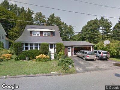
33 Manning St Williamstown, MA 01267
Estimated Value: $328,545 - $412,000
3
Beds
2
Baths
1,092
Sq Ft
$331/Sq Ft
Est. Value
About This Home
This home is located at 33 Manning St, Williamstown, MA 01267 and is currently estimated at $361,136, approximately $330 per square foot. 33 Manning St is a home located in Berkshire County with nearby schools including Lanesborough Elementary School, Mt. Greylock Regional High School, and Pine Cobble School.
Ownership History
Date
Name
Owned For
Owner Type
Purchase Details
Closed on
Jul 21, 2021
Sold by
Resio Michael A and Agostini Carolyn A
Bought by
Resio Matthew and Resio Benjamin
Current Estimated Value
Create a Home Valuation Report for This Property
The Home Valuation Report is an in-depth analysis detailing your home's value as well as a comparison with similar homes in the area
Home Values in the Area
Average Home Value in this Area
Purchase History
| Date | Buyer | Sale Price | Title Company |
|---|---|---|---|
| Resio Matthew | -- | None Available |
Source: Public Records
Mortgage History
| Date | Status | Borrower | Loan Amount |
|---|---|---|---|
| Previous Owner | Resio Michael A | $161,982 | |
| Previous Owner | Resio Michael A | $215,310 | |
| Previous Owner | Resio Michael A | $199,200 | |
| Previous Owner | Resio Michael A | $45,000 | |
| Previous Owner | Resio Michael A | $61,000 |
Source: Public Records
Tax History Compared to Growth
Tax History
| Year | Tax Paid | Tax Assessment Tax Assessment Total Assessment is a certain percentage of the fair market value that is determined by local assessors to be the total taxable value of land and additions on the property. | Land | Improvement |
|---|---|---|---|---|
| 2025 | $4,473 | $324,100 | $87,900 | $236,200 |
| 2024 | $4,387 | $289,600 | $83,600 | $206,000 |
| 2023 | $4,292 | $265,400 | $76,100 | $189,300 |
| 2022 | $4,025 | $237,900 | $73,200 | $164,700 |
| 2021 | $3,602 | $208,200 | $73,200 | $135,000 |
| 2020 | $3,589 | $203,900 | $73,400 | $130,500 |
| 2019 | $3,480 | $192,800 | $81,200 | $111,600 |
| 2018 | $3,459 | $192,800 | $81,200 | $111,600 |
| 2017 | $3,285 | $192,800 | $81,200 | $111,600 |
| 2016 | $3,044 | $192,800 | $81,200 | $111,600 |
| 2015 | $3,010 | $192,800 | $81,200 | $111,600 |
| 2014 | $2,827 | $185,000 | $74,300 | $110,700 |
Source: Public Records
Map
Nearby Homes
- 291 Cole Ave Unit 293
- 295 Cole Ave
- 290 Cole Ave
- 12 Arnold St Unit 16
- 33 Linden St
- 60 Arnold St Unit 62
- 24 Henderson Rd
- 111 Park St
- 123 Chestnut St
- 404 North St
- 21 Berkshire Dr
- 495 Main St
- 1 River Run Unit 1
- 12 River Run
- 424 N Hemlock Ln
- 1127 N Hoosac Rd
- 160 Water St Unit 301
- 160 Water St Unit 23
- 160 Water St Unit 103
- 160 Water St Unit 209