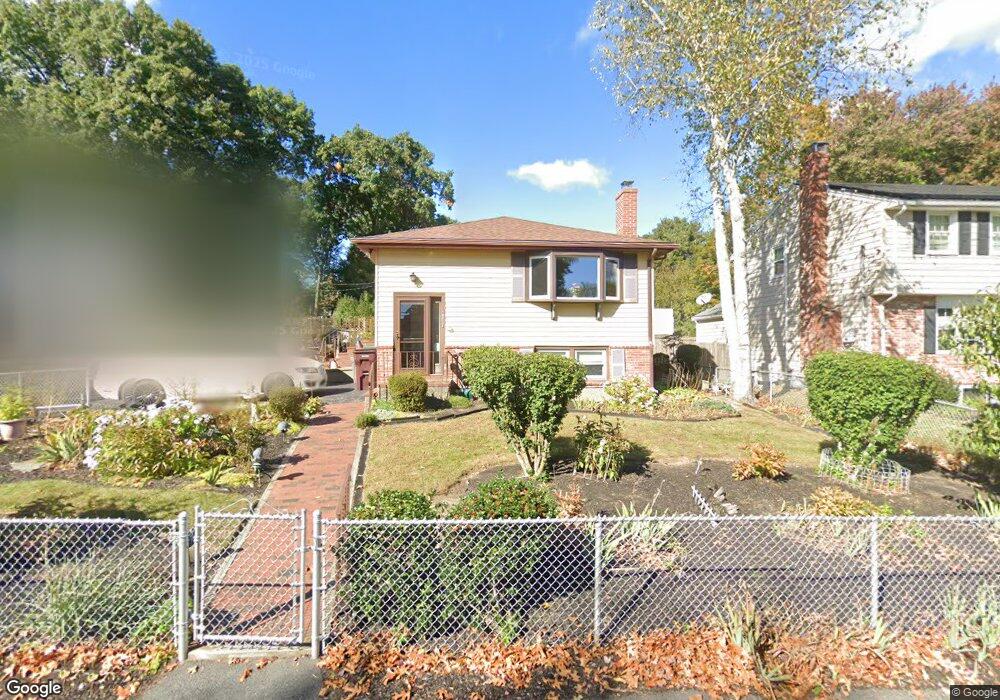
33 Mckinley Ave Dedham, MA 02026
Oakdale NeighborhoodEstimated Value: $661,000 - $745,000
3
Beds
2
Baths
1,224
Sq Ft
$567/Sq Ft
Est. Value
About This Home
This home is located at 33 Mckinley Ave, Dedham, MA 02026 and is currently estimated at $694,390, approximately $567 per square foot. 33 Mckinley Ave is a home located in Norfolk County with nearby schools including Oakdale Elementary School, Dedham Middle School, and Dedham High School.
Ownership History
Date
Name
Owned For
Owner Type
Purchase Details
Closed on
Nov 30, 2018
Sold by
Vanryzin Paul D and Vanryzin Ursula B
Bought by
Vanryzin Paul D and Vanryzin Ursula B
Current Estimated Value
Home Financials for this Owner
Home Financials are based on the most recent Mortgage that was taken out on this home.
Original Mortgage
$697,500
Outstanding Balance
$614,512
Interest Rate
4.8%
Mortgage Type
FHA
Estimated Equity
$79,878
Purchase Details
Closed on
Jan 5, 2011
Sold by
Mcdonnell Staci B
Bought by
Vanryzin Paul D and Vanryzin Ursula B
Create a Home Valuation Report for This Property
The Home Valuation Report is an in-depth analysis detailing your home's value as well as a comparison with similar homes in the area
Home Values in the Area
Average Home Value in this Area
Purchase History
| Date | Buyer | Sale Price | Title Company |
|---|---|---|---|
| Vanryzin Paul D | -- | -- | |
| Vanryzin Paul D | -- | -- | |
| Mcdonnell Staci B | -- | -- |
Source: Public Records
Mortgage History
| Date | Status | Borrower | Loan Amount |
|---|---|---|---|
| Open | Vanryzin Paul D | $697,500 |
Source: Public Records
Tax History
| Year | Tax Paid | Tax Assessment Tax Assessment Total Assessment is a certain percentage of the fair market value that is determined by local assessors to be the total taxable value of land and additions on the property. | Land | Improvement |
|---|---|---|---|---|
| 2025 | $8,144 | $645,300 | $349,400 | $295,900 |
| 2024 | $7,718 | $617,400 | $321,600 | $295,800 |
| 2023 | $7,749 | $603,500 | $298,500 | $305,000 |
| 2022 | $7,088 | $530,900 | $273,000 | $257,900 |
| 2021 | $6,861 | $501,900 | $273,000 | $228,900 |
| 2020 | $6,606 | $481,500 | $261,600 | $219,900 |
| 2019 | $6,346 | $448,500 | $237,400 | $211,100 |
| 2018 | $6,108 | $419,800 | $216,700 | $203,100 |
| 2017 | $5,882 | $398,500 | $208,100 | $190,400 |
| 2016 | $5,830 | $376,400 | $184,900 | $191,500 |
| 2015 | $5,347 | $336,900 | $175,800 | $161,100 |
| 2014 | $5,298 | $329,500 | $175,800 | $153,700 |
Source: Public Records
Map
Nearby Homes
- 6 Snow Ln
- 59 Hamilton Ave
- 600 East St
- 926 East St
- 58 Jersey St
- 50 Sprague St
- 45 Circuit Rd
- 98 Cedar St Unit 2
- 56 Mount Vernon St
- 22 Azalea Cir
- 28 Linden Place
- 441 Washington St Unit 301
- 442 High St
- 186 Carroll Ave
- 21 Birch St
- 46 Church St
- 165 Highland St Unit 165
- 18 Greensboro Rd
- 12 Blossom St
- 55 Church St Unit 1
- 27 Mckinley Ave
- 5 Snow Ln
- 45 Mckinley Ave
- 32 Mckinley Ave
- 21 Mckinley Ave
- 40 Mckinley Ave
- 40 Mckinley Ave Unit 1
- 11 Snow Ln
- 24 Mckinley Ave
- 10 Snow Ln
- 281 Fairbanks Rd
- 44 Mckinley Ave
- 30 Taft Ln
- 115 Rustcraft Rd
- 111 Rustcraft Rd
- 121 Rustcraft Rd
- 105 Rustcraft Rd
- 50 Mckinley Ave
- 125 Rustcraft Rd
- 346 Central Ave
Your Personal Tour Guide
Ask me questions while you tour the home.