
Seller's Agent in 2025
Lori Penney
ERA Key Realty Services
(978) 375-2520
6 in this area
284 Total Sales
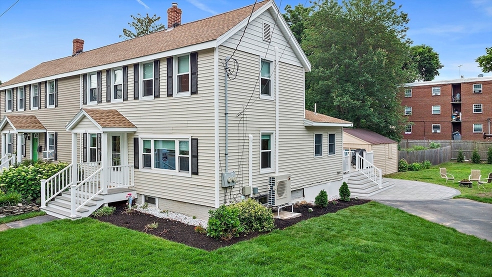
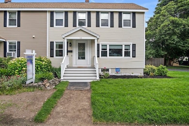
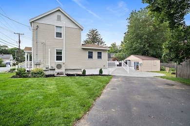
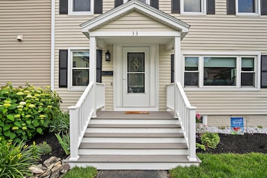

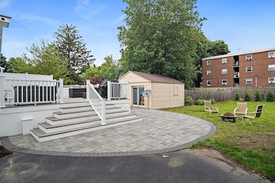

Beautifully updated 2 bed, 2 bath townhouse with 4-car parking and a spacious yard featuring a new 24x28 composite deck with vinyl railings—perfect for entertaining. The sun-drenched kitchen boasts white shaker cabinets, quartz countertops, island, gas cooking, wine fridge with serving station, and two remote-controlled skylights. Flows seamlessly into the dining and living areas. First-floor full bath, separate laundry room, and mini-split for comfort. Upstairs offers two hardwood-floor bedrooms, another full bath with stand-up shower, and a mini-split in both bedrooms. Fresh sod just placed on front side lawn. Outdoor shed provides ample storage. Walk to downtown Reading’s restaurants, library, town common, and train. Easy access to I-93 & I-95! Open house Friday June 20th 4-5:30, Saturday 6/21 11-12:30, and Sunday 6/22. 11-12:30.
| Date | Type | Sale Price | Title Company |
|---|---|---|---|
| Quit Claim Deed | $596,000 | -- | |
| Deed | $596,000 | -- | |
| Quit Claim Deed | -- | None Available | |
| Quit Claim Deed | -- | None Available | |
| Quit Claim Deed | -- | None Available | |
| Deed | $98,100 | -- |
| Date | Status | Loan Amount | Loan Type |
|---|---|---|---|
| Open | $396,000 | New Conventional | |
| Closed | $396,000 | New Conventional | |
| Previous Owner | $10,000 | No Value Available | |
| Previous Owner | $105,000 | No Value Available |
| Date | Event | Price | List to Sale | Price per Sq Ft |
|---|---|---|---|---|
| 08/01/2025 08/01/25 | Sold | $596,000 | +8.4% | $429 / Sq Ft |
| 06/24/2025 06/24/25 | Pending | -- | -- | -- |
| 06/19/2025 06/19/25 | For Sale | $550,000 | -- | $396 / Sq Ft |
| Year | Tax Paid | Tax Assessment Tax Assessment Total Assessment is a certain percentage of the fair market value that is determined by local assessors to be the total taxable value of land and additions on the property. | Land | Improvement |
|---|---|---|---|---|
| 2025 | $5,545 | $486,800 | $0 | $486,800 |
| 2024 | $5,470 | $466,700 | $0 | $466,700 |
| 2023 | $5,264 | $418,100 | $0 | $418,100 |
| 2022 | $5,249 | $393,800 | $0 | $393,800 |
| 2021 | $5,237 | $379,200 | $0 | $379,200 |
| 2020 | $5,155 | $369,500 | $0 | $369,500 |
| 2019 | $5,050 | $354,900 | $0 | $354,900 |
| 2018 | $4,640 | $334,500 | $0 | $334,500 |
| 2017 | $4,467 | $318,400 | $0 | $318,400 |
| 2016 | $4,344 | $299,600 | $0 | $299,600 |
| 2015 | $4,253 | $289,300 | $0 | $289,300 |
| 2014 | $3,877 | $263,000 | $0 | $263,000 |
Seller's Agent in 2025
Lori Penney
ERA Key Realty Services
(978) 375-2520
6 in this area
284 Total Sales
Buyer's Agent in 2025
Samantha Huang
Denkar Realty Group
(617) 838-8484
1 in this area
16 Total Sales
Source: MLS Property Information Network (MLS PIN)
MLS Number: 73394104
APN: READ-000016-000701-000266
Disclaimer: Certain information contained herein is derived from information provided by parties other than Homes.com. All information provided is deemed reliable, but is not guaranteed to be accurate and should be independently verified.
![]() The property listing data and information, or the Images, set forth herein were provided to MLS Property Information Network, Inc. from third party sources, including sellers, lessors and public records, and were compiled by MLS Property Information Network, Inc. The property listing data and information, and the Images, are for the personal, non-commercial use of consumers having a good faith interest in purchasing or leasing listed properties of the type displayed to them and may not be used for any purpose other than to identify prospective properties which such consumers may have a good faith interest in purchasing or leasing. MLS Property Information Network, Inc. and its subscribers disclaim any and all representations and warranties as to the accuracy of the property listing data and information, or as to the accuracy of any of the Images, set forth herein.
The property listing data and information, or the Images, set forth herein were provided to MLS Property Information Network, Inc. from third party sources, including sellers, lessors and public records, and were compiled by MLS Property Information Network, Inc. The property listing data and information, and the Images, are for the personal, non-commercial use of consumers having a good faith interest in purchasing or leasing listed properties of the type displayed to them and may not be used for any purpose other than to identify prospective properties which such consumers may have a good faith interest in purchasing or leasing. MLS Property Information Network, Inc. and its subscribers disclaim any and all representations and warranties as to the accuracy of the property listing data and information, or as to the accuracy of any of the Images, set forth herein.
Ask me questions while you tour the home.