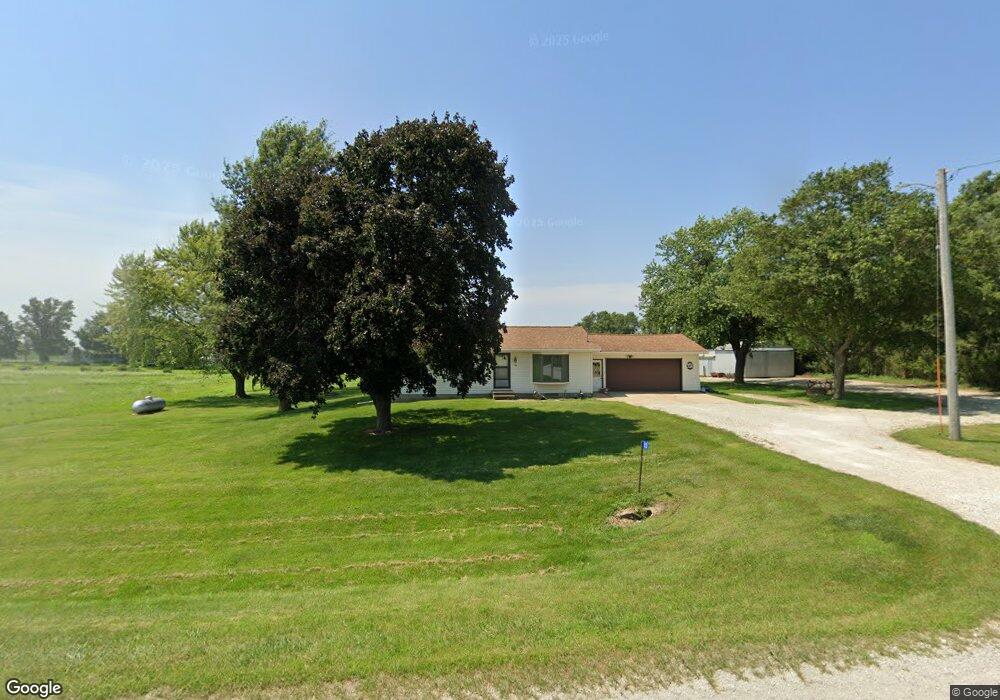
33 N Canfield Rd Waterloo, IA 50703
Estimated Value: $185,000 - $301,625
3
Beds
1
Bath
1,422
Sq Ft
$174/Sq Ft
Est. Value
About This Home
This home is located at 33 N Canfield Rd, Waterloo, IA 50703 and is currently estimated at $247,906, approximately $174 per square foot. 33 N Canfield Rd is a home located in Black Hawk County with nearby schools including Dunkerton Elementary School and Dunkerton High School.
Ownership History
Date
Name
Owned For
Owner Type
Purchase Details
Closed on
May 15, 2018
Sold by
Newhall Richard W and Newhall Susan E
Bought by
Newhall Nolan R
Current Estimated Value
Home Financials for this Owner
Home Financials are based on the most recent Mortgage that was taken out on this home.
Original Mortgage
$100,000
Outstanding Balance
$84,877
Interest Rate
3.8%
Mortgage Type
Adjustable Rate Mortgage/ARM
Estimated Equity
$163,029
Create a Home Valuation Report for This Property
The Home Valuation Report is an in-depth analysis detailing your home's value as well as a comparison with similar homes in the area
Home Values in the Area
Average Home Value in this Area
Purchase History
| Date | Buyer | Sale Price | Title Company |
|---|---|---|---|
| Newhall Nolan R | $125,000 | -- |
Source: Public Records
Mortgage History
| Date | Status | Borrower | Loan Amount |
|---|---|---|---|
| Open | Newhall Nolan R | $100,000 |
Source: Public Records
Tax History Compared to Growth
Tax History
| Year | Tax Paid | Tax Assessment Tax Assessment Total Assessment is a certain percentage of the fair market value that is determined by local assessors to be the total taxable value of land and additions on the property. | Land | Improvement |
|---|---|---|---|---|
| 2025 | $2,284 | $205,180 | $10,560 | $194,620 |
| 2024 | $2,284 | $188,800 | $8,260 | $180,540 |
| 2023 | $2,014 | $188,800 | $8,260 | $180,540 |
| 2022 | $1,946 | $133,690 | $6,620 | $127,070 |
| 2021 | $2,044 | $132,220 | $7,150 | $125,070 |
| 2020 | $2,020 | $131,810 | $6,800 | $125,010 |
| 2019 | $2,020 | $131,810 | $6,800 | $125,010 |
| 2018 | $1,892 | $134,970 | $9,790 | $125,180 |
| 2017 | $1,922 | $134,970 | $9,790 | $125,180 |
| 2016 | $1,822 | $136,520 | $11,100 | $125,420 |
| 2015 | $1,822 | $136,520 | $11,100 | $125,420 |
| 2014 | $1,898 | $137,740 | $12,030 | $125,710 |
Source: Public Records
Map
Nearby Homes
- 1827 N Pilot Grove Rd
- 0 Newell St Unit NBR20241901
- 6418 Independence Ave Unit 6440
- Lot 3 Ann St
- 5955 Osage Rd
- 6616 Lafayette Rd
- 6611 Lafayette Rd
- 6513 Lafayette Rd
- 0 Indian Creek Rd
- 00 Indian Creek Rd
- 229 Landmark Dr
- TBD E Donald St
- 245 Bordner Dr
- 619 Sal Ave
- 524 Christopher Cir
- 414 3rd St
- 205 W Dunkerton St
- 305 W Dunkerton St
- 0 Dubuque Rd Unit NBR20242713
- 301 W Sycamore St
- 129 N Canfield Rd
- 141 N Canfield Rd
- 8901 Independence Ave
- 243 N Canfield Rd
- 8819 Independence Ave
- 8745 Independence Ave
- 9124 Independence Ave
- 345 N Canfield Rd
- 441 N Canfield Rd
- 511 N Canfield Rd
- 519 N Canfield Rd
- 8734 Independence Ave
- 705 N Canfield Rd
- 9623 Independence Ave
- 9635 Independence Ave
- 00 Canfield Rd
- 0 Canfield Rd
- 8115 Independence Ave
- 9210 Newell St
- 8010 Independence Ave