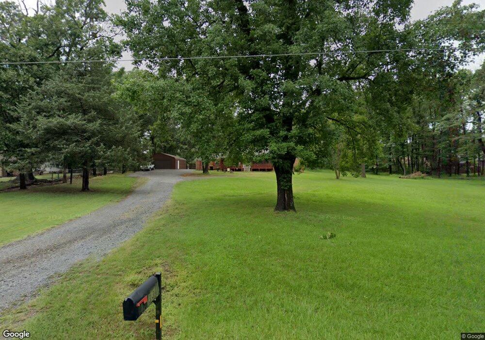
33 N Main St Mayflower, AR 72106
Estimated Value: $248,350 - $275,000
Studio
2
Baths
2,087
Sq Ft
$126/Sq Ft
Est. Value
About This Home
This home is located at 33 N Main St, Mayflower, AR 72106 and is currently estimated at $263,088, approximately $126 per square foot. 33 N Main St is a home located in Faulkner County with nearby schools including Mayflower Elementary School, Mayflower Middle School, and Mayflower High School.
Ownership History
Date
Name
Owned For
Owner Type
Purchase Details
Closed on
Jul 22, 2011
Bought by
White Vanharold
Current Estimated Value
Purchase Details
Closed on
Aug 15, 2005
Bought by
Satterfield
Purchase Details
Closed on
Oct 14, 2003
Bought by
Redempt# 187741
Purchase Details
Closed on
Aug 1, 1996
Bought by
Mathis
Purchase Details
Closed on
Apr 22, 1996
Bought by
Deed Of Dedication
Purchase Details
Closed on
Dec 20, 1995
Bought by
Mathis
Purchase Details
Closed on
Sep 9, 1988
Bought by
Miller
Create a Home Valuation Report for This Property
The Home Valuation Report is an in-depth analysis detailing your home's value as well as a comparison with similar homes in the area
Home Values in the Area
Average Home Value in this Area
Purchase History
| Date | Buyer | Sale Price | Title Company |
|---|---|---|---|
| White Vanharold | $140,000 | -- | |
| Satterfield | $115,000 | -- | |
| Redempt# 187741 | -- | -- | |
| Mathis | $60,000 | -- | |
| Deed Of Dedication | -- | -- | |
| Mathis | -- | -- | |
| Miller | $75,000 | -- |
Source: Public Records
Tax History
| Year | Tax Paid | Tax Assessment Tax Assessment Total Assessment is a certain percentage of the fair market value that is determined by local assessors to be the total taxable value of land and additions on the property. | Land | Improvement |
|---|---|---|---|---|
| 2025 | $1,591 | $41,390 | $6,000 | $35,390 |
| 2024 | $1,530 | $41,390 | $6,000 | $35,390 |
| 2023 | $1,457 | $27,600 | $6,000 | $21,600 |
| 2022 | $1,147 | $27,600 | $6,000 | $21,600 |
| 2021 | $1,116 | $27,600 | $6,000 | $21,600 |
| 2020 | $1,148 | $28,180 | $9,600 | $18,580 |
| 2019 | $1,148 | $28,180 | $9,600 | $18,580 |
| 2018 | $1,173 | $28,180 | $9,600 | $18,580 |
| 2017 | $1,117 | $28,180 | $9,600 | $18,580 |
| 2016 | $1,054 | $25,920 | $9,600 | $16,320 |
| 2015 | $1,272 | $24,090 | $3,000 | $21,090 |
| 2014 | $957 | $24,090 | $3,000 | $21,090 |
Source: Public Records
Map
Nearby Homes
- 58 Ledrick Cir
- 9 Center Rd
- 14 Cross St
- 7 Vineyard Dr
- 11 Vineyard Dr
- 113 E Sunbelt Ct
- 103 E Sunbelt Ct
- 111 E Sunbelt Ct
- 117 E Sunbelt Ct
- 114 E Sunbelt Ct
- 109 E Sunbelt Ct
- 112 E Sunbelt Ct
- 107 E Sunbelt Ct
- 110 E Sunbelt Ct
- 105 E Sunbelt Ct
- Tract 2 Joseph Rd
- 664 Highway 365
- 108 E Sunbelt Ct
- Justin Plan at The Vineyard
- Bellvue Plan at The Vineyard
- 19 Smoke Tree Ln
- 31 N Main St
- 23 Smoke Tree Ln
- 15 Starlite Rd S
- 19 Starlite Rd S
- 15 Smoke Tree Ln
- 23 Starlite Rd S
- 3 Starlite Rd S
- 11 Starlite Rd S
- 36 Ledrick Cir
- 34 Ledrick Cir
- 0 Starlite Rd S Unit 15029403
- 0 Starlite Rd S Unit 15030371
- 0 Starlite Rd S Unit 15030915
- 27 Starlite Rd S
- 16 S Starlite Rd
- 28 Smoke Tree Ln
- 27 N Main St
- 38 Ledrick Cir
- 24 Smoke Tree Ln
