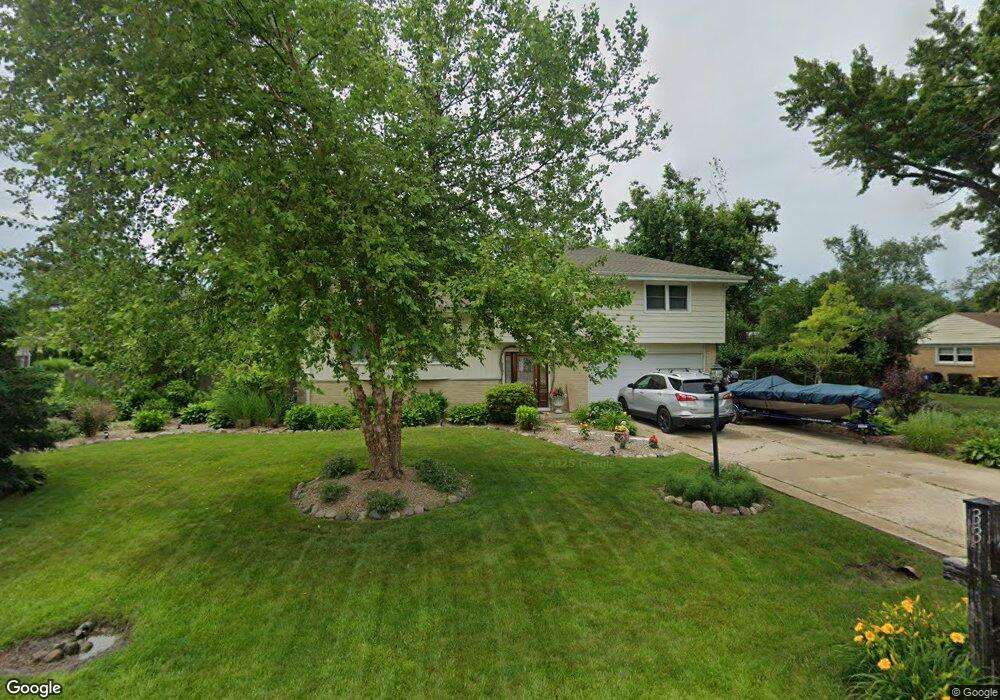
33 N Wildwood Dr Prospect Heights, IL 60070
Estimated Value: $493,000 - $548,088
4
Beds
3
Baths
1,684
Sq Ft
$305/Sq Ft
Est. Value
About This Home
This home is located at 33 N Wildwood Dr, Prospect Heights, IL 60070 and is currently estimated at $513,272, approximately $304 per square foot. 33 N Wildwood Dr is a home located in Cook County with nearby schools including Dwight D Eisenhower Elementary School, Anne Sullivan Elementary School, and Betsy Ross Elementary School.
Ownership History
Date
Name
Owned For
Owner Type
Purchase Details
Closed on
Dec 15, 1998
Sold by
Janus Walter T and Janus Yvonne M
Bought by
Marzano Anthony A
Current Estimated Value
Home Financials for this Owner
Home Financials are based on the most recent Mortgage that was taken out on this home.
Original Mortgage
$215,100
Interest Rate
6.78%
Create a Home Valuation Report for This Property
The Home Valuation Report is an in-depth analysis detailing your home's value as well as a comparison with similar homes in the area
Home Values in the Area
Average Home Value in this Area
Purchase History
| Date | Buyer | Sale Price | Title Company |
|---|---|---|---|
| Marzano Anthony A | $239,000 | -- |
Source: Public Records
Mortgage History
| Date | Status | Borrower | Loan Amount |
|---|---|---|---|
| Previous Owner | Marzano Anthony A | $215,100 |
Source: Public Records
Tax History Compared to Growth
Tax History
| Year | Tax Paid | Tax Assessment Tax Assessment Total Assessment is a certain percentage of the fair market value that is determined by local assessors to be the total taxable value of land and additions on the property. | Land | Improvement |
|---|---|---|---|---|
| 2024 | $10,424 | $38,000 | $16,280 | $21,720 |
| 2023 | $9,744 | $38,000 | $16,280 | $21,720 |
| 2022 | $9,744 | $38,000 | $16,280 | $21,720 |
| 2021 | $8,165 | $28,231 | $12,718 | $15,513 |
| 2020 | $7,979 | $28,231 | $12,718 | $15,513 |
| 2019 | $7,929 | $31,403 | $12,718 | $18,685 |
| 2018 | $9,931 | $35,561 | $11,192 | $24,369 |
| 2017 | $9,838 | $35,561 | $11,192 | $24,369 |
| 2016 | $9,501 | $35,561 | $11,192 | $24,369 |
| 2015 | $9,152 | $31,461 | $9,666 | $21,795 |
| 2014 | $9,044 | $31,461 | $9,666 | $21,795 |
| 2013 | $8,797 | $31,461 | $9,666 | $21,795 |
Source: Public Records
Map
Nearby Homes
- 21 E Stonegate Dr
- 10 N Wildwood Dr
- 1014 N Elmhurst Rd
- 412 Cherry Creek Ln
- 1044 Creekside Ct Unit 2B
- 1201 Pleasant Run Dr Unit 312
- 940 Tanglewood Dr
- 2812 Jackson Dr
- 1094 Shady Tree Ln
- 701 Garth Rd
- 2822 Jackson Dr
- 1088 Pear Tree Ln
- 307 Anne Ct
- 791 Lakeside Circle Dr Unit 1
- 2060 N Charter Point Dr Unit 14
- 1054 Harbour Ct Unit 1A
- 1500 Harbour Dr Unit 1D
- 1500 Harbour Dr Unit 2K
- 705 Lakeside Circle Dr Unit 2
- 1038 Harbour Ct Unit 2A
- 1014 Sherwood Dr Unit 4
- 35 N Wildwood Dr
- 1012 Sherwood Dr
- 23 W Stonegate Dr
- 37 N Wildwood Dr
- 21 W Stonegate Dr
- 32 N Wildwood Dr
- 1010 Sherwood Dr
- 1015 Sherwood Dr
- 30 N Wildwood Dr
- 34 N Wildwood Dr
- 36 N Wildwood Dr
- 25 W Stonegate Dr
- 1013 Sherwood Dr
- 19 N Wildwood Dr
- 1101 Sherwood Dr
- 24 W Stonegate Dr Unit 4
- 38 N Wildwood Dr
- 1011 Sherwood Dr
- 1008 Sherwood Dr