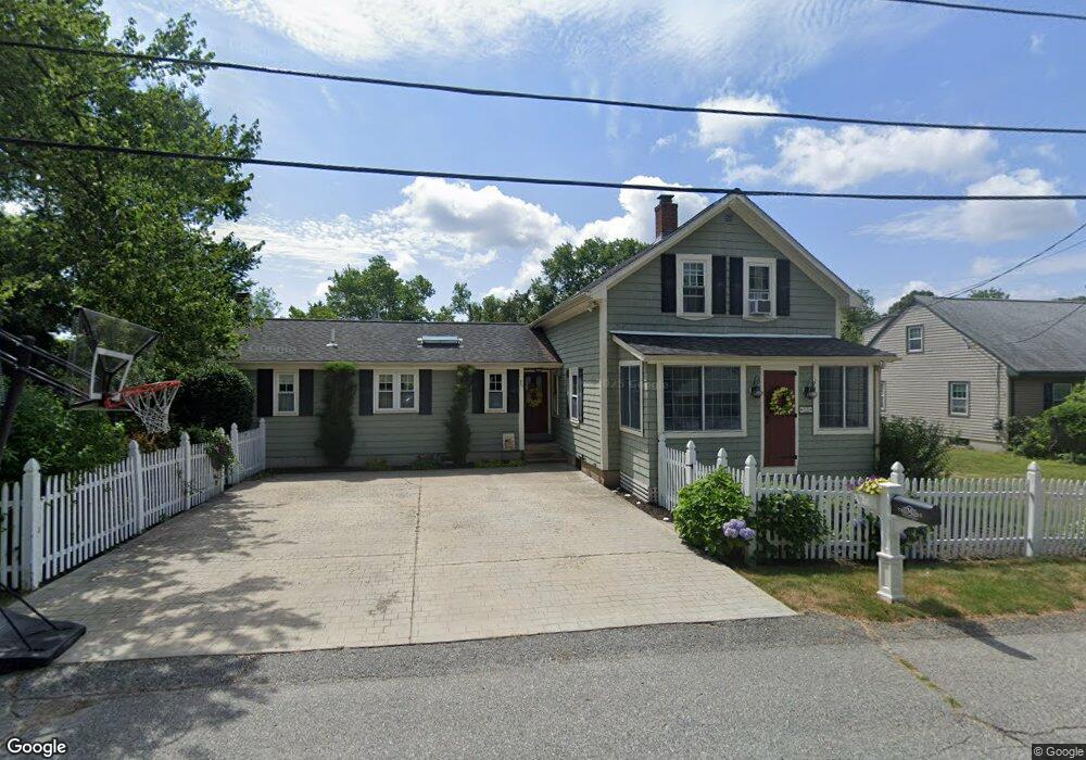
33 Olive St Cumberland, RI 02864
Monastery Heights NeighborhoodEstimated Value: $479,948 - $710,000
3
Beds
2
Baths
2,094
Sq Ft
$273/Sq Ft
Est. Value
About This Home
This home is located at 33 Olive St, Cumberland, RI 02864 and is currently estimated at $571,737, approximately $273 per square foot. 33 Olive St is a home located in Providence County with nearby schools including Garvin Memorial School, Joseph L. McCourt Middle School, and Cumberland High School.
Ownership History
Date
Name
Owned For
Owner Type
Purchase Details
Closed on
May 30, 2002
Sold by
Bright Brian S and Bright Renee M
Bought by
Moran Jamie F and Moran Tina M
Current Estimated Value
Purchase Details
Closed on
Jun 29, 1999
Sold by
Lapre Daniel T and Lapre Mary Jane
Bought by
Bright Brian and Bright Renee M
Create a Home Valuation Report for This Property
The Home Valuation Report is an in-depth analysis detailing your home's value as well as a comparison with similar homes in the area
Home Values in the Area
Average Home Value in this Area
Purchase History
| Date | Buyer | Sale Price | Title Company |
|---|---|---|---|
| Moran Jamie F | $250,000 | -- | |
| Bright Brian | $135,000 | -- |
Source: Public Records
Mortgage History
| Date | Status | Borrower | Loan Amount |
|---|---|---|---|
| Open | Bright Brian | $165,000 | |
| Closed | Bright Brian | $174,000 | |
| Closed | Bright Brian | $50,000 |
Source: Public Records
Tax History Compared to Growth
Tax History
| Year | Tax Paid | Tax Assessment Tax Assessment Total Assessment is a certain percentage of the fair market value that is determined by local assessors to be the total taxable value of land and additions on the property. | Land | Improvement |
|---|---|---|---|---|
| 2025 | $5,015 | $408,700 | $141,400 | $267,300 |
| 2024 | $4,884 | $408,700 | $141,400 | $267,300 |
| 2023 | $4,749 | $408,700 | $141,400 | $267,300 |
| 2022 | $4,449 | $296,800 | $111,100 | $185,700 |
| 2021 | $4,375 | $296,800 | $111,100 | $185,700 |
| 2020 | $4,250 | $296,800 | $111,100 | $185,700 |
| 2019 | $3,791 | $238,700 | $89,800 | $148,900 |
| 2018 | $3,681 | $238,700 | $89,800 | $148,900 |
| 2017 | $3,631 | $238,700 | $89,800 | $148,900 |
| 2016 | $3,577 | $209,400 | $85,900 | $123,500 |
| 2015 | $3,577 | $209,400 | $85,900 | $123,500 |
| 2014 | $11,285 | $209,400 | $85,900 | $123,500 |
| 2013 | $3,738 | $236,900 | $85,700 | $151,200 |
Source: Public Records
Map
Nearby Homes
- 33 Valley St
- 44 Marshall Ave
- 27 Norman St
- 8 Dorr St
- 500 Mendon Rd Unit 216
- 17 Mowry Ave
- 18 Meadowcrest Dr
- 200 Old Mendon Rd
- 163 Woodside Ave
- 16 Kent St
- 207 Mendon Rd
- 153 Morris St
- 70 Mohawk St
- 11 Woodside Ave
- 6 Streamview Dr
- 1551 Diamond Hill Rd
- 98 Iroquois Rd
- 34 Goddard St
- 0 Narragansett Rd
- 73 Grandview Dr
- 29 Olive St
- 144 Marshall Ave
- 25 Olive St
- 102 Lonsdale Farm Rd
- 136 Marshall Ave
- 106 Lonsdale Farm Rd
- 34 Olive St
- 30 Olive St
- 38 Olive St
- 100 Lonsdale Farm Rd
- 14 Lonsdale Farm Rd
- 10 Lonsdale Farm Rd
- 24 Olive St
- 103 Lonsdale Farm Rd
- 21 Olive St
- 360 Hamilton St
- 44 Olive St
- 115 Hamilton St
- 114 Lonsdale Farm Rd
- 166 Marshall Ave