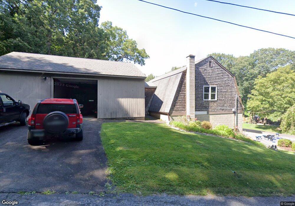
33 Porter Hill Rd Bethlehem, CT 06751
Estimated Value: $477,000 - $616,000
3
Beds
3
Baths
1,638
Sq Ft
$350/Sq Ft
Est. Value
About This Home
This home is located at 33 Porter Hill Rd, Bethlehem, CT 06751 and is currently estimated at $573,879, approximately $350 per square foot. 33 Porter Hill Rd is a home located in Litchfield County with nearby schools including Bethlehem Elementary School, Mitchell Elementary School, and Woodbury Middle School.
Ownership History
Date
Name
Owned For
Owner Type
Purchase Details
Closed on
Jan 20, 2022
Sold by
Butkus Maryann B
Bought by
Maryann B Butkus T
Current Estimated Value
Purchase Details
Closed on
Jan 24, 1973
Bought by
Butkus Walter C and Butkus Mary Ann
Create a Home Valuation Report for This Property
The Home Valuation Report is an in-depth analysis detailing your home's value as well as a comparison with similar homes in the area
Home Values in the Area
Average Home Value in this Area
Purchase History
| Date | Buyer | Sale Price | Title Company |
|---|---|---|---|
| Maryann B Butkus T | -- | None Available | |
| Maryann B Butkus T B | -- | None Available | |
| Butkus Walter C | -- | -- |
Source: Public Records
Mortgage History
| Date | Status | Borrower | Loan Amount |
|---|---|---|---|
| Previous Owner | Butkus Walter C | $275,000 | |
| Previous Owner | Butkus Walter C | $400,000 | |
| Previous Owner | Butkus Walter C | $25,000 | |
| Previous Owner | Butkus Walter C | $10,000 |
Source: Public Records
Tax History
| Year | Tax Paid | Tax Assessment Tax Assessment Total Assessment is a certain percentage of the fair market value that is determined by local assessors to be the total taxable value of land and additions on the property. | Land | Improvement |
|---|---|---|---|---|
| 2025 | $6,846 | $303,200 | $83,800 | $219,400 |
| 2024 | $6,595 | $303,200 | $83,800 | $219,400 |
| 2023 | $6,562 | $238,700 | $78,500 | $160,200 |
| 2022 | $6,564 | $238,700 | $78,500 | $160,200 |
| 2021 | $6,567 | $238,700 | $78,500 | $160,200 |
| 2020 | $3,625 | $135,700 | $78,500 | $57,200 |
| 2019 | $6,073 | $226,700 | $78,500 | $148,200 |
| 2018 | $5,719 | $236,800 | $89,000 | $147,800 |
| 2017 | $6,010 | $236,800 | $89,000 | $147,800 |
| 2016 | $5,543 | $236,800 | $89,000 | $147,800 |
| 2015 | $5,437 | $236,800 | $89,000 | $147,800 |
| 2014 | $5,321 | $236,800 | $89,000 | $147,800 |
Source: Public Records
Map
Nearby Homes
- 0 Tulip Tree Village Unit 5 24128353
- 6 Tulip Tree Ln
- 20 Cowles Rd
- 195 Hinman Rd
- 319 Main St S
- 0 Cowles Rd
- 45 N Gate Rd
- 182 Magnolia Hill Rd
- 1545 Main St N
- 221 Charter Oak Dr
- 305 Killorin Rd
- 114 Wheeler Farm Rd
- 8 Main St N
- 14 Meadow Crest Dr
- 20 Grandview Ave
- 65 Weekeepeemee Rd
- 4 Hard Hill Rd S
- 7 Circuit Ave
- 90 Rowley Rd
- 57 Bayview Cir
- 17 Porter Hill Rd
- 57 Porter Hill Rd
- 450 Nonnewaug Rd
- 7 Porter Hill Rd
- 611 Main St S
- 26 Porter Hill Rd
- 466 Nonnewaug Rd
- 458 Nonnewaug Rd
- 474 Nonnewaug Rd
- 440 Nonnewaug Rd
- 603 Main St S
- 482 Nonnewaug Rd
- 494 Nonnewaug Rd
- 597 Main St S
- 488 Hard Hill Rd S
- 500 Nonnewaug Rd
- 500 Nonnewaug Rd Unit C
- 500 Nonnewaug Rd Unit A
- 500 Nonnewaug Rd Unit 3
- 612 Main St S
Your Personal Tour Guide
Ask me questions while you tour the home.