Estimated Value: $335,000 - $392,000
2
Beds
1
Bath
984
Sq Ft
$369/Sq Ft
Est. Value
About This Home
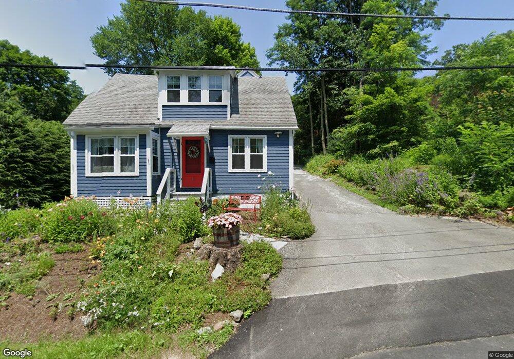
This home is located at 33 Saint Ann's Ave, Lenox, MA 01240 and is currently estimated at $362,926, approximately $368 per square foot. 33 Saint Ann's Ave is a home located in Berkshire County with nearby schools including Morris Elementary School, Lenox Memorial High School, and Berkshire Country Day School.
Ownership History
Date
Name
Owned For
Owner Type
Purchase Details
Closed on
Feb 1, 2002
Sold by
Czop Paula
Bought by
Aronoff Marc J
Current Estimated Value
Home Financials for this Owner
Home Financials are based on the most recent Mortgage that was taken out on this home.
Original Mortgage
$112,000
Interest Rate
7.15%
Mortgage Type
Purchase Money Mortgage
Purchase Details
Closed on
Jun 5, 1997
Sold by
Smedvig Rolf T
Bought by
Czop Paula
Home Financials for this Owner
Home Financials are based on the most recent Mortgage that was taken out on this home.
Original Mortgage
$81,000
Interest Rate
7.98%
Mortgage Type
Purchase Money Mortgage
Create a Home Valuation Report for This Property
The Home Valuation Report is an in-depth analysis detailing your home's value as well as a comparison with similar homes in the area
Home Values in the Area
Average Home Value in this Area
Purchase History
| Date | Buyer | Sale Price | Title Company |
|---|---|---|---|
| Aronoff Marc J | $119,000 | -- | |
| Czop Paula | $90,000 | -- |
Source: Public Records
Mortgage History
| Date | Status | Borrower | Loan Amount |
|---|---|---|---|
| Open | Czop Paula | $111,880 | |
| Closed | Czop Paula | $5,800 | |
| Closed | Czop Paula | $112,000 | |
| Previous Owner | Czop Paula | $81,000 |
Source: Public Records
Tax History Compared to Growth
Tax History
| Year | Tax Paid | Tax Assessment Tax Assessment Total Assessment is a certain percentage of the fair market value that is determined by local assessors to be the total taxable value of land and additions on the property. | Land | Improvement |
|---|---|---|---|---|
| 2025 | $2,633 | $290,900 | $141,000 | $149,900 |
| 2024 | $2,420 | $266,800 | $133,000 | $133,800 |
| 2023 | $2,439 | $266,300 | $125,400 | $140,900 |
| 2022 | $2,386 | $220,100 | $104,600 | $115,500 |
| 2021 | $2,324 | $199,500 | $96,000 | $103,500 |
| 2020 | $2,306 | $190,600 | $93,200 | $97,400 |
| 2019 | $2,244 | $187,800 | $93,200 | $94,600 |
| 2018 | $2,243 | $184,800 | $91,400 | $93,400 |
| 2017 | $2,223 | $182,100 | $89,600 | $92,500 |
| 2016 | $2,019 | $166,000 | $75,500 | $90,500 |
| 2015 | $1,946 | $157,800 | $70,700 | $87,100 |
Source: Public Records
Map
Nearby Homes
- 31 Saint Ann's Ave
- 15 Hubbard St
- 7 Hubbard St
- 13 Taconic Ave
- 137 Housatonic St
- 3 Morgan Manor Unit 3 - 8
- 9 Bolton Dr
- 2 Kemble St
- 80 West St
- 19 Hawthorne St Unit Stables 1A
- 0 Main St
- 20 E Dugway Rd
- 59 Hawthorne St
- 165 Kemble St Unit 5
- 165 Kemble St Unit 17
- 54 Dunmore Ct
- 153 E Dugway Rd
- 4 Evergreen Trail
- 30 - 5 Clifton Ct
- 30 Clifden Ct Unit 5
- 33 Saint Anns Ave
- 31 Saint Anns Ave
- 41 Saint Anns Ave
- 29 Saint Anns Ave
- 29 Saint Ann's Ave
- 39 Saint Anns Ave
- 27 Saint Anns Ave
- 25 Saint Anns Ave
- 34 Saint Anns Ave
- 44 Saint Ann's Ave
- 44 Saint Anns Ave
- 32 Hubbard St
- 26 Saint Anns Ave
- 26 Saint Ann's Ave
- 21 Saint Anns Ave
- 28 Hubbard St
- 47 Saint Anns Ave
- 48 Saint Anns Ave
- 7 Hillside Dr
- 22 Hubbard St