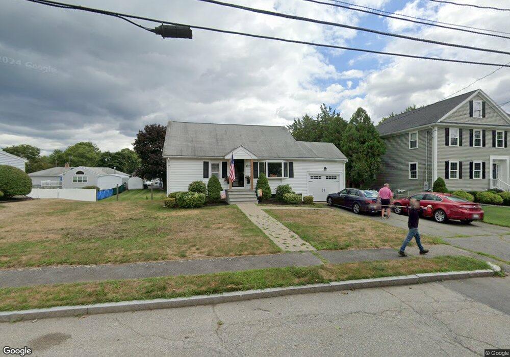
33 Sheffield Rd Waltham, MA 02451
North Waltham NeighborhoodEstimated Value: $776,000 - $882,000
3
Beds
2
Baths
1,728
Sq Ft
$472/Sq Ft
Est. Value
About This Home
This home is located at 33 Sheffield Rd, Waltham, MA 02451 and is currently estimated at $814,883, approximately $471 per square foot. 33 Sheffield Rd is a home located in Middlesex County with nearby schools including Douglas Macarthur Elementary School, John F Kennedy Middle School, and Waltham Sr High School.
Ownership History
Date
Name
Owned For
Owner Type
Purchase Details
Closed on
May 17, 2023
Sold by
Macneil Roderick P and Macneil Jane M
Bought by
Macneil Ft
Current Estimated Value
Purchase Details
Closed on
May 31, 1996
Sold by
Macneil Georgina P
Bought by
Macneil Roderick P
Home Financials for this Owner
Home Financials are based on the most recent Mortgage that was taken out on this home.
Original Mortgage
$140,000
Interest Rate
7.91%
Mortgage Type
Purchase Money Mortgage
Create a Home Valuation Report for This Property
The Home Valuation Report is an in-depth analysis detailing your home's value as well as a comparison with similar homes in the area
Home Values in the Area
Average Home Value in this Area
Purchase History
| Date | Buyer | Sale Price | Title Company |
|---|---|---|---|
| Macneil Ft | -- | None Available | |
| Macneil Roderick P | $175,000 | -- |
Source: Public Records
Mortgage History
| Date | Status | Borrower | Loan Amount |
|---|---|---|---|
| Previous Owner | Macneil Roderick P | $140,000 | |
| Previous Owner | Macneil Roderick P | $46,500 | |
| Previous Owner | Macneil Roderick P | $25,000 |
Source: Public Records
Tax History Compared to Growth
Tax History
| Year | Tax Paid | Tax Assessment Tax Assessment Total Assessment is a certain percentage of the fair market value that is determined by local assessors to be the total taxable value of land and additions on the property. | Land | Improvement |
|---|---|---|---|---|
| 2025 | $7,045 | $717,400 | $443,000 | $274,400 |
| 2024 | $6,695 | $694,500 | $423,400 | $271,100 |
| 2023 | $6,636 | $643,000 | $384,200 | $258,800 |
| 2022 | $6,541 | $587,200 | $345,000 | $242,200 |
| 2021 | $6,475 | $572,000 | $345,000 | $227,000 |
| 2020 | $6,442 | $539,100 | $321,400 | $217,700 |
| 2019 | $6,468 | $510,900 | $317,500 | $193,400 |
| 2018 | $5,968 | $473,300 | $294,000 | $179,300 |
| 2017 | $5,601 | $445,900 | $266,600 | $179,300 |
| 2016 | $5,266 | $430,200 | $250,900 | $179,300 |
| 2015 | $4,887 | $372,200 | $219,500 | $152,700 |
Source: Public Records
Map
Nearby Homes
- 1105 Lexington St Unit 102
- 14 Benjamin Rd
- 30 Jacqueline Rd Unit C
- 30 Wampum Ave
- 15 Kings Way Unit 25
- 98 Seminole Ave
- 249 Lake St
- 234 Lake St
- 133 Lake St
- 129 Lake St
- 5 April Ln Unit 12
- 311 Concord Ave
- 463 Lincoln St
- 14 Piedmont Ave
- 65 Montclair Ave
- 28 Hillcrest St
- 92 Milner St
- 87 Clocktower Dr Unit 2207
- 107 Clocktower Dr Unit 3302
- 170 Clocktower Dr Unit 5103
- 25 Sheffield Rd
- 34 Miriam Rd
- 36 Sheffield Rd
- 28 Miriam Rd
- 45 Sheffield Rd
- 40 Miriam Rd
- 5 Whittier Ave
- 19 Sheffield Rd
- 20 Miriam Rd
- 5 Brewster Rd
- 48 Miriam Rd
- 12 Brewster Rd
- 11 Whittier Ave
- 51 Sheffield Rd
- 11 Sheffield Rd
- 11 Sheffield Rd Unit 11
- 4 Whittier Ave
- 14 Miriam Rd
- 54 Miriam Rd
- 54 Sheffield Rd