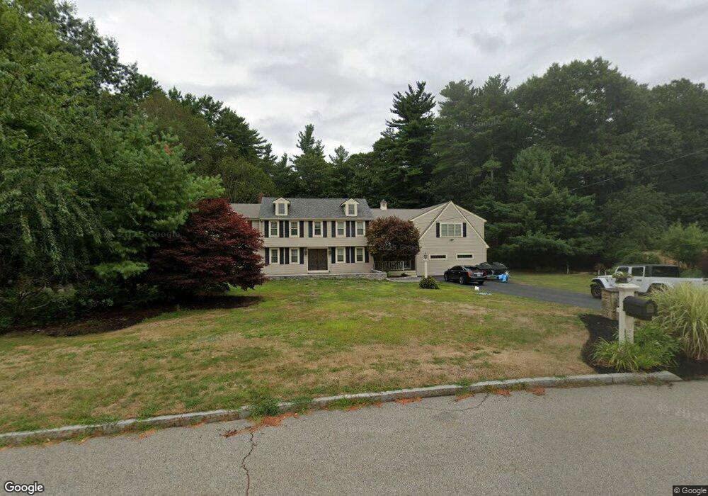
33 Stockbridge Rd Hanover, MA 02339
Estimated Value: $1,083,000 - $1,298,000
4
Beds
3
Baths
4,206
Sq Ft
$281/Sq Ft
Est. Value
About This Home
This home is located at 33 Stockbridge Rd, Hanover, MA 02339 and is currently estimated at $1,180,448, approximately $280 per square foot. 33 Stockbridge Rd is a home located in Plymouth County with nearby schools including Hanover High School, The Master's Academy, and Cardinal Cushing Centers.
Ownership History
Date
Name
Owned For
Owner Type
Purchase Details
Closed on
Nov 8, 2023
Sold by
Nassif Elias J
Bought by
33 Stockbridge Rd Rt and Nassif
Current Estimated Value
Purchase Details
Closed on
Sep 19, 2019
Sold by
Jam Rt
Bought by
Nassif Elias J
Purchase Details
Closed on
Jan 2, 2004
Sold by
Nassif Elias J
Bought by
Jam Rt and Nassif
Purchase Details
Closed on
Aug 22, 2003
Sold by
Nassif Elias J
Bought by
J A M Rt and Nassif
Purchase Details
Closed on
Jul 31, 2003
Sold by
Clifford Richard B and Clifford Jami M
Bought by
Nassif Elias J
Purchase Details
Closed on
Dec 15, 2000
Sold by
Giorgi Ruth E
Bought by
Clifford Richard B and Clifford Jami M
Create a Home Valuation Report for This Property
The Home Valuation Report is an in-depth analysis detailing your home's value as well as a comparison with similar homes in the area
Home Values in the Area
Average Home Value in this Area
Purchase History
| Date | Buyer | Sale Price | Title Company |
|---|---|---|---|
| 33 Stockbridge Rd Rt | -- | None Available | |
| Nassif Elias J | -- | -- | |
| Jam Rt | -- | -- | |
| J A M Rt | -- | -- | |
| Nassif Elias J | $470,000 | -- | |
| Clifford Richard B | $349,900 | -- |
Source: Public Records
Mortgage History
| Date | Status | Borrower | Loan Amount |
|---|---|---|---|
| Previous Owner | Clifford Richard B | $120,000 | |
| Previous Owner | Clifford Richard B | $50,000 | |
| Previous Owner | Clifford Richard B | $31,000 |
Source: Public Records
Tax History
| Year | Tax Paid | Tax Assessment Tax Assessment Total Assessment is a certain percentage of the fair market value that is determined by local assessors to be the total taxable value of land and additions on the property. | Land | Improvement |
|---|---|---|---|---|
| 2025 | $14,070 | $1,139,300 | $281,200 | $858,100 |
| 2024 | $13,559 | $1,056,000 | $281,200 | $774,800 |
| 2023 | $13,726 | $1,017,500 | $255,900 | $761,600 |
| 2022 | $13,240 | $868,200 | $255,900 | $612,300 |
| 2021 | $12,504 | $765,700 | $232,800 | $532,900 |
| 2020 | $12,102 | $742,000 | $232,800 | $509,200 |
| 2019 | $11,633 | $708,900 | $232,800 | $476,100 |
| 2018 | $10,220 | $666,900 | $232,800 | $434,100 |
| 2017 | $10,631 | $643,500 | $216,700 | $426,800 |
| 2016 | $10,357 | $614,300 | $197,100 | $417,200 |
| 2015 | $9,921 | $614,300 | $197,100 | $417,200 |
Source: Public Records
Map
Nearby Homes
- 95 Tecumseh Dr
- 51 Cervelli Farm Dr
- 37 Dr
- 23 Cervelli Farm Dr
- 38 Cervelli Farm Dr
- 9 Cervelli Farm Dr
- 250 Center St
- 36 Grove St
- 75 School St
- 127 King St
- 114 Graham Hill Dr
- 430 Brook Bend Rd
- 139 Fairwood Dr
- 339 State St
- 24 Estes Rd
- 51 Farmside Dr
- 724 Whitman St
- 17 Hayford Trail Unit 12
- 168 Larchmont Ln
- 7 Hayford Trail Unit 12
- 43 Stockbridge Rd
- 27 Stockbridge Rd
- 28 Stockbridge Rd
- 581 Center St
- 48 Stockbridge Rd
- 54 Stockbridge Rd
- 599 Center St
- 605 Center St
- 609 Center St
- 553 Center St
- 580 Center St
- 135 Taylor Ave Unit C
- 135 Taylor Ave
- 625 Center St
- 564 Center St
- 592 Center St
- 606 Center St
- 552 Center St
- 633 Center St
- 618 Center St
Your Personal Tour Guide
Ask me questions while you tour the home.