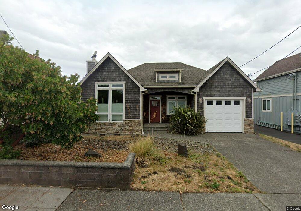
330 9th Ave Seaside, OR 97138
Estimated Value: $566,000 - $674,000
3
Beds
2
Baths
1,643
Sq Ft
$368/Sq Ft
Est. Value
About This Home
This home is located at 330 9th Ave, Seaside, OR 97138 and is currently estimated at $604,136, approximately $367 per square foot. 330 9th Ave is a home located in Clatsop County with nearby schools including Seaside High School.
Ownership History
Date
Name
Owned For
Owner Type
Purchase Details
Closed on
Sep 27, 2023
Sold by
F Michael Bales Living Trust
Bought by
Gogulis Llc
Current Estimated Value
Purchase Details
Closed on
Feb 23, 2018
Sold by
Holtgraves Katherine and Merilee J Bales Revocable Trus
Bought by
Thompson Molly M and Barney Caryn N
Purchase Details
Closed on
Jul 28, 2017
Sold by
Bales Merilee Jean
Bought by
Bales Merilee J and Holtgraves Katherine
Purchase Details
Closed on
Dec 27, 2011
Sold by
Bales Michael
Bought by
Bales F Michael and The F Michael Bales Living Trust
Purchase Details
Closed on
Dec 2, 2009
Sold by
Bales Michael and Bales Merilee Jean
Bought by
Bales Michael and Bales Merilee Jean
Create a Home Valuation Report for This Property
The Home Valuation Report is an in-depth analysis detailing your home's value as well as a comparison with similar homes in the area
Purchase History
| Date | Buyer | Sale Price | Title Company |
|---|---|---|---|
| Gogulis Llc | -- | None Listed On Document | |
| Thompson Molly M | -- | None Available | |
| Bales Merilee J | -- | None Available | |
| Bales F Michael | -- | None Available | |
| Bales Michael | -- | None Available |
Source: Public Records
Tax History
| Year | Tax Paid | Tax Assessment Tax Assessment Total Assessment is a certain percentage of the fair market value that is determined by local assessors to be the total taxable value of land and additions on the property. | Land | Improvement |
|---|---|---|---|---|
| 2025 | $5,163 | $359,316 | -- | -- |
| 2024 | $5,011 | $348,852 | -- | -- |
| 2023 | $4,863 | $338,692 | $0 | $0 |
| 2022 | $4,731 | $328,828 | $0 | $0 |
| 2021 | $4,630 | $319,251 | $0 | $0 |
| 2020 | $4,522 | $309,953 | $0 | $0 |
| 2019 | $4,399 | $300,926 | $0 | $0 |
Source: Public Records
Map
Nearby Homes
- 1022 N Prom Tradewinds Condo
- 1022 N Prom Tradewinds Condo Unit 208
- 908-910 N Franklin St
- 1022 N Promenade Unit 208
- 245 12th Ave
- 460 10th Ave
- 460 12th Ave
- 423 N Downing St
- 1000 N Holladay Dr Unit 402
- 1000 N Holladay Dr
- 1000 N Holladay Dr Unit 304
- 337 16th Ave
- 815 N King St
- 350 17th Ave
- 1110 6th Ave
- 911 1st Ave
- 26 Avenue A
- 1299 6th Ave
- 811 17th Ave
- 790 17th Ave
Your Personal Tour Guide
Ask me questions while you tour the home.