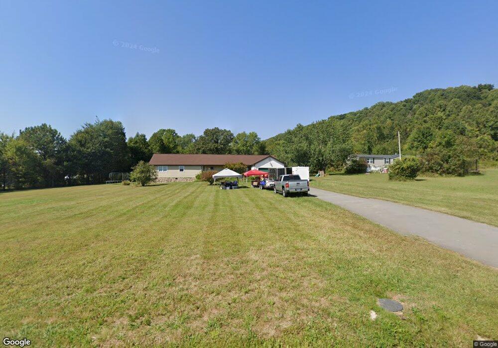
330 B Wells Ln Powell, TN 37849
South Clinton NeighborhoodEstimated Value: $276,000 - $351,000
Studio
2
Baths
1,456
Sq Ft
$224/Sq Ft
Est. Value
About This Home
This home is located at 330 B Wells Ln, Powell, TN 37849 and is currently estimated at $325,460, approximately $223 per square foot. 330 B Wells Ln is a home located in Anderson County with nearby schools including Clinton High School.
Ownership History
Date
Name
Owned For
Owner Type
Purchase Details
Closed on
Aug 24, 2006
Current Estimated Value
Purchase Details
Closed on
Jun 8, 2005
Sold by
Sanders Patricia K
Bought by
Snyder George W
Home Financials for this Owner
Home Financials are based on the most recent Mortgage that was taken out on this home.
Original Mortgage
$134,500
Interest Rate
5.69%
Purchase Details
Closed on
Apr 3, 2002
Sold by
Sanders James
Bought by
Sanders Patricia K
Purchase Details
Closed on
Nov 2, 1999
Sold by
Wade Kenneth W
Bought by
Sanders Patricia
Purchase Details
Closed on
May 20, 1991
Bought by
Mannis Cecil E and Mannis Wife Connie R
Create a Home Valuation Report for This Property
The Home Valuation Report is an in-depth analysis detailing your home's value as well as a comparison with similar homes in the area
Home Values in the Area
Average Home Value in this Area
Purchase History
| Date | Buyer | Sale Price | Title Company |
|---|---|---|---|
| -- | -- | -- | |
| Snyder George W | $134,500 | -- | |
| Sanders Patricia K | -- | -- | |
| Sanders Patricia | $110,000 | -- | |
| Mannis Cecil E | $12,000 | -- |
Source: Public Records
Mortgage History
| Date | Status | Borrower | Loan Amount |
|---|---|---|---|
| Previous Owner | Mannis Cecil E | $134,500 |
Source: Public Records
Tax History
| Year | Tax Paid | Tax Assessment Tax Assessment Total Assessment is a certain percentage of the fair market value that is determined by local assessors to be the total taxable value of land and additions on the property. | Land | Improvement |
|---|---|---|---|---|
| 2025 | $994 | $67,900 | $8,500 | $59,400 |
| 2024 | $994 | $37,800 | $4,750 | $33,050 |
| 2023 | $994 | $37,800 | $0 | $0 |
| 2022 | $994 | $37,800 | $4,750 | $33,050 |
| 2021 | $994 | $37,800 | $4,750 | $33,050 |
| 2020 | $994 | $37,800 | $4,750 | $33,050 |
| 2019 | $956 | $33,075 | $4,750 | $28,325 |
| 2018 | $923 | $33,075 | $4,750 | $28,325 |
| 2017 | $923 | $33,075 | $4,750 | $28,325 |
| 2016 | $923 | $33,075 | $4,750 | $28,325 |
| 2015 | -- | $33,075 | $4,750 | $28,325 |
| 2014 | -- | $33,075 | $4,750 | $28,325 |
| 2013 | -- | $36,600 | $0 | $0 |
Source: Public Records
Map
Nearby Homes
- 614 Mehaffey Rd
- 340 Blacksferry Rd
- 0 Creek Rd Unit 1301015
- 8001 Yount Rd Unit 45
- 119 Old State Cir
- 0 Moore Ln
- 134 Mockingbird Hill Ln
- 162 Tori Kait Ln
- 129 Turkey Rd
- 7600 Gynevere Dr
- 7569 Glastonbury Rd
- 1037 Foust Carney Rd
- 129 Moore Ln
- 2215 Clinton Hwy
- 170 Cedar Cir
- 246 Old Blacksferry Ln
- 435 Sherwood Estates Cir
- 3927 Hillbrook Dr
- 7432 Glastonbury Rd
- 7509 Seekirk Ln
- 346 B Wells Ln
- 684 Mehaffey Rd
- 712 Mehaffey Rd
- 708 Mehaffey Rd
- 727 Mehaffey Rd
- 349 B Wells Ln
- 737 Mehaffey Rd
- 125 Sanctuary Ln
- 662 Mehaffey Rd Unit 666
- 656 Mehaffey Rd
- 667 Mehaffey Rd
- 117 Sanctuary Ln
- 750 Mehaffey Rd
- 105 Sanctuary Ln
- 0 Mehaffey Rd
- 650 Mehaffey Rd
- 743 Mehaffey Rd
- 644 Mehaffey Rd
- 634 Mehaffey Rd
- 759 Mehaffey Rd
Your Personal Tour Guide
Ask me questions while you tour the home.