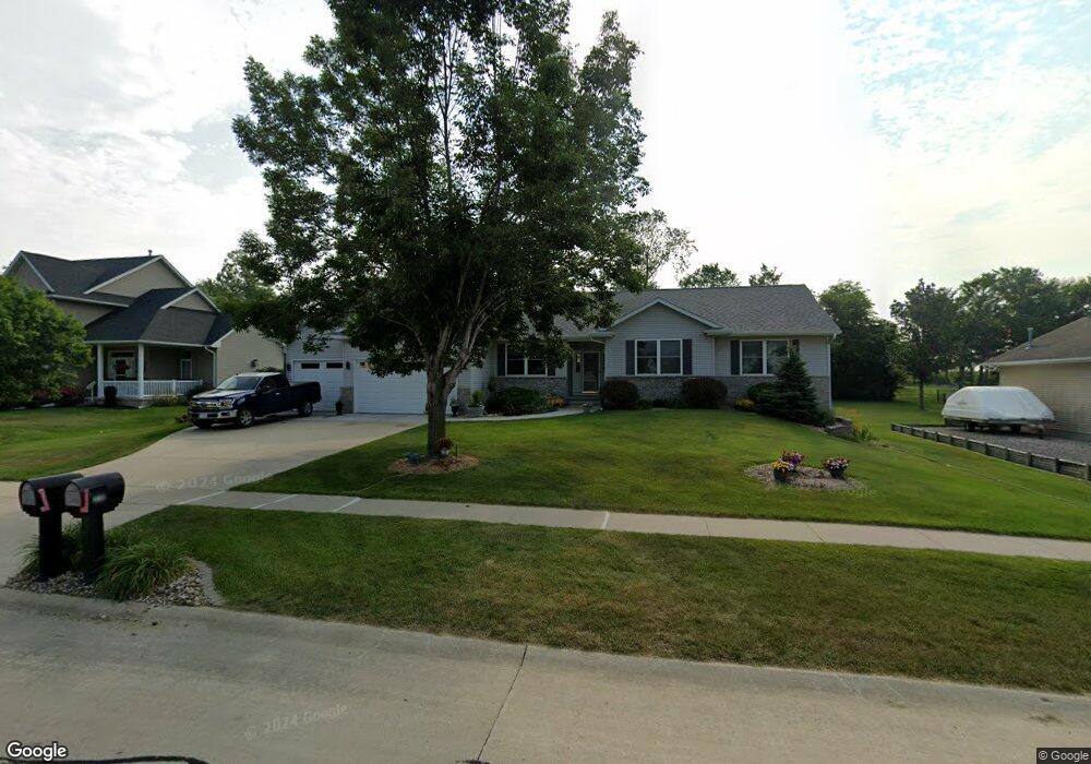
330 Brougham Rd Robins, IA 52328
Estimated Value: $406,561 - $431,000
4
Beds
4
Baths
2,120
Sq Ft
$197/Sq Ft
Est. Value
About This Home
This home is located at 330 Brougham Rd, Robins, IA 52328 and is currently estimated at $416,640, approximately $196 per square foot. 330 Brougham Rd is a home located in Linn County with nearby schools including Echo Hill Elementary School, Oak Ridge School, and Linn-Mar High School.
Ownership History
Date
Name
Owned For
Owner Type
Purchase Details
Closed on
Dec 21, 1999
Sold by
Koski Melvin J and Koski Judith A
Bought by
Lang Lee S and Lang Mary F
Current Estimated Value
Home Financials for this Owner
Home Financials are based on the most recent Mortgage that was taken out on this home.
Original Mortgage
$190,400
Outstanding Balance
$58,885
Interest Rate
7.7%
Mortgage Type
Construction
Estimated Equity
$357,755
Purchase Details
Closed on
Jan 25, 1999
Sold by
Zeran Roger W
Bought by
Koski Melvin J and Koski Judith A
Create a Home Valuation Report for This Property
The Home Valuation Report is an in-depth analysis detailing your home's value as well as a comparison with similar homes in the area
Home Values in the Area
Average Home Value in this Area
Purchase History
| Date | Buyer | Sale Price | Title Company |
|---|---|---|---|
| Lang Lee S | $33,000 | -- | |
| Koski Melvin J | -- | -- |
Source: Public Records
Mortgage History
| Date | Status | Borrower | Loan Amount |
|---|---|---|---|
| Open | Lang Lee S | $190,400 |
Source: Public Records
Tax History Compared to Growth
Tax History
| Year | Tax Paid | Tax Assessment Tax Assessment Total Assessment is a certain percentage of the fair market value that is determined by local assessors to be the total taxable value of land and additions on the property. | Land | Improvement |
|---|---|---|---|---|
| 2025 | $6,110 | $409,800 | $55,300 | $354,500 |
| 2024 | $6,114 | $407,400 | $55,300 | $352,100 |
| 2023 | $6,114 | $407,400 | $55,300 | $352,100 |
| 2022 | $6,346 | $368,500 | $55,300 | $313,200 |
| 2021 | $6,304 | $368,500 | $55,300 | $313,200 |
| 2020 | $6,304 | $342,000 | $55,300 | $286,700 |
| 2019 | $5,842 | $318,400 | $55,300 | $263,100 |
| 2018 | $5,630 | $318,400 | $55,300 | $263,100 |
| 2017 | $5,586 | $308,600 | $55,300 | $253,300 |
| 2016 | $5,654 | $308,600 | $55,300 | $253,300 |
| 2015 | $5,670 | $308,600 | $55,300 | $253,300 |
| 2014 | $5,510 | $308,600 | $55,300 | $253,300 |
| 2013 | $5,308 | $308,600 | $55,300 | $253,300 |
Source: Public Records
Map
Nearby Homes
- 0 Maple St
- 545 Evergreen Ln
- 9014 Grand Oaks Dr NE
- 9124 Grand Oaks Dr NE
- 8926 Norway Dr NE
- 8809 Middlebury Ct NE
- 8908 Norway Dr NE
- 1332 Stratton Dr NE
- 165 Timber Ln
- 70.78 Acres M L Quass Rd
- 923 Messina Dr NE
- 929 Messina Dr NE
- 8201 Council St NE
- 207 Meadows Field Dr NE
- 219 Meadows Field Dr NE
- 222 Mccarran Ave NE
- 226 Mccarran Ave NE
- 8901 Zeppelin Ave NE
- 8139 Turtlerun Dr NE
- 219 Mccarran Ave NE
- 350 Brougham Rd
- 312 Brougham Ct
- 445 Cypress Ct
- 370 Brougham Rd
- 440 Cypress Ct
- 314 Brougham Ct
- 325 Brougham Rd
- 335 Brougham Rd
- 355 Brougham Rd
- 390 Brougham Rd
- 375 Brougham Rd
- 455 Cypress Ct
- 315 Brougham Rd
- 450 Cypress Ct
- 385 Brougham Rd
- 400 Brougham Rd
- 445 Hickory Ct
- 307 Brougham Ct
- 305 Brougham Rd
- 330 Phaeton Dr