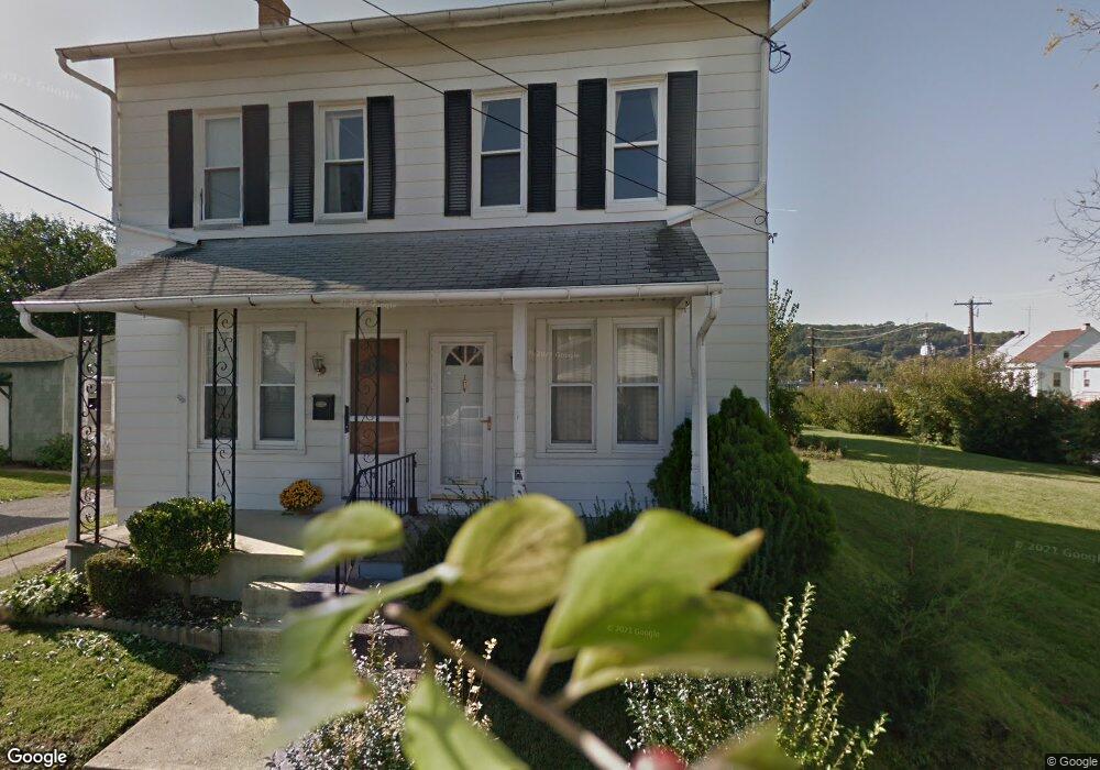
330 Catherine St Reading, PA 19607
Estimated Value: $193,000 - $231,000
3
Beds
2
Baths
1,271
Sq Ft
$163/Sq Ft
Est. Value
About This Home
This home is located at 330 Catherine St, Reading, PA 19607 and is currently estimated at $207,136, approximately $162 per square foot. 330 Catherine St is a home located in Berks County with nearby schools including Cumru Elementary School, Governor Mifflin Intermediate School, and Governor Mifflin Middle School.
Ownership History
Date
Name
Owned For
Owner Type
Purchase Details
Closed on
Feb 12, 2010
Sold by
Rudisill Mildred M and Rudisill Dennis L
Bought by
Bennethum David M
Current Estimated Value
Home Financials for this Owner
Home Financials are based on the most recent Mortgage that was taken out on this home.
Original Mortgage
$80,000
Outstanding Balance
$53,184
Interest Rate
5.12%
Mortgage Type
New Conventional
Estimated Equity
$153,952
Purchase Details
Closed on
Feb 25, 2004
Sold by
Rudisill David W and Rudisill Mildred M
Bought by
Rudisill Mildred M
Create a Home Valuation Report for This Property
The Home Valuation Report is an in-depth analysis detailing your home's value as well as a comparison with similar homes in the area
Home Values in the Area
Average Home Value in this Area
Purchase History
| Date | Buyer | Sale Price | Title Company |
|---|---|---|---|
| Bennethum David M | $100,000 | Old Republic National Title | |
| Rudisill Mildred M | -- | -- |
Source: Public Records
Mortgage History
| Date | Status | Borrower | Loan Amount |
|---|---|---|---|
| Open | Bennethum David M | $80,000 |
Source: Public Records
Tax History Compared to Growth
Tax History
| Year | Tax Paid | Tax Assessment Tax Assessment Total Assessment is a certain percentage of the fair market value that is determined by local assessors to be the total taxable value of land and additions on the property. | Land | Improvement |
|---|---|---|---|---|
| 2025 | $751 | $46,500 | $25,500 | $21,000 |
| 2024 | $2,120 | $46,500 | $25,500 | $21,000 |
| 2023 | $2,064 | $46,500 | $25,500 | $21,000 |
| 2022 | $2,041 | $46,500 | $25,500 | $21,000 |
| 2021 | $2,018 | $46,500 | $25,500 | $21,000 |
| 2020 | $2,018 | $46,500 | $25,500 | $21,000 |
| 2019 | $1,995 | $46,500 | $25,500 | $21,000 |
| 2018 | $1,971 | $46,500 | $25,500 | $21,000 |
| 2017 | $1,935 | $46,500 | $25,500 | $21,000 |
| 2016 | $661 | $46,500 | $25,500 | $21,000 |
| 2015 | $661 | $46,500 | $25,500 | $21,000 |
| 2014 | $604 | $46,500 | $25,500 | $21,000 |
Source: Public Records
Map
Nearby Homes
- 31 S Wyomissing Ave
- 31 S Sterley St Unit 401
- 31 S Sterley St Unit 101
- 305 W Elm St
- 120 S Miller St
- 27 Pennsylvania Ave
- 33 Pennsylvania Ave
- 24 Philadelphia Ave
- 137 E Elm St
- 322 New Holland Ave
- 136 E Elm St
- 405 State St
- 8 Bancroft Terrace Unit 8
- 5 Charlemont Ct
- 419 Holland St
- 18 Rosemont Ave
- 401 E Lancaster Ave
- 310 4th St
- 429 Devon Terrace
- 320 Hillside Dr
- 30 S Wyomissing Ave
- 32 S Wyomissing Ave
- 308 W Lancaster Ave
- 310 W Lancaster Ave Unit 2W
- 310 W Lancaster Ave
- 34 S Wyomissing Ave
- 36 S Wyomissing Ave
- 312 W Lancaster Ave
- 306 W Lancaster Ave
- 332 Catherine St
- 42 S Wyomissing Ave
- 44 S Wyomissing Ave
- 300 W Lancaster Ave
- 34 Hendel St
- 36 Hendel St
- 32 Hendel St
- 38 Hendel St
- 30 Hendel St
- 40 Hendel St
- 42 Hendel St