Estimated Value: $273,000 - $326,000
--
Bed
2
Baths
1,152
Sq Ft
$263/Sq Ft
Est. Value
About This Home
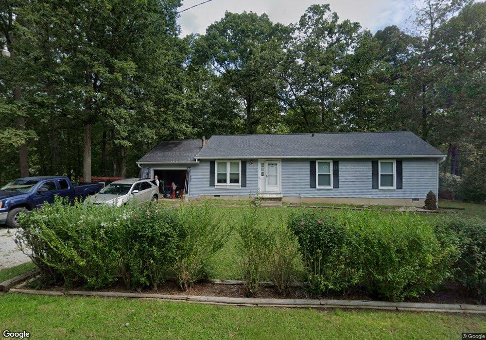
This home is located at 330 Cedar Ln, Lusby, MD 20657 and is currently estimated at $302,939, approximately $262 per square foot. 330 Cedar Ln is a home located in Calvert County with nearby schools including Patuxent Appeal Elementary Campus, Mill Creek Middle School, and Patuxent High School.
Ownership History
Date
Name
Owned For
Owner Type
Purchase Details
Closed on
Jul 31, 1996
Sold by
Hartsock Frederic Lane and Hartsock Susan D
Bought by
Stayrook Everett Hugo and Stayrook Kim A
Current Estimated Value
Purchase Details
Closed on
Jun 26, 1990
Sold by
Franzen Bradly A
Bought by
Hartsock Frederic Lane and Hartsock Susan D
Home Financials for this Owner
Home Financials are based on the most recent Mortgage that was taken out on this home.
Original Mortgage
$92,542
Interest Rate
10.16%
Create a Home Valuation Report for This Property
The Home Valuation Report is an in-depth analysis detailing your home's value as well as a comparison with similar homes in the area
Home Values in the Area
Average Home Value in this Area
Purchase History
| Date | Buyer | Sale Price | Title Company |
|---|---|---|---|
| Stayrook Everett Hugo | $100,000 | -- | |
| Hartsock Frederic Lane | $91,400 | -- |
Source: Public Records
Mortgage History
| Date | Status | Borrower | Loan Amount |
|---|---|---|---|
| Previous Owner | Hartsock Frederic Lane | $92,542 | |
| Closed | Stayrook Everett Hugo | -- |
Source: Public Records
Tax History Compared to Growth
Tax History
| Year | Tax Paid | Tax Assessment Tax Assessment Total Assessment is a certain percentage of the fair market value that is determined by local assessors to be the total taxable value of land and additions on the property. | Land | Improvement |
|---|---|---|---|---|
| 2025 | $2,632 | $220,833 | $0 | $0 |
| 2024 | $2,632 | $203,867 | $0 | $0 |
| 2023 | $1,942 | $186,900 | $55,200 | $131,700 |
| 2022 | $1,868 | $179,767 | $0 | $0 |
| 2021 | $4,588 | $172,633 | $0 | $0 |
| 2020 | $416 | $165,500 | $55,200 | $110,300 |
| 2019 | $1,681 | $160,233 | $0 | $0 |
| 2018 | $1,626 | $154,967 | $0 | $0 |
| 2017 | $1,966 | $149,700 | $0 | $0 |
| 2016 | -- | $149,700 | $0 | $0 |
| 2015 | $2,366 | $149,700 | $0 | $0 |
| 2014 | $2,366 | $151,400 | $0 | $0 |
Source: Public Records
Map
Nearby Homes
- 383 Red Cloud Rd
- 11615 Big Bear Ln
- 389 Thunderbird Dr
- 11722 Big Bear Ln
- 285 Red Cloud Rd
- 291 Red Cloud Rd
- 12361 Silver Rock Cir
- 12516 Olivet Rd
- 11616 Deadwood Dr
- 232 Thunderbird Dr
- 11609 Deadwood Dr
- 228 Thunderbird Dr
- 12609 Olivet Rd
- 542 Chisholm Trail
- 513 Bridle Ct
- 11522 Buckskin Ct
- 646 White Rock Rd
- 11590 Durango Dr
- 634 Silver Rock Rd
- 513 Cody Trail
- 334 Cedar Ln
- 331 Cedar Ln
- 333 Cedar Ln
- 11849 Spruce St
- 11845 Spruce St
- 11838 Spruce St
- 11853 Spruce St
- 338 Cedar Ln
- 11836 Arrowhead Trail
- 11841 Spruce St
- 11831 Arrowhead Trail
- 11837 Spruce St
- 337 Cedar Ln
- 11857 Spruce St
- 11832 Arrowhead Trail
- 11839 Poplar Ct
- 341 Cedar Ln
- 342 Cedar Ln
- 11833 Spruce St
- 331 Thunderbird Dr