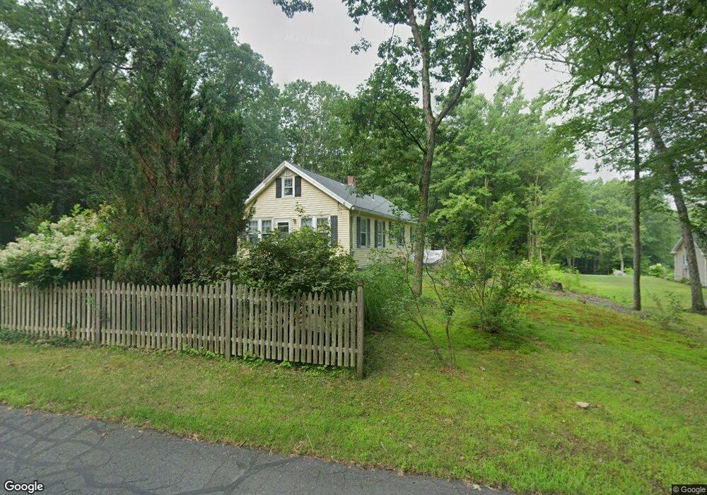
330 Coles Meadow Rd Northampton, MA 01060
Florence NeighborhoodEstimated Value: $382,506 - $489,000
4
Beds
1
Bath
1,320
Sq Ft
$322/Sq Ft
Est. Value
About This Home
This home is located at 330 Coles Meadow Rd, Northampton, MA 01060 and is currently estimated at $425,127, approximately $322 per square foot. 330 Coles Meadow Rd is a home located in Hampshire County with nearby schools including Northampton High School and The Montessori School of Northampton.
Ownership History
Date
Name
Owned For
Owner Type
Purchase Details
Closed on
Jan 17, 2008
Sold by
Mccool Donald
Bought by
Jessup Margaret R
Current Estimated Value
Home Financials for this Owner
Home Financials are based on the most recent Mortgage that was taken out on this home.
Original Mortgage
$211,000
Interest Rate
6.02%
Mortgage Type
Purchase Money Mortgage
Purchase Details
Closed on
Aug 1, 1989
Sold by
Steele Carol A
Bought by
Mccool Donald
Create a Home Valuation Report for This Property
The Home Valuation Report is an in-depth analysis detailing your home's value as well as a comparison with similar homes in the area
Home Values in the Area
Average Home Value in this Area
Purchase History
| Date | Buyer | Sale Price | Title Company |
|---|---|---|---|
| Jessup Margaret R | $231,000 | -- | |
| Mccool Donald | $116,000 | -- |
Source: Public Records
Mortgage History
| Date | Status | Borrower | Loan Amount |
|---|---|---|---|
| Open | Mccool Donald | $204,000 | |
| Closed | Jessup Margaret R | $211,000 | |
| Previous Owner | Mccool Donald | $75,000 | |
| Previous Owner | Mccool Donald | $100,000 | |
| Previous Owner | Mccool Donald | $88,400 |
Source: Public Records
Tax History
| Year | Tax Paid | Tax Assessment Tax Assessment Total Assessment is a certain percentage of the fair market value that is determined by local assessors to be the total taxable value of land and additions on the property. | Land | Improvement |
|---|---|---|---|---|
| 2025 | $4,175 | $299,700 | $94,200 | $205,500 |
| 2024 | $4,141 | $272,600 | $90,000 | $182,600 |
| 2023 | $4,087 | $258,000 | $81,600 | $176,400 |
| 2022 | $3,714 | $207,600 | $76,600 | $131,000 |
| 2021 | $3,312 | $190,700 | $73,200 | $117,500 |
| 2020 | $3,204 | $190,700 | $73,200 | $117,500 |
| 2019 | $3,413 | $196,500 | $85,700 | $110,800 |
| 2018 | $3,319 | $194,800 | $85,700 | $109,100 |
| 2017 | $3,251 | $194,800 | $85,700 | $109,100 |
| 2016 | $3,148 | $194,800 | $85,700 | $109,100 |
| 2015 | $3,168 | $200,500 | $90,700 | $109,800 |
| 2014 | $3,086 | $200,500 | $90,700 | $109,800 |
Source: Public Records
Map
Nearby Homes
- 32 Stonewall Dr
- 12 Dwight St
- 182 Old Stage Rd
- 88 Pines Edge Dr Unit 88
- 62 Bridge St
- 80 Damon Rd Unit 5104
- 80 Damon Rd Unit 4302
- 289 Hatfield St
- 18 Elm St
- 575 Bridge Rd Unit 12-7
- 575 Bridge Rd Unit 10-5
- 0 Terrace Ln
- 0 Pantry Rd Unit 73430264
- 44 Sheffield Ln
- 2 Juniper Place
- 0 Haydenville Rd
- 76 Maple St
- 53 E Center St
- 67 Park St Unit A
- 35 Hubbard Ave
- 336 Coles Meadow Rd
- 327 Coles Meadow Rd
- 349 Coles Meadow Rd
- 310 Coles Meadow Rd
- 323 Coles Meadow Rd
- 357 Coles Meadow Rd
- 301 Coles Meadow Rd
- 287 Coles Meadow Rd
- 286 Coles Meadow Rd
- 367 Coles Meadow Rd
- 279 Coles Meadow Rd
- 377 Coles Meadow Rd
- 390 Coles Meadow Rd
- 262 Coles Meadow Rd
- 248 Coles Meadow Rd
- 255 Coles Meadow Rd
- 414 Coles Meadow Rd
- 247 Coles Meadow Rd
- 218 Coles Meadow Rd
- 235 Coles Meadow Rd
Your Personal Tour Guide
Ask me questions while you tour the home.