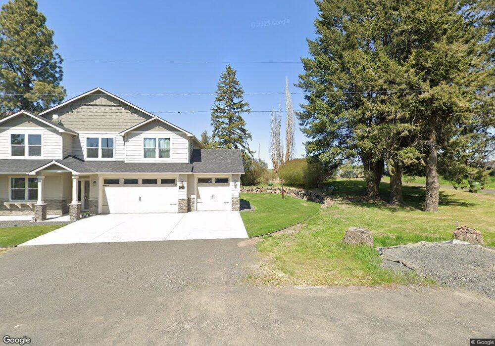
330 E 6th St Spangle, WA 99031
Estimated Value: $494,000 - $801,000
4
Beds
3
Baths
3,246
Sq Ft
$197/Sq Ft
Est. Value
About This Home
This home is located at 330 E 6th St, Spangle, WA 99031 and is currently estimated at $638,325, approximately $196 per square foot. 330 E 6th St is a home with nearby schools including Liberty Elementary/Junior High School, Liberty High School, and Upper Columbia Academy - Elementary School.
Ownership History
Date
Name
Owned For
Owner Type
Purchase Details
Closed on
Oct 7, 2020
Sold by
Anderson Trevor D
Bought by
Anderson Trever D and Lust Alexandra
Current Estimated Value
Home Financials for this Owner
Home Financials are based on the most recent Mortgage that was taken out on this home.
Original Mortgage
$355,500
Interest Rate
4.12%
Mortgage Type
Construction
Purchase Details
Closed on
Jul 5, 2020
Sold by
Anderson Steven C
Bought by
Anderson Trever D
Create a Home Valuation Report for This Property
The Home Valuation Report is an in-depth analysis detailing your home's value as well as a comparison with similar homes in the area
Purchase History
| Date | Buyer | Sale Price | Title Company |
|---|---|---|---|
| Anderson Trever D | -- | First American Title | |
| Anderson Trever D | -- | None Available |
Source: Public Records
Mortgage History
| Date | Status | Borrower | Loan Amount |
|---|---|---|---|
| Closed | Anderson Trever D | $355,500 |
Source: Public Records
Tax History
| Year | Tax Paid | Tax Assessment Tax Assessment Total Assessment is a certain percentage of the fair market value that is determined by local assessors to be the total taxable value of land and additions on the property. | Land | Improvement |
|---|---|---|---|---|
| 2025 | $6,993 | $624,100 | $50,000 | $574,100 |
| 2024 | $6,993 | $727,800 | $70,000 | $657,800 |
| 2023 | $4,930 | $657,300 | $70,000 | $587,300 |
| 2022 | $5,586 | $586,800 | $70,000 | $516,800 |
| 2021 | $2,296 | $187,950 | $53,550 | $134,400 |
| 2020 | $2,030 | $159,500 | $51,100 | $108,400 |
| 2019 | $1,755 | $140,700 | $45,500 | $95,200 |
| 2018 | $1,848 | $127,050 | $37,450 | $89,600 |
| 2017 | $1,670 | $116,120 | $26,520 | $89,600 |
| 2016 | $1,528 | $114,120 | $26,520 | $87,600 |
| 2015 | $1,520 | $108,360 | $26,260 | $82,100 |
| 2014 | -- | $109,860 | $26,260 | $83,600 |
| 2013 | -- | $0 | $0 | $0 |
Source: Public Records
Map
Nearby Homes
- 365 N Pine St
- 205 E 1st St
- Lot 2 Nka Cheney Spangle Rd Unit Parcel 32085.9041
- 3013 E Watt Rd
- 1112 E Jennings Rd
- XXX E Cornwall Rd
- 102 E Cameron Rd
- 1403 W Jennings Rd
- 20xxx S Parker Rd
- 22711 S Gateway Ln
- 6919 E Spangle Waverly Rd
- 497 E Stutler Rd
- 18206 S Hanson Pond Ln
- 19212 S Aspen Meadows Dr
- 0 Unassigned Address Rd Unit SAR202513397
- 177XX S Smythe Rd
- nka Unassigned Address Rd
- 15010 S Stentz Rd
- 17901 S Aspen Meadows Dr
- 16771 S Sherman Rd
Your Personal Tour Guide
Ask me questions while you tour the home.