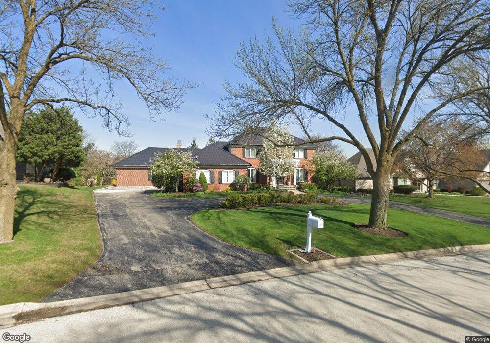
330 Hambletonian Dr Unit 4 Oak Brook, IL 60523
North Westmont NeighborhoodEstimated Value: $914,513 - $1,199,000
--
Bed
--
Bath
2,956
Sq Ft
$352/Sq Ft
Est. Value
About This Home
This home is located at 330 Hambletonian Dr Unit 4, Oak Brook, IL 60523 and is currently estimated at $1,039,128, approximately $351 per square foot. 330 Hambletonian Dr Unit 4 is a home located in DuPage County with nearby schools including Highland Elementary School, Herrick Middle School, and Downer Grove North High School.
Ownership History
Date
Name
Owned For
Owner Type
Purchase Details
Closed on
Dec 31, 2001
Sold by
West Suburban Bank
Bought by
Tameling Eva W
Current Estimated Value
Home Financials for this Owner
Home Financials are based on the most recent Mortgage that was taken out on this home.
Original Mortgage
$375,000
Interest Rate
7.14%
Create a Home Valuation Report for This Property
The Home Valuation Report is an in-depth analysis detailing your home's value as well as a comparison with similar homes in the area
Home Values in the Area
Average Home Value in this Area
Purchase History
| Date | Buyer | Sale Price | Title Company |
|---|---|---|---|
| Tameling Eva W | $474,000 | -- |
Source: Public Records
Mortgage History
| Date | Status | Borrower | Loan Amount |
|---|---|---|---|
| Previous Owner | Tameling Eva W | $375,000 |
Source: Public Records
Tax History Compared to Growth
Tax History
| Year | Tax Paid | Tax Assessment Tax Assessment Total Assessment is a certain percentage of the fair market value that is determined by local assessors to be the total taxable value of land and additions on the property. | Land | Improvement |
|---|---|---|---|---|
| 2024 | $13,005 | $269,020 | $112,466 | $156,554 |
| 2023 | $12,483 | $248,770 | $104,000 | $144,770 |
| 2022 | $11,893 | $239,130 | $99,970 | $139,160 |
| 2021 | $10,856 | $233,180 | $97,480 | $135,700 |
| 2020 | $10,251 | $228,070 | $95,340 | $132,730 |
| 2019 | $9,876 | $216,830 | $90,640 | $126,190 |
| 2018 | $10,143 | $218,520 | $85,800 | $132,720 |
| 2017 | $9,517 | $208,230 | $81,760 | $126,470 |
| 2016 | $9,229 | $189,160 | $77,020 | $112,140 |
| 2015 | $9,055 | $176,220 | $71,750 | $104,470 |
| 2014 | $11,177 | $209,260 | $52,680 | $156,580 |
| 2013 | $11,134 | $212,210 | $53,420 | $158,790 |
Source: Public Records
Map
Nearby Homes
- 2919 35th St
- 3021 35th St
- 3412 Meyers Rd
- 130 39th St
- 120 39th St
- Hudson Plan at Talon Preserve
- Stockwell Plan at Talon Preserve
- Sutcliff Plan at Talon Preserve
- Lyndale Plan at Talon Preserve
- 100 39th St
- 110 39th St
- 525 36th St
- 3220 Meyers Rd
- 3811 N Park St
- 3730 Sterling Rd
- 3916 Liberty Blvd
- 3112 Cara Ln
- 425 40th St
- 1753 Midwest Club Pkwy
- 1751 Midwest Club Pkwy
- 328 Hambletonian Dr
- 332 Hambletonian Dr
- 329 Hambletonian Dr
- 326 Hambletonian Dr
- 600 Ridgewood Ct
- 327 Hambletonian Dr
- 820 Red Stable Way
- 331 Hambletonian Dr
- 822 Red Stable Way
- 818 Red Stable Way
- 602 Ridgewood Ct
- 325 Hambletonian Dr
- 324 Hambletonian Dr
- 333 Hambletonian Dr
- 824 Red Stable Way
- 816 Red Stable Way
- 604 Ridgewood Ct
- 524 Forest Mews Dr
- 323 Hambletonian Dr
- 522 Forest Mews Dr