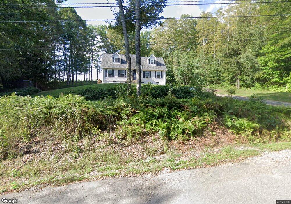
330 Jenness Hill Rd Bristol, NH 03222
Estimated Value: $429,567 - $523,000
3
Beds
3
Baths
1,865
Sq Ft
$255/Sq Ft
Est. Value
About This Home
This home is located at 330 Jenness Hill Rd, Bristol, NH 03222 and is currently estimated at $474,892, approximately $254 per square foot. 330 Jenness Hill Rd is a home located in Grafton County with nearby schools including Bristol Elementary School, A Lakes Region Montessori, and New Hampton School.
Ownership History
Date
Name
Owned For
Owner Type
Purchase Details
Closed on
Jul 5, 2006
Sold by
Mellon Dennis J and Mellon Doreen S
Bought by
Muzzey Victor G and Muzzey Tara L
Current Estimated Value
Home Financials for this Owner
Home Financials are based on the most recent Mortgage that was taken out on this home.
Original Mortgage
$209,520
Outstanding Balance
$119,867
Interest Rate
6%
Mortgage Type
Adjustable Rate Mortgage/ARM
Estimated Equity
$355,025
Create a Home Valuation Report for This Property
The Home Valuation Report is an in-depth analysis detailing your home's value as well as a comparison with similar homes in the area
Home Values in the Area
Average Home Value in this Area
Purchase History
| Date | Buyer | Sale Price | Title Company |
|---|---|---|---|
| Muzzey Victor G | $216,000 | -- |
Source: Public Records
Mortgage History
| Date | Status | Borrower | Loan Amount |
|---|---|---|---|
| Open | Muzzey Victor G | $209,520 | |
| Previous Owner | Muzzey Victor G | $25,000 |
Source: Public Records
Tax History Compared to Growth
Tax History
| Year | Tax Paid | Tax Assessment Tax Assessment Total Assessment is a certain percentage of the fair market value that is determined by local assessors to be the total taxable value of land and additions on the property. | Land | Improvement |
|---|---|---|---|---|
| 2024 | $4,984 | $211,000 | $53,100 | $157,900 |
| 2023 | $4,800 | $211,000 | $53,100 | $157,900 |
| 2022 | $4,429 | $211,000 | $53,100 | $157,900 |
| 2021 | $4,264 | $211,000 | $53,100 | $157,900 |
| 2020 | $3,961 | $211,000 | $53,100 | $157,900 |
| 2019 | $3,947 | $173,100 | $43,300 | $129,800 |
| 2018 | $3,774 | $173,100 | $43,300 | $129,800 |
| 2017 | $574 | $173,100 | $43,300 | $129,800 |
| 2016 | $3,569 | $173,100 | $43,300 | $129,800 |
| 2015 | $3,553 | $176,500 | $36,700 | $139,800 |
| 2014 | $3,553 | $176,500 | $36,700 | $139,800 |
| 2013 | $3,562 | $176,500 | $36,700 | $139,800 |
Source: Public Records
Map
Nearby Homes
- 82 Jenness Hill Rd
- 216 Jenness Hill Rd
- 0 Old Bristol Rd Unit 11 5050556
- 2110 Summer St
- 14 Mansfield Woods Way
- 6 Mansfield Woods Way
- 00 Oakcrest
- 12 Wolfe Den Dr
- 112 Town House Rd
- R3 Lot 30 Gordon Hill Rd
- 427 Old Bristol Rd
- 94 Mandi Ln
- Lot 20 Smoke Rise Rd
- 42 Smoke Rise Rd
- Lot 7 Lindsay Ln
- Lot 5 Lindsay Ln
- 5 Pemi Shores Condo Rd Unit A
- 820 Old Bristol Rd
- 41 Baldwin Ave
- 80 Ridge Rd
- 18 Jenness Hill Ln
- Lot 6.2 Jenness Hill Rd
- Lot 2 Jenness Hill Rd
- Lot 5 Jenness Hill Rd
- 0 Jenness Hill Rd
- 315 Jenness Hill Rd
- 290 Jenness Hill Rd
- 270 Jenness Hill Rd
- 277 Jenness Hill Rd
- Lot 18 Jenness Hill Ln
- Lot 17 Jenness Hill Ln
- Lot 10 Jenness Hill Ln
- 4240 River Rd
- 58 Jenness Hill Rd
- 250 Jenness Hill Rd
- 4185 River Rd
- 251 Jenness Hill Rd
- 44 Jenness Hill Rd
- 81 Jenness Hill Rd
- 243 Jenness Hill Rd