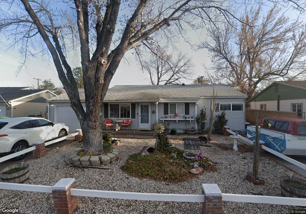
330 Richards Way Sparks, NV 89431
McCarran Boulevard-Probasco NeighborhoodEstimated Value: $405,398 - $449,000
4
Beds
2
Baths
1,527
Sq Ft
$283/Sq Ft
Est. Value
About This Home
This home is located at 330 Richards Way, Sparks, NV 89431 and is currently estimated at $432,600, approximately $283 per square foot. 330 Richards Way is a home located in Washoe County with nearby schools including Florence Drake Elementary School, George L Dilworth Middle School, and Sparks High School.
Ownership History
Date
Name
Owned For
Owner Type
Purchase Details
Closed on
Oct 29, 2018
Sold by
Roach Thomas A and Roach Aunetta M
Bought by
Roach Thomas A and Roach Aunetta M
Current Estimated Value
Purchase Details
Closed on
Feb 8, 2007
Sold by
Roach Thomas A and Roach Aunetta M
Bought by
Roach Tom and Roach Aunetta
Home Financials for this Owner
Home Financials are based on the most recent Mortgage that was taken out on this home.
Original Mortgage
$189,000
Interest Rate
6.17%
Mortgage Type
New Conventional
Create a Home Valuation Report for This Property
The Home Valuation Report is an in-depth analysis detailing your home's value as well as a comparison with similar homes in the area
Home Values in the Area
Average Home Value in this Area
Purchase History
| Date | Buyer | Sale Price | Title Company |
|---|---|---|---|
| Roach Thomas A | -- | None Available | |
| Roach Tom | -- | Stewart Title Of Northern Nv |
Source: Public Records
Mortgage History
| Date | Status | Borrower | Loan Amount |
|---|---|---|---|
| Closed | Roach Tom | $189,000 |
Source: Public Records
Tax History Compared to Growth
Tax History
| Year | Tax Paid | Tax Assessment Tax Assessment Total Assessment is a certain percentage of the fair market value that is determined by local assessors to be the total taxable value of land and additions on the property. | Land | Improvement |
|---|---|---|---|---|
| 2025 | $798 | $53,702 | $33,565 | $20,137 |
| 2024 | $798 | $49,885 | $30,065 | $19,820 |
| 2023 | $776 | $49,649 | $31,325 | $18,324 |
| 2022 | $754 | $41,122 | $26,180 | $14,942 |
| 2021 | $730 | $32,519 | $17,955 | $14,564 |
| 2020 | $707 | $31,233 | $16,940 | $14,293 |
| 2019 | $584 | $29,395 | $15,890 | $13,505 |
| 2018 | $568 | $24,664 | $11,725 | $12,939 |
| 2017 | $551 | $23,103 | $10,395 | $12,708 |
| 2016 | $537 | $22,071 | $9,345 | $12,726 |
| 2015 | $537 | $20,178 | $7,700 | $12,478 |
| 2014 | $522 | $18,166 | $6,440 | $11,726 |
| 2013 | -- | $16,294 | $4,270 | $12,024 |
Source: Public Records
Map
Nearby Homes
- 1940 4th St Unit 51
- 1940 4th St Unit 44
- 1940 4th St Unit 20
- 213 Sawyer Way
- 1945 4th St Unit 32
- 1945 4th St Unit 10
- 119 Devere Way
- 10 Sheridan Way
- 109 M St
- 465 Lenwood Dr
- 1020 York Way
- 377 Granada Dr
- 780 Emerson Way
- 120 E Lenwood Dr
- 345 H St
- 2865 Patrice Dr
- 2579 11th St
- 3311 Sprout Way
- 935 Emerson Way
- 1160 York Way
- 340 Richards Way
- 320 Richards Way
- 333 Sawyer Way
- 343 Sawyer Way
- 323 Sawyer Way
- 300 Richards Way
- 363 Sawyer Way
- 303 Sawyer Way
- 343 Richards Way
- 301 Richards Way
- 380 Richards Way
- 288 Richards Way
- 363 Richards Way
- 363 Richards Way Unit Way
- 383 Sawyer Way
- 289 Sawyer Way
- 383 Richards Way
- 2031 3rd St
- 2140 4th St
- 2220 Key Cir