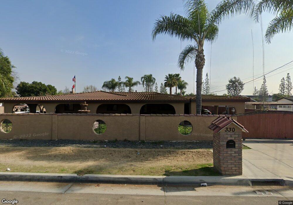
330 S 5th Ave La Puente, CA 91746
Avocado Heights NeighborhoodEstimated Value: $951,000 - $1,204,874
3
Beds
2
Baths
1,500
Sq Ft
$706/Sq Ft
Est. Value
About This Home
This home is located at 330 S 5th Ave, La Puente, CA 91746 and is currently estimated at $1,059,219, approximately $706 per square foot. 330 S 5th Ave is a home located in Los Angeles County with nearby schools including Palm Elementary School, Orange Grove Middle School, and Los Altos High School.
Ownership History
Date
Name
Owned For
Owner Type
Purchase Details
Closed on
Nov 19, 2010
Sold by
Gomez Raul
Bought by
Rancho Gomez Llc
Current Estimated Value
Purchase Details
Closed on
May 18, 1999
Sold by
Rippy Richard R
Bought by
Gomez Raul
Home Financials for this Owner
Home Financials are based on the most recent Mortgage that was taken out on this home.
Original Mortgage
$249,300
Interest Rate
7.64%
Create a Home Valuation Report for This Property
The Home Valuation Report is an in-depth analysis detailing your home's value as well as a comparison with similar homes in the area
Home Values in the Area
Average Home Value in this Area
Purchase History
| Date | Buyer | Sale Price | Title Company |
|---|---|---|---|
| Rancho Gomez Llc | -- | None Available | |
| Gomez Raul | $277,000 | Southland Title Company |
Source: Public Records
Mortgage History
| Date | Status | Borrower | Loan Amount |
|---|---|---|---|
| Previous Owner | Gomez Raul | $249,300 |
Source: Public Records
Tax History Compared to Growth
Tax History
| Year | Tax Paid | Tax Assessment Tax Assessment Total Assessment is a certain percentage of the fair market value that is determined by local assessors to be the total taxable value of land and additions on the property. | Land | Improvement |
|---|---|---|---|---|
| 2025 | $7,619 | $581,925 | $242,218 | $339,707 |
| 2024 | $7,619 | $570,516 | $237,469 | $333,047 |
| 2023 | $7,439 | $559,330 | $232,813 | $326,517 |
| 2022 | $7,231 | $548,364 | $228,249 | $320,115 |
| 2021 | $7,104 | $537,613 | $223,774 | $313,839 |
| 2019 | $6,908 | $521,669 | $217,138 | $304,531 |
| 2018 | $6,379 | $511,441 | $212,881 | $298,560 |
| 2016 | $5,898 | $491,582 | $204,615 | $286,967 |
| 2015 | $5,790 | $484,199 | $201,542 | $282,657 |
| 2014 | $5,712 | $474,716 | $197,595 | $277,121 |
Source: Public Records
Map
Nearby Homes
- 320 S 5th Ave
- 421 S 5th Ave
- 338 S 4th Ave
- 227 S 4th Ave
- 335 Willow Ave
- 433 Sunkist Ave
- 13903 Moccasin St
- 452 Willow Ave
- 901 S 6th Ave Unit 238
- 901 S 6th Ave Unit 159
- 901 S 6th Ave Unit 447
- 901 S 6th Ave Unit 205
- 901 S 6th Ave
- 208 S 2nd Ave
- 901 6th Ave Unit 9
- 901 6th Ave Unit 252
- 901 6th Ave Unit 235
- 544 N Orange Ave Unit B
- 717 Pamela Kay Ln
- 14455 Marwood St
- 343 S 5th Ave
- 321 S 5th Ave
- 356 S 5th Ave
- 310 S 5th Ave
- 340 S 5th Ave
- 14212 Proctor Ave
- 14160 Proctor Ave
- 14216 Proctor Ave
- 304 S 5th Ave
- 14224 Proctor Ave
- 14152 Proctor Ave
- 14232 Proctor Ave
- 333 S 5th Ave
- 14146 Proctor Ave
- 403 S 5th Ave
- 410 S 5th Ave
- 14138 Proctor Ave
- 349 S 5th Ave
- 416 S 5th Ave
- 353 S 5th Ave