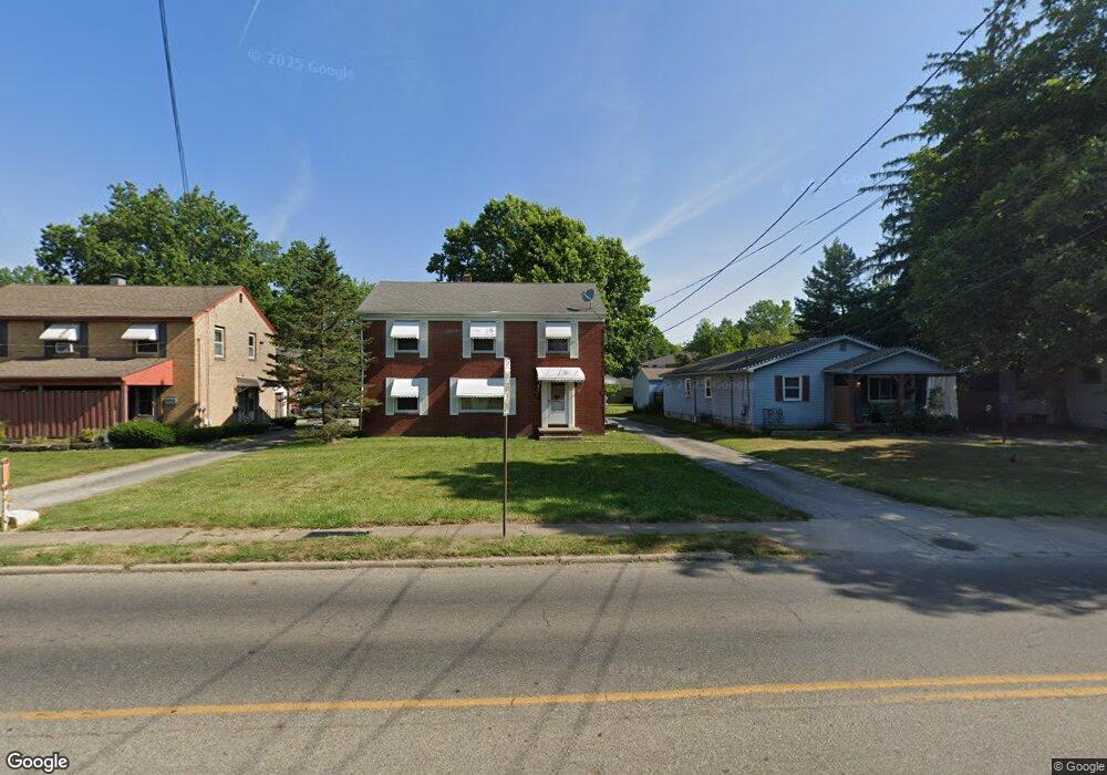
330 Shields Rd Unit 332 Youngstown, OH 44512
Estimated Value: $139,000 - $176,000
4
Beds
2
Baths
1,998
Sq Ft
$78/Sq Ft
Est. Value
About This Home
This home is located at 330 Shields Rd Unit 332, Youngstown, OH 44512 and is currently estimated at $156,379, approximately $78 per square foot. 330 Shields Rd Unit 332 is a home located in Mahoning County with nearby schools including West Boulevard Elementary School, Boardman Center Middle School, and Boardman High School.
Ownership History
Date
Name
Owned For
Owner Type
Purchase Details
Closed on
Aug 29, 2019
Sold by
Ferguson Jamie L and Ferguson Marcia M
Bought by
Omansky Matt E
Current Estimated Value
Home Financials for this Owner
Home Financials are based on the most recent Mortgage that was taken out on this home.
Original Mortgage
$65,250
Outstanding Balance
$56,771
Interest Rate
3.8%
Mortgage Type
New Conventional
Estimated Equity
$99,608
Purchase Details
Closed on
Apr 17, 2000
Sold by
Anderson Jack H
Bought by
Ferguson Jamie L and Ferguson Marcia M
Purchase Details
Closed on
May 11, 1977
Bought by
Anderson Jack H
Create a Home Valuation Report for This Property
The Home Valuation Report is an in-depth analysis detailing your home's value as well as a comparison with similar homes in the area
Home Values in the Area
Average Home Value in this Area
Purchase History
| Date | Buyer | Sale Price | Title Company |
|---|---|---|---|
| Omansky Matt E | $87,000 | Title Professionals Inc | |
| Ferguson Jamie L | $80,000 | -- | |
| Anderson Jack H | -- | -- |
Source: Public Records
Mortgage History
| Date | Status | Borrower | Loan Amount |
|---|---|---|---|
| Open | Omansky Matt E | $65,250 |
Source: Public Records
Tax History
| Year | Tax Paid | Tax Assessment Tax Assessment Total Assessment is a certain percentage of the fair market value that is determined by local assessors to be the total taxable value of land and additions on the property. | Land | Improvement |
|---|---|---|---|---|
| 2025 | $1,999 | $39,320 | $6,240 | $33,080 |
| 2024 | $2,046 | $39,320 | $6,240 | $33,080 |
| 2023 | $2,019 | $39,320 | $6,240 | $33,080 |
| 2022 | $1,669 | $24,790 | $6,310 | $18,480 |
| 2021 | $1,670 | $24,790 | $6,310 | $18,480 |
| 2020 | $1,678 | $24,790 | $6,310 | $18,480 |
| 2019 | $1,632 | $21,370 | $5,440 | $15,930 |
| 2018 | $1,393 | $21,370 | $5,440 | $15,930 |
| 2017 | $1,600 | $21,370 | $5,440 | $15,930 |
| 2016 | $1,809 | $27,540 | $5,440 | $22,100 |
| 2015 | $1,773 | $27,540 | $5,440 | $22,100 |
| 2014 | $1,779 | $27,540 | $5,440 | $22,100 |
| 2013 | $1,758 | $27,540 | $5,440 | $22,100 |
Source: Public Records
Map
Nearby Homes
- 322 Shields Rd
- 244 Shields Rd
- 237 Shields Rd
- 227 Shields Rd
- 5200 West Blvd Unit 405
- 5200 West Blvd Unit 505
- 311 Brainard Dr
- 144 Mill Creek Dr
- 85 Lake Shore Dr
- 4833 Oak Knoll Dr
- 4225 Stratford Rd
- 4941 Market St
- 5810 West Blvd
- 4250 Oak Knoll Dr
- 153 Overhill Rd
- 4717 Market St
- 28 Terrace Dr
- 27 Erskine Ave
- 94 Jennette Dr
- 28 Jennette Dr
- 332 Shields Rd
- 330 332 Shields Rd
- 334 Shields Rd Unit 336
- 324 Shields Rd Unit 326
- 342 Shields Rd Unit 346
- 340 Shields Rd
- 5123 Allen Dr Unit 125
- 5115 Allen Dr Unit 117
- 5111 Allen Dr Unit 113
- 5120 Glenwood Ave Unit C
- 5120 Glenwood Ave Unit D
- 5120 Glenwood Ave Unit A
- 5120 Glenwood Ave
- 315 Shields Rd
- 346 Shields Rd Unit 348
- 5107 Allen Dr
- 5100 Glenwood Ave Unit 1
- 5118 Allen Dr
- 5120 Allen Dr Unit 122
- 5124 Allen Dr Unit 126
Your Personal Tour Guide
Ask me questions while you tour the home.